


<< Our Photo Pages >> Culterpark Hill - Hillfort in Scotland in South Lanarkshire
Submitted by h_fenton on Saturday, 15 January 2011 Page Views: 4257
Iron Age and Later PrehistorySite Name: Culterpark HillCountry: Scotland
NOTE: This site is 0.874 km away from the location you searched for.
County: South Lanarkshire Type: Hillfort
Nearest Town: Biggar Nearest Village: Coulter
Map Ref: NT02213305
Latitude: 55.581248N Longitude: 3.552807W
Condition:
| 5 | Perfect |
| 4 | Almost Perfect |
| 3 | Reasonable but with some damage |
| 2 | Ruined but still recognisable as an ancient site |
| 1 | Pretty much destroyed, possibly visible as crop marks |
| 0 | No data. |
| -1 | Completely destroyed |
| 5 | Superb |
| 4 | Good |
| 3 | Ordinary |
| 2 | Not Good |
| 1 | Awful |
| 0 | No data. |
| 5 | Can be driven to, probably with disabled access |
| 4 | Short walk on a footpath |
| 3 | Requiring a bit more of a walk |
| 2 | A long walk |
| 1 | In the middle of nowhere, a nightmare to find |
| 0 | No data. |
| 5 | co-ordinates taken by GPS or official recorded co-ordinates |
| 4 | co-ordinates scaled from a detailed map |
| 3 | co-ordinates scaled from a bad map |
| 2 | co-ordinates of the nearest village |
| 1 | co-ordinates of the nearest town |
| 0 | no data |
Be the first person to rate this site - see the 'Contribute!' box in the right hand menu.
Internal Links:
External Links:
I have visited· I would like to visit
h_fenton has visited here
")
See: http://canmore.rcahms.gov.uk/en/site/48749/details/culterpark+hill/
You may be viewing yesterday's version of this page. To see the most up to date information please register for a free account.
Do not use the above information on other web sites or publications without permission of the contributor.
Andy B has found this location on Google Street View:
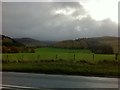
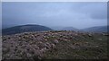
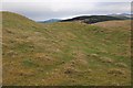
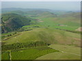
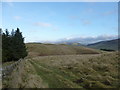
Nearby Images from Geograph Britain and Ireland:
©2014(licence)
©2022(licence)
©2020(licence)
©2006(licence)
©2012(licence)
The above images may not be of the site on this page, they are loaded from Geograph.
Please Submit an Image of this site or go out and take one for us!
Click here to see more info for this site
Nearby sites
Key: Red: member's photo, Blue: 3rd party photo, Yellow: other image, Green: no photo - please go there and take one, Grey: site destroyed
Download sites to:
KML (Google Earth)
GPX (GPS waypoints)
CSV (Garmin/Navman)
CSV (Excel)
To unlock full downloads you need to sign up as a Contributory Member. Otherwise downloads are limited to 50 sites.
Turn off the page maps and other distractions
Nearby sites listing. In the following links * = Image available
438m SE 144° Snaip Hill* Hillfort (NT02463269)
1.6km ESE 123° Nisbet* Hillfort (NT03543216)
3.6km N 350° Biggar Cursus Cursus (NT01663657)
4.2km ENE 73° Mitchelhill Rings Hillfort (NT06283417)
5.1km NNE 19° Moat Park Heritage Centre Museum (NT040378)
5.9km ENE 64° Cleuch Hill* Cairn (NT07573546)
5.9km E 87° Knowe Kniffling* Hillfort (NT08163323)
6.1km NW 317° Boatbridge Quarry Cist (NS981376)
6.3km E 84° Mill Rings Misc. Earthwork (NT08493357)
6.5km ENE 68° Parkgatestone Hill Ancient Village or Settlement (NT08293529)
7.0km WNW 300° Fallburn at Tinto Hillfort (NS96193674)
7.2km NNE 12° Carwood Farm Ancient Village or Settlement (NT039401)
8.3km SW 234° Devonshaw Hill* Hillfort (NS954283)
8.5km E 79° Whitslade Hill Burnt Mound Artificial Mound (NT10603447)
9.0km ENE 74° Helm End Hillfort (NT10983532)
9.2km E 85° Rachan Hill Henge (NT11423363)
9.3km E 83° Piper's Stone Standing Stone (Menhir) (NT11533400)
9.9km ESE 114° Patervan Cairn, Buildings & Mound* Cairn (NT11192885)
10.1km ESE 115° Patervan Settlement* Ancient Village or Settlement (NT11252854)
10.1km E 99° Woodend, Mossfennan Farm* Cist (NT12173124)
10.1km ESE 110° Laigh Hill (Tweeddale)* Ancient Village or Settlement (NT11632933)
10.2km ESE 111° Norman's Castle* Stone Fort or Dun (NT11722915)
10.5km ENE 75° Dreva Craig* Standing Stone (Menhir) (NT12453545)
10.7km ENE 76° Dreva Craig* Hillfort (NT12673533)
11.0km ENE 76° Dreva Hill West (Broughton)* Ancient Village or Settlement (NT12923553)
View more nearby sites and additional images


 We would like to know more about this location. Please feel free to add a brief description and any relevant information in your own language.
 Wir möchten mehr über diese Stätte erfahren. Bitte zögern Sie nicht, eine kurze Beschreibung und relevante Informationen in Deutsch hinzuzufügen.
 Nous aimerions en savoir encore un peu sur les lieux. S'il vous plaît n'hesitez pas à ajouter une courte description et tous les renseignements pertinents dans votre propre langue.
 Quisieramos informarnos un poco más de las lugares. No dude en añadir una breve descripción y otros datos relevantes en su propio idioma.