


<< Text Pages >> Pen-y-Gaer (Denbighshire) - Stone Circle in Wales in Denbighshire
Submitted by Tom_Bullock on Wednesday, 03 March 2004 Page Views: 6747
Neolithic and Bronze AgeSite Name: Pen-y-Gaer (Denbighshire)Country: Wales
NOTE: This site is 2.8 km away from the location you searched for.
County: Denbighshire Type: Stone Circle
Map Ref: SH964473 Landranger Map Number: 116
Latitude: 53.012946N Longitude: 3.545643W
Condition:
| 5 | Perfect |
| 4 | Almost Perfect |
| 3 | Reasonable but with some damage |
| 2 | Ruined but still recognisable as an ancient site |
| 1 | Pretty much destroyed, possibly visible as crop marks |
| 0 | No data. |
| -1 | Completely destroyed |
| 5 | Superb |
| 4 | Good |
| 3 | Ordinary |
| 2 | Not Good |
| 1 | Awful |
| 0 | No data. |
| 5 | Can be driven to, probably with disabled access |
| 4 | Short walk on a footpath |
| 3 | Requiring a bit more of a walk |
| 2 | A long walk |
| 1 | In the middle of nowhere, a nightmare to find |
| 0 | No data. |
| 5 | co-ordinates taken by GPS or official recorded co-ordinates |
| 4 | co-ordinates scaled from a detailed map |
| 3 | co-ordinates scaled from a bad map |
| 2 | co-ordinates of the nearest village |
| 1 | co-ordinates of the nearest town |
| 0 | no data |
Internal Links:
External Links:
Ancient site in Denbighshire
Have you visited this site? Please add a comment below.
You may be viewing yesterday's version of this page. To see the most up to date information please register for a free account.
Do not use the above information on other web sites or publications without permission of the contributor.
Nearby Images from Geograph Britain and Ireland:
©2006(licence)
©2009(licence)
![SH9647 : Looking down on Cerrigydrudion [SH9548] by David Medcalf](https://s1.geograph.org.uk/photos/18/18/181869_4a019cf8_120x120.jpg)
©2006(licence)
©2017(licence)
©2019(licence)
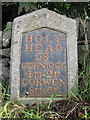
The above images may not be of the site on this page, they are loaded from Geograph.
Please Submit an Image of this site or go out and take one for us!
Click here to see more info for this site
Nearby sites
Key: Red: member's photo, Blue: 3rd party photo, Yellow: other image, Green: no photo - please go there and take one, Grey: site destroyed
Download sites to:
KML (Google Earth)
GPX (GPS waypoints)
CSV (Garmin/Navman)
CSV (Excel)
To unlock full downloads you need to sign up as a Contributory Member. Otherwise downloads are limited to 50 sites.
Turn off the page maps and other distractions
Nearby sites listing. In the following links * = Image available
748m NNE 33° Caer Caradog* Hillfort (SH96824792)
984m NW 309° Cronglwyd Fawr Barrow* Round Barrow(s) (SH9565047940)
5.1km NNE 23° Caer Ddunod* Hillfort (SH985520)
5.7km W 276° Moel Eglwys Cairn* Cairn (SH9071348011)
5.8km N 358° Hafod-y-llan Isaf Cairn Circle* Ring Cairn (SH963531)
6.0km WNW 283° Cefnhirfynydd Uchaf Cairn 1* Cairn (SH9056048725)
6.0km WNW 282° Cefnhirfynydd Uchaf Cairn 2* Cairn (SH9054048710)
6.2km WNW 284° Cefnhirfynydd Uchaf Enclosure* Ancient Village or Settlement (SH9037148889)
6.2km W 279° Cefnhirfynydd Uchaf Cairn 3* Cairn (SH9024848454)
6.4km NNW 340° Cerrig y Drudion Stone Circle (SH943533)
6.4km WNW 282° Cefnhirfynydd Uchaf Cairnfield* Barrow Cemetery (SH9016648725)
6.5km WNW 283° Cefnhirfynydd Uchaf Standing Stone* Standing Stone (Menhir) (SH9004348910)
6.9km ENE 57° Preseb y Fawch Frech* Stone Circle (SJ023509)
6.9km SSE 154° Cefn Caer Euni* Ring Cairn (SH993410)
7.0km SSE 148° Caer Euni* Hillfort (SJ000413)
7.1km W 280° Garn Prys* Cairn (SH89374866)
7.3km S 177° Coed y Bedo* Standing Stone (Menhir) (SH96664003)
7.4km W 269° Caer Garn Cairn and Round Barrow* Barrow Cemetery (SH8897047270)
7.8km WNW 295° Carreg Nanw* Modern Stone Circle etc (SH8940550794)
8.1km NE 35° Y Foel Frech Stone Circle (SJ012539)
8.7km ENE 76° Dinas Melin-y-Wig* Hillfort (SJ049492)
9.0km N 11° Brenig 14 Cairn (SH983561)
9.1km NW 317° Bwlch y Garnedd Hut Circle* Ancient Village or Settlement (SH90305401)
9.1km NNW 332° Nant Heilyn* Ring Cairn (SH92355543)
9.1km NW 318° Lon Bwlch y Garnedd standing stones* Standing Stones (SH9046154197)
View more nearby sites and additional images


 We would like to know more about this location. Please feel free to add a brief description and any relevant information in your own language.
 Wir möchten mehr über diese Stätte erfahren. Bitte zögern Sie nicht, eine kurze Beschreibung und relevante Informationen in Deutsch hinzuzufügen.
 Nous aimerions en savoir encore un peu sur les lieux. S'il vous plaît n'hesitez pas à ajouter une courte description et tous les renseignements pertinents dans votre propre langue.
 Quisieramos informarnos un poco más de las lugares. No dude en añadir una breve descripción y otros datos relevantes en su propio idioma.