


<< Our Photo Pages >> Long Plantation Bowl Barrows - Barrow Cemetery in England in Devon
Submitted by EbenMC on Thursday, 08 February 2024 Page Views: 138
Neolithic and Bronze AgeSite Name: Long Plantation Bowl Barrows Alternative Name: Upton Pyne Barrow GroupCountry: England
NOTE: This site is 1.045 km away from the location you searched for.
County: Devon Type: Barrow Cemetery
Nearest Town: Exeter Nearest Village: Brampford Speke
Map Ref: SX9182199200
Latitude: 50.782251N Longitude: 3.535866W
Condition:
| 5 | Perfect |
| 4 | Almost Perfect |
| 3 | Reasonable but with some damage |
| 2 | Ruined but still recognisable as an ancient site |
| 1 | Pretty much destroyed, possibly visible as crop marks |
| 0 | No data. |
| -1 | Completely destroyed |
| 5 | Superb |
| 4 | Good |
| 3 | Ordinary |
| 2 | Not Good |
| 1 | Awful |
| 0 | No data. |
| 5 | Can be driven to, probably with disabled access |
| 4 | Short walk on a footpath |
| 3 | Requiring a bit more of a walk |
| 2 | A long walk |
| 1 | In the middle of nowhere, a nightmare to find |
| 0 | No data. |
| 5 | co-ordinates taken by GPS or official recorded co-ordinates |
| 4 | co-ordinates scaled from a detailed map |
| 3 | co-ordinates scaled from a bad map |
| 2 | co-ordinates of the nearest village |
| 1 | co-ordinates of the nearest town |
| 0 | no data |
Internal Links:
External Links:
")
There are two bowl barrows scheduled by Historic England in this immediate vicinity:
1. Bowl barrow in Long Plantation, 680m NE of Starved Oak Cross at SX 91821 99200, and
2. Bowl barrow in Long Plantation, 610m NE of Starved Oak Cross at SX 91762 99170.
Both the HE entries state: "Th[ese] bowl barrow[s] is[are] one of the best-preserved upstanding examples within the Upton Pyne barrow group, and it has survived without previous archaeological disturbance; tree roots and a badger set affect the barrow to only a limited extent and depth, leaving a high likelihood of intact funerary deposits. The unusual low-lying position of the Upton Pyne barrow cemetery, its good overall preservation, and the quality of the dating, constructional and artefactual information that it has already produced, have all resulted in its frequent mention in national reviews of Bronze Age funerary monuments."
There are another four barrows shown on the HE map (Historic England Map Search, cut and paste co-ordinates below, and reduce scale of map. These four barrows lie to the west of this pair of barrows].
You may be viewing yesterday's version of this page. To see the most up to date information please register for a free account.
")
Do not use the above information on other web sites or publications without permission of the contributor.
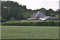
Nearby Images from Geograph Britain and Ireland:
©2009(licence)
©2009(licence)
©2015(licence)
©2015(licence)
©2015(licence)
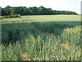
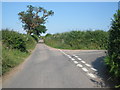
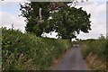
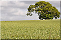
The above images may not be of the site on this page, they are loaded from Geograph.
Please Submit an Image of this site or go out and take one for us!
Click here to see more info for this site
Nearby sites
Key: Red: member's photo, Blue: 3rd party photo, Yellow: other image, Green: no photo - please go there and take one, Grey: site destroyed
Download sites to:
KML (Google Earth)
GPX (GPS waypoints)
CSV (Garmin/Navman)
CSV (Excel)
To unlock full downloads you need to sign up as a Contributory Member. Otherwise downloads are limited to 50 sites.
Turn off the page maps and other distractions
Nearby sites listing. In the following links * = Image available
335m WSW 251° Three Barrows (Devon)* Barrow Cemetery (SX915991)
1.1km NW 324° No Mans Chapel tumulus* Barrow Cemetery (SS912001)
2.4km ENE 70° Nether Exe Cursus* Cursus (SX94079995)
4.8km SE 132° Mincimore Copse Tumulus* Round Barrow(s) (SX953959)
5.1km NW 318° Raddon Hill* Causewayed Enclosure (SS885031)
5.6km E 80° Dolbury Hillfort* Hillfort (SS974001)
5.8km WNW 288° Shobrooke Church Preaching Cross Ancient Cross (SS863011)
5.8km WNW 289° Shobrooke Holy Well* Holy Well or Sacred Spring (SS8632301236)
6.1km N 354° Cadbury Castle (Devon)* Hillfort (SS913053)
6.3km S 175° Royal Albert Memorial Museum* Museum (SX922929)
6.7km S 176° St Martin's Well (Exeter) Holy Well or Sacred Spring (SX922925)
7.5km ENE 75° Holy Well (Broadclyst)* Holy Well or Sacred Spring (SS9914700962)
8.4km W 276° Libbett's Well* Holy Well or Sacred Spring (SS835003)
8.5km W 276° St Boniface's Well (Crediton)* Holy Well or Sacred Spring (SS834003)
9.3km W 265° Uton Holy Well* Holy Well or Sacred Spring (SX825986)
11.1km WSW 258° Posbury Camp Hillfort (SX80889711)
12.5km WSW 253° Higher Bury Camp Hillfort (SX79789572)
12.5km SSE 156° Topsham Museum* Museum (SX9673987646)
13.3km NNE 17° Cranmore Castle Hillfort (SS959119)
15.1km WNW 282° Copplestone Cross* Ancient Cross (SS7706802606)
15.4km NW 310° Berry Castle (Black Dog)* Hillfort (SS802093)
15.7km ESE 118° Aylesbeare Common tumulus* Round Barrow(s) (SY056916)
15.8km W 262° Lethen Castle Hillfort (SX761974)
16.3km NNE 23° Craze Lowman Mound* Round Barrow(s) (SS98611399)
16.4km SE 135° Woodbury Castle* Hillfort (SY032874)
View more nearby sites and additional images


 We would like to know more about this location. Please feel free to add a brief description and any relevant information in your own language.
 Wir möchten mehr über diese Stätte erfahren. Bitte zögern Sie nicht, eine kurze Beschreibung und relevante Informationen in Deutsch hinzuzufügen.
 Nous aimerions en savoir encore un peu sur les lieux. S'il vous plaît n'hesitez pas à ajouter une courte description et tous les renseignements pertinents dans votre propre langue.
 Quisieramos informarnos un poco más de las lugares. No dude en añadir una breve descripción y otros datos relevantes en su propio idioma.