


<< Our Photo Pages >> Dolmen de la Pandera de la Serrezuela - Burial Chamber or Dolmen in Spain in Andalucía
Submitted by ShamrockStone on Monday, 28 December 2020 Page Views: 357
Neolithic and Bronze AgeSite Name: Dolmen de la Pandera de la SerrezuelaCountry: Spain
NOTE: This site is 16.048 km away from the location you searched for.
Region: Andalucía Type: Burial Chamber or Dolmen
Nearest Village: Moreda
Latitude: 37.431200N Longitude: 3.346W
Condition:
| 5 | Perfect |
| 4 | Almost Perfect |
| 3 | Reasonable but with some damage |
| 2 | Ruined but still recognisable as an ancient site |
| 1 | Pretty much destroyed, possibly visible as crop marks |
| 0 | No data. |
| -1 | Completely destroyed |
| 5 | Superb |
| 4 | Good |
| 3 | Ordinary |
| 2 | Not Good |
| 1 | Awful |
| 0 | No data. |
| 5 | Can be driven to, probably with disabled access |
| 4 | Short walk on a footpath |
| 3 | Requiring a bit more of a walk |
| 2 | A long walk |
| 1 | In the middle of nowhere, a nightmare to find |
| 0 | No data. |
| 5 | co-ordinates taken by GPS or official recorded co-ordinates |
| 4 | co-ordinates scaled from a detailed map |
| 3 | co-ordinates scaled from a bad map |
| 2 | co-ordinates of the nearest village |
| 1 | co-ordinates of the nearest town |
| 0 | no data |
Be the first person to rate this site - see the 'Contribute!' box in the right hand menu.
Internal Links:
External Links:
")
You may be viewing yesterday's version of this page. To see the most up to date information please register for a free account.
Do not use the above information on other web sites or publications without permission of the contributor.
Nearby Images from Flickr
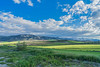
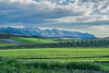
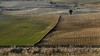
The above images may not be of the site on this page, but were taken nearby. They are loaded from Flickr so please click on them for image credits.
Click here to see more info for this site
Nearby sites
Click here to view sites on an interactive map of the areaKey: Red: member's photo, Blue: 3rd party photo, Yellow: other image, Green: no photo - please go there and take one, Grey: site destroyed
Download sites to:
KML (Google Earth)
GPX (GPS waypoints)
CSV (Garmin/Navman)
CSV (Excel)
To unlock full downloads you need to sign up as a Contributory Member. Otherwise downloads are limited to 50 sites.
Turn off the page maps and other distractions
Nearby sites listing. In the following links * = Image available
8.4km SSE 149° Necrópolis Megalitica de Panoria* Burial Chamber or Dolmen
9.9km ENE 66° Dólmen del Espartal 8* Burial Chamber or Dolmen
9.9km ENE 66° Dólmen del Espartal 9* Burial Chamber or Dolmen
9.9km ENE 66° Dólmen del Espartal 10* Burial Chamber or Dolmen
9.9km ENE 66° Dólmen del Espartal 13* Burial Chamber or Dolmen
9.9km ENE 66° Dólmen del Espartal 7* Burial Chamber or Dolmen
9.9km ENE 66° Dólmen del Espartal 11* Burial Chamber or Dolmen
10.0km ENE 66° Dólmen del Espartal 12* Burial Chamber or Dolmen
10.0km ENE 66° Dólmen del Espartal 6* Burial Chamber or Dolmen
10.0km ENE 66° Dólmen del Espartal 3* Burial Chamber or Dolmen
10.0km ENE 66° Dólmen del Espartal 5* Burial Chamber or Dolmen
10.0km ENE 66° Dólmen del Espartal 4* Burial Chamber or Dolmen
10.0km ENE 66° Dólmen del Espartal 1* Burial Chamber or Dolmen
10.0km ENE 66° Dólmen del Espartal 2* Burial Chamber or Dolmen
15.2km ENE 73° Necrópolis Megalítica del Morrón de la Meseta* Burial Chamber or Dolmen
15.9km E 96° Fonelas Megalithic cemetery* Burial Chamber or Dolmen
17.9km ENE 59° Dolmen del Cortijo de Olivares* Burial Chamber or Dolmen
23.0km ENE 69° Petroglifos del Cerro de la Mina* Rock Art
26.5km E 80° Dolmen Gorafe 066* Burial Chamber or Dolmen
26.5km E 80° Dolmen Gorafe 065* Burial Chamber or Dolmen
26.5km E 80° Dolmen Gorafe 067* Burial Chamber or Dolmen
26.6km E 81° Dolmen Gorafe 083 Burial Chamber or Dolmen
26.6km E 80° Dolmen Gorafe 069 Burial Chamber or Dolmen
26.6km E 80° Dolmen Gorafe 068* Burial Chamber or Dolmen
26.6km E 80° Dolmen Gorafe 070 Burial Chamber or Dolmen
View more nearby sites and additional images


 We would like to know more about this location. Please feel free to add a brief description and any relevant information in your own language.
 Wir möchten mehr über diese Stätte erfahren. Bitte zögern Sie nicht, eine kurze Beschreibung und relevante Informationen in Deutsch hinzuzufügen.
 Nous aimerions en savoir encore un peu sur les lieux. S'il vous plaît n'hesitez pas à ajouter une courte description et tous les renseignements pertinents dans votre propre langue.
 Quisieramos informarnos un poco más de las lugares. No dude en añadir una breve descripción y otros datos relevantes en su propio idioma.