


<< Text Pages >> Cae Garreg - Stone Row / Alignment in Wales in Powys
Submitted by Anonymous on Monday, 30 September 2002 Page Views: 6088
Neolithic and Bronze AgeSite Name: Cae Garreg Alternative Name: Dau Fraich a Dau LawCountry: Wales
NOTE: This site is 3.668 km away from the location you searched for.
County: Powys Type: Stone Row / Alignment
Nearest Village: Tylwch / Pant-y-Dwr
Map Ref: SN963777 Landranger Map Number: 136
Latitude: 52.387474N Longitude: 3.525166W
Condition:
| 5 | Perfect |
| 4 | Almost Perfect |
| 3 | Reasonable but with some damage |
| 2 | Ruined but still recognisable as an ancient site |
| 1 | Pretty much destroyed, possibly visible as crop marks |
| 0 | No data. |
| -1 | Completely destroyed |
| 5 | Superb |
| 4 | Good |
| 3 | Ordinary |
| 2 | Not Good |
| 1 | Awful |
| 0 | No data. |
| 5 | Can be driven to, probably with disabled access |
| 4 | Short walk on a footpath |
| 3 | Requiring a bit more of a walk |
| 2 | A long walk |
| 1 | In the middle of nowhere, a nightmare to find |
| 0 | No data. |
| 5 | co-ordinates taken by GPS or official recorded co-ordinates |
| 4 | co-ordinates scaled from a detailed map |
| 3 | co-ordinates scaled from a bad map |
| 2 | co-ordinates of the nearest village |
| 1 | co-ordinates of the nearest town |
| 0 | no data |
Internal Links:
External Links:
Stone Row (Alignment) in Powys
In the 19th Century a line of toppled stones was reported but by 1957 only one remained.
Update October 2019: This now destroyed stone row is featured on the Stone Rows of Great Britain website - see their entry for Cae Garreg. The SRoGB notes that this was: "a probable single stone row measuring 27.4m long that included 8 large stones situated on an elongated natural knoll. The row was orientated east to west and stood in an area with another standing stone with which it may have been directly associated and a barrow".
A single standing stone at SN 96377 77641, said to be the one survivor of a possible four poster associated with the row, is recorded as Coflein NPRN 304952 (Henriw, Standing Stone; Dau Friach a Dau Law).
You may be viewing yesterday's version of this page. To see the most up to date information please register for a free account.
Do not use the above information on other web sites or publications without permission of the contributor.
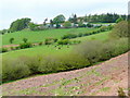
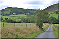
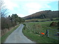
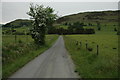
Nearby Images from Geograph Britain and Ireland:
©2009(licence)
©2012(licence)
©2007(licence)
©2010(licence)
©2010(licence)
The above images may not be of the site on this page, they are loaded from Geograph.
Please Submit an Image of this site or go out and take one for us!
Click here to see more info for this site
Nearby sites
Key: Red: member's photo, Blue: 3rd party photo, Yellow: other image, Green: no photo - please go there and take one, Grey: site destroyed
Download sites to:
KML (Google Earth)
GPX (GPS waypoints)
CSV (Garmin/Navman)
CSV (Excel)
To unlock full downloads you need to sign up as a Contributory Member. Otherwise downloads are limited to 50 sites.
![]()
Turn off the page maps and other distractions
Nearby sites listing. In the following links * = Image available
95m SE 127° Henriw* Standing Stone (Menhir) (SN9637577642)
141m SE 134° Cwm Saesan Stone Circle (SN964776)
1.4km WSW 238° Cwm y Saeson Standing Stone* Standing Stones (SN9507776977)
4.1km SW 219° Gwastad Stone Row Stone Row / Alignment (SN9368974584)
6.2km S 182° Marteg Valley* Cairn (SN95997155)
6.8km SW 234° Rhiw Afon Cairn* Ring Cairn (SN90707387)
7.0km SW 232° Cerrig Llwydion Round Barrow* Round Barrow(s) (SN90677345)
7.1km SSE 165° Creggin* Round Barrow(s) (SN980708)
7.1km SW 236° Carn Wen (Rhiw Afon)* Cairn (SN90287384)
7.3km WSW 238° Carn Nant Y Ffald* Cairn (SN90057397)
8.0km SSW 206° Maengwyngweddew* Standing Stone (Menhir) (SN926706)
8.0km ENE 78° Banc Du (Powys)* Stone Circle (SO042792)
8.1km SSW 192° Maen Serth* Standing Stone (Menhir) (SN944698)
8.2km SSW 197° Clap yr Arian* Cairn (SN937699)
8.3km WSW 237° Banc Cynnydd Cairn* Cairn (SN89227338)
8.3km W 260° Carn Y Groes* Cairn (SN88077645)
8.4km SW 215° Blaen Fign Cairn 2* Cairn (SN914709)
8.4km WSW 236° Banc Cynnydd Cairn 2* Cairn (SN89177318)
8.6km SSW 200° Briddell Felen A* Standing Stone (Menhir) (SN93226964)
8.7km SSW 199° Briddell Felen B* Chambered Tomb (SN93256957)
8.9km WSW 252° Blaen Clawdd Du Cairn* Cairn (SN87767517)
9.0km SSW 196° Banc Trehesglog Cairn* Cist (SN93636909)
9.3km SSW 199° Tre Heslog Stone Row* Stone Row / Alignment (SN9310668922)
9.4km SSW 199° Tre Heslog Cist* Cist (SN931689)
9.4km SSE 158° Ty Lettice Barrows* Round Barrow(s) (SN99606889)
View more nearby sites and additional images


 We would like to know more about this location. Please feel free to add a brief description and any relevant information in your own language.
 Wir möchten mehr über diese Stätte erfahren. Bitte zögern Sie nicht, eine kurze Beschreibung und relevante Informationen in Deutsch hinzuzufügen.
 Nous aimerions en savoir encore un peu sur les lieux. S'il vous plaît n'hesitez pas à ajouter une courte description et tous les renseignements pertinents dans votre propre langue.
 Quisieramos informarnos un poco más de las lugares. No dude en añadir una breve descripción y otros datos relevantes en su propio idioma.