

<< Our Photo Pages >> Holy Well (Broadclyst) - Holy Well or Sacred Spring in England in Devon
Submitted by KiwiBetsy on Friday, 08 September 2006 Page Views: 12559
Springs and Holy WellsSite Name: Holy Well (Broadclyst)Country: England County: Devon Type: Holy Well or Sacred Spring
Nearest Town: Exeter Nearest Village: Broadclyst
Map Ref: SS9914700962
Latitude: 50.799413N Longitude: 3.432468W
Condition:
| 5 | Perfect |
| 4 | Almost Perfect |
| 3 | Reasonable but with some damage |
| 2 | Ruined but still recognisable as an ancient site |
| 1 | Pretty much destroyed, possibly visible as crop marks |
| 0 | No data. |
| -1 | Completely destroyed |
| 5 | Superb |
| 4 | Good |
| 3 | Ordinary |
| 2 | Not Good |
| 1 | Awful |
| 0 | No data. |
| 5 | Can be driven to, probably with disabled access |
| 4 | Short walk on a footpath |
| 3 | Requiring a bit more of a walk |
| 2 | A long walk |
| 1 | In the middle of nowhere, a nightmare to find |
| 0 | No data. |
| 5 | co-ordinates taken by GPS or official recorded co-ordinates |
| 4 | co-ordinates scaled from a detailed map |
| 3 | co-ordinates scaled from a bad map |
| 2 | co-ordinates of the nearest village |
| 1 | co-ordinates of the nearest town |
| 0 | no data |
Internal Links:
External Links:
I have visited· I would like to visit
Silkscream would like to visit
 (PID:23982)")
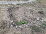
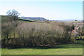
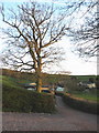
On the B3181 north of Budlake take the lane leading to Lower Comberoy Farm. About a quarter of a mile down the lane, on the south side, is a wooden gate opening into a small untended wood.
There is no path but if one slithers to the bottom of a small slope and turns around, there waiting for them is a real gem.
This large, rather overgrown wellhouse houses a deep pool of clear water which appears to be being tapped as a water supply, even so a considerable amount flows from the front of the wellhouse making for a wet approach. A wood and wire frame had been placed across the entrance to the wellhouse but was easily moved for this photo.
You may be viewing yesterday's version of this page. To see the most up to date information please register for a free account.
 (PID:236810)")
 (PID:236809)")
 (PID:23983)")
Do not use the above information on other web sites or publications without permission of the contributor.
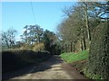
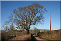
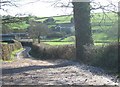
Nearby Images from Geograph Britain and Ireland:
©2011(licence)
©2006(licence)
©2011(licence)
©2006(licence)
©2010(licence)
The above images may not be of the site on this page, they are loaded from Geograph.
Please Submit an Image of this site or go out and take one for us!
Click here to see more info for this site
Nearby sites
Key: Red: member's photo, Blue: 3rd party photo, Yellow: other image, Green: no photo - please go there and take one, Grey: site destroyed
Download sites to:
KML (Google Earth)
GPX (GPS waypoints)
CSV (Garmin/Navman)
CSV (Excel)
To unlock full downloads you need to sign up as a Contributory Member. Otherwise downloads are limited to 50 sites.
Turn off the page maps and other distractions
Nearby sites listing. In the following links * = Image available
1.9km WSW 243° Dolbury Hillfort* Hillfort (SS974001)
5.2km WSW 258° Nether Exe Cursus* Cursus (SX94079995)
6.4km SW 216° Mincimore Copse Tumulus* Round Barrow(s) (SX953959)
7.5km WSW 255° Long Plantation Bowl Barrows* Barrow Cemetery (SX9182199200)
7.8km WSW 255° Three Barrows (Devon)* Barrow Cemetery (SX915991)
8.0km W 263° No Mans Chapel tumulus* Barrow Cemetery (SS912001)
8.9km WNW 298° Cadbury Castle (Devon)* Hillfort (SS913053)
10.6km SW 220° Royal Albert Memorial Museum* Museum (SX922929)
10.8km W 280° Raddon Hill* Causewayed Enclosure (SS885031)
10.9km SW 218° St Martin's Well (Exeter) Holy Well or Sacred Spring (SX922925)
11.4km SE 144° Aylesbeare Common tumulus* Round Barrow(s) (SY056916)
11.4km NNW 342° Cranmore Castle Hillfort (SS959119)
12.3km E 79° Hembury Fort* Hillfort (ST113031)
12.8km W 270° Shobrooke Holy Well* Holy Well or Sacred Spring (SS8632301236)
12.8km W 270° Shobrooke Church Preaching Cross Ancient Cross (SS863011)
13.0km N 357° Craze Lowman Mound* Round Barrow(s) (SS98611399)
13.5km S 189° Topsham Museum* Museum (SX9673987646)
14.1km SSE 162° Woodbury Castle* Hillfort (SY032874)
14.7km ENE 71° Row Barrow (Devon)* Round Barrow(s) (ST13180561)
14.8km SSE 155° Tor Barrow (Colaton Raleigh Common) Round Barrow(s) (SY05088737)
15.6km W 266° Libbett's Well* Holy Well or Sacred Spring (SS835003)
15.7km W 266° St Boniface's Well (Crediton)* Holy Well or Sacred Spring (SS834003)
16.1km ESE 106° Farway & Gittisham Hill Cemetery* Barrow Cemetery (SY146962)
16.8km W 261° Uton Holy Well* Holy Well or Sacred Spring (SX825986)
16.8km SE 124° Sidbury Castle* Hillfort (SY129913)
View more nearby sites and additional images


 We would like to know more about this location. Please feel free to add a brief description and any relevant information in your own language.
 Wir möchten mehr über diese Stätte erfahren. Bitte zögern Sie nicht, eine kurze Beschreibung und relevante Informationen in Deutsch hinzuzufügen.
 Nous aimerions en savoir encore un peu sur les lieux. S'il vous plaît n'hesitez pas à ajouter une courte description et tous les renseignements pertinents dans votre propre langue.
 Quisieramos informarnos un poco más de las lugares. No dude en añadir una breve descripción y otros datos relevantes en su propio idioma.