

<< Our Photo Pages >> Mincimore Copse Tumulus - Round Barrow(s) in England in Devon
Submitted by EbenMC on Monday, 01 April 2024 Page Views: 58
Neolithic and Bronze AgeSite Name: Mincimore Copse TumulusCountry: England
NOTE: This site is 5.461 km away from the location you searched for.
County: Devon Type: Round Barrow(s)
Nearest Town: Exeter Nearest Village: Poltimore
Map Ref: SX953959
Latitude: 50.753225N Longitude: 3.485595W
Condition:
| 5 | Perfect |
| 4 | Almost Perfect |
| 3 | Reasonable but with some damage |
| 2 | Ruined but still recognisable as an ancient site |
| 1 | Pretty much destroyed, possibly visible as crop marks |
| 0 | No data. |
| -1 | Completely destroyed |
| 5 | Superb |
| 4 | Good |
| 3 | Ordinary |
| 2 | Not Good |
| 1 | Awful |
| 0 | No data. |
| 5 | Can be driven to, probably with disabled access |
| 4 | Short walk on a footpath |
| 3 | Requiring a bit more of a walk |
| 2 | A long walk |
| 1 | In the middle of nowhere, a nightmare to find |
| 0 | No data. |
| 5 | co-ordinates taken by GPS or official recorded co-ordinates |
| 4 | co-ordinates scaled from a detailed map |
| 3 | co-ordinates scaled from a bad map |
| 2 | co-ordinates of the nearest village |
| 1 | co-ordinates of the nearest town |
| 0 | no data |
Internal Links:
External Links:
")
Tall barrow located in Mincimore Copse above the site of the Battle of Pinhoe of 1001, it is situated in an enclave. It is unclear if the surrounding geography is natural or dug out to form part of a defensive earthwork.
You may be viewing yesterday's version of this page. To see the most up to date information please register for a free account.
")
")
Do not use the above information on other web sites or publications without permission of the contributor.
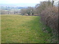
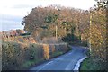
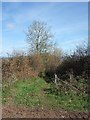
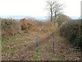
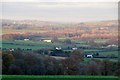
Nearby Images from Geograph Britain and Ireland:
©2006(licence)
©2013(licence)
©2011(licence)
©2012(licence)
©2013(licence)
The above images may not be of the site on this page, they are loaded from Geograph.
Please Submit an Image of this site or go out and take one for us!
Click here to see more info for this site
Nearby sites
Key: Red: member's photo, Blue: 3rd party photo, Yellow: other image, Green: no photo - please go there and take one, Grey: site destroyed
Download sites to:
KML (Google Earth)
GPX (GPS waypoints)
CSV (Garmin/Navman)
CSV (Excel)
To unlock full downloads you need to sign up as a Contributory Member. Otherwise downloads are limited to 50 sites.
Turn off the page maps and other distractions
Nearby sites listing. In the following links * = Image available
4.2km NNW 342° Nether Exe Cursus* Cursus (SX94079995)
4.3km SW 225° Royal Albert Memorial Museum* Museum (SX922929)
4.6km SW 221° St Martin's Well (Exeter) Holy Well or Sacred Spring (SX922925)
4.7km NNE 25° Dolbury Hillfort* Hillfort (SS974001)
4.8km NW 312° Long Plantation Bowl Barrows* Barrow Cemetery (SX9182199200)
5.0km NW 309° Three Barrows (Devon)* Barrow Cemetery (SX915991)
5.9km NW 315° No Mans Chapel tumulus* Barrow Cemetery (SS912001)
6.4km NE 36° Holy Well (Broadclyst)* Holy Well or Sacred Spring (SS9914700962)
8.4km S 169° Topsham Museum* Museum (SX9673987646)
9.9km NW 316° Raddon Hill* Causewayed Enclosure (SS885031)
10.2km NNW 336° Cadbury Castle (Devon)* Hillfort (SS913053)
10.4km WNW 299° Shobrooke Church Preaching Cross Ancient Cross (SS863011)
10.4km WNW 300° Shobrooke Holy Well* Holy Well or Sacred Spring (SS8632301236)
11.1km ESE 112° Aylesbeare Common tumulus* Round Barrow(s) (SY056916)
11.6km SE 136° Woodbury Castle* Hillfort (SY032874)
12.6km WNW 289° Libbett's Well* Holy Well or Sacred Spring (SS835003)
12.7km WNW 289° St Boniface's Well (Crediton)* Holy Well or Sacred Spring (SS834003)
13.0km SE 130° Tor Barrow (Colaton Raleigh Common) Round Barrow(s) (SY05088737)
13.0km W 281° Uton Holy Well* Holy Well or Sacred Spring (SX825986)
14.4km W 274° Posbury Camp Hillfort (SX80889711)
15.5km W 268° Higher Bury Camp Hillfort (SX79789572)
16.0km N 1° Cranmore Castle Hillfort (SS959119)
17.4km ESE 116° Seven Stones (Devon)* Stone Circle (SY10758787)
17.5km ENE 65° Hembury Fort* Hillfort (ST113031)
18.0km ESE 123° High Peak* Ancient Village or Settlement (SY103859)
View more nearby sites and additional images


 We would like to know more about this location. Please feel free to add a brief description and any relevant information in your own language.
 Wir möchten mehr über diese Stätte erfahren. Bitte zögern Sie nicht, eine kurze Beschreibung und relevante Informationen in Deutsch hinzuzufügen.
 Nous aimerions en savoir encore un peu sur les lieux. S'il vous plaît n'hesitez pas à ajouter une courte description et tous les renseignements pertinents dans votre propre langue.
 Quisieramos informarnos un poco más de las lugares. No dude en añadir una breve descripción y otros datos relevantes en su propio idioma.