


<< Text Pages >> Llyn-y-cefn Cursus - Cursus in Wales in Denbighshire
Submitted by EssexMan on Wednesday, 07 April 2010 Page Views: 3094
Neolithic and Bronze AgeSite Name: Llyn-y-cefn CursusCountry: Wales
NOTE: This site is 1.679 km away from the location you searched for.
County: Denbighshire Type: Cursus
Nearest Town: Wrexham Nearest Village: Llyn-y-cefn
Map Ref: SJ05854355 Landranger Map Number: 125
Latitude: 52.980994N Longitude: 3.403742W
Condition:
| 5 | Perfect |
| 4 | Almost Perfect |
| 3 | Reasonable but with some damage |
| 2 | Ruined but still recognisable as an ancient site |
| 1 | Pretty much destroyed, possibly visible as crop marks |
| 0 | No data. |
| -1 | Completely destroyed |
| 5 | Superb |
| 4 | Good |
| 3 | Ordinary |
| 2 | Not Good |
| 1 | Awful |
| 0 | No data. |
| 5 | Can be driven to, probably with disabled access |
| 4 | Short walk on a footpath |
| 3 | Requiring a bit more of a walk |
| 2 | A long walk |
| 1 | In the middle of nowhere, a nightmare to find |
| 0 | No data. |
| 5 | co-ordinates taken by GPS or official recorded co-ordinates |
| 4 | co-ordinates scaled from a detailed map |
| 3 | co-ordinates scaled from a bad map |
| 2 | co-ordinates of the nearest village |
| 1 | co-ordinates of the nearest town |
| 0 | no data |
Internal Links:
External Links:
Cruciform Long Enclosure in Denbighshire
Status: Doubtful
NMR No. PRN 101422
Extent: 400mx20m
Terminal type: Unknown
Note: This location marks one terminal (end) of a cursus monument. The location of the other terminal can be found in the Nearby Site list below.
You may be viewing yesterday's version of this page. To see the most up to date information please register for a free account.
Do not use the above information on other web sites or publications without permission of the contributor.
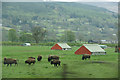
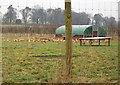
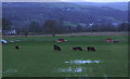
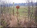
Nearby Images from Geograph Britain and Ireland:
©2010(licence)
©2010(licence)
©2007(licence)
©2010(licence)

©2012(licence)
The above images may not be of the site on this page, they are loaded from Geograph.
Please Submit an Image of this site or go out and take one for us!
Click here to see more info for this site
Nearby sites
Key: Red: member's photo, Blue: 3rd party photo, Yellow: other image, Green: no photo - please go there and take one, Grey: site destroyed
Download sites to:
KML (Google Earth)
GPX (GPS waypoints)
CSV (Garmin/Navman)
CSV (Excel)
To unlock full downloads you need to sign up as a Contributory Member. Otherwise downloads are limited to 50 sites.
Turn off the page maps and other distractions
Nearby sites listing. In the following links * = Image available
369m ESE 108° Corwen Cursus Cursus (SJ06204343)
394m ESE 119° Corwen Cursus Cursus (SJ06194335)
402m E 96° Llyn-y-cefn Cursus Cursus (SJ06254350)
1.2km ENE 61° Ffynnon Sulien* Holy Well or Sacred Spring (SJ06884409)
1.8km E 99° Corwen Gorsedd Circle Modern Stone Circle etc (SJ0763443219)
2.0km E 93° St Mael and St Sulien* Standing Stone (Menhir) (SJ0787243397)
3.0km ENE 73° Caer Drewyn* Hillfort (SJ0876544395)
3.4km ENE 74° Pen Coed Mawr field system* Ancient Village or Settlement (SJ09124441)
3.8km NNE 26° Ffynnon Beuno (Gwyddelwern)* Holy Well or Sacred Spring (SJ07584692)
4.1km SSW 194° Tyn y Coed* Chambered Cairn (SJ0476839603)
5.6km NE 53° Bwrdd y Tri Arglwydd* Chambered Tomb (SJ10454682)
5.7km SSW 211° Tyfos* Stone Circle (SJ02843876)
5.7km N 349° Dinas Melin-y-Wig* Hillfort (SJ049492)
6.0km SE 138° Nant Croes Y Wernen* Stone Circle (SJ09813906)
6.3km WSW 248° Caer Euni* Hillfort (SJ000413)
6.4km S 181° Moel Ty Uchaf* Stone Circle (SJ05613717)
6.9km E 93° Owain Glyndwr's House (Site of)* Rock Art (SJ12754309)
7.0km WSW 248° Cefn Caer Euni* Ring Cairn (SH993410)
7.3km SSE 158° Pen Bwlch Llandrillo Cairn (SJ08513674)
7.4km S 179° Cerrig Bwlch Y Fedw* Stone Circle (SJ05873615)
7.7km SW 217° Branas Uchaf* Chambered Cairn (SJ01123752)
7.8km SSE 154° Careg-Y-Caws* Cairn (SJ09133650)
7.8km NE 44° Tom Dongen Round Barrow* Round Barrow(s) (SJ1137049060)
8.0km N 3° Ffynnon Sarah* Holy Well or Sacred Spring (SJ064515)
8.2km NNW 333° Preseb y Fawch Frech* Stone Circle (SJ023509)
View more nearby sites and additional images


 We would like to know more about this location. Please feel free to add a brief description and any relevant information in your own language.
 Wir möchten mehr über diese Stätte erfahren. Bitte zögern Sie nicht, eine kurze Beschreibung und relevante Informationen in Deutsch hinzuzufügen.
 Nous aimerions en savoir encore un peu sur les lieux. S'il vous plaît n'hesitez pas à ajouter une courte description et tous les renseignements pertinents dans votre propre langue.
 Quisieramos informarnos un poco más de las lugares. No dude en añadir una breve descripción y otros datos relevantes en su propio idioma.