 with our Megalithic Portal iPhone app")


<< Text Pages >> Chapel Well (Beckton) - Holy Well or Sacred Spring in Scotland in Dumfries and Galloway
Submitted by Anne T on Thursday, 30 June 2022 Page Views: 866
Springs and Holy WellsSite Name: Chapel Well (Beckton) Alternative Name: Beckton Well (Lockerbie)Country: Scotland
NOTE: This site is 1.704 km away from the location you searched for.
County: Dumfries and Galloway Type: Holy Well or Sacred Spring
Nearest Town: Lockerbie Nearest Village: Beckton
Map Ref: NY12948243
Latitude: 55.128564N Longitude: 3.366894W
Condition:
| 5 | Perfect |
| 4 | Almost Perfect |
| 3 | Reasonable but with some damage |
| 2 | Ruined but still recognisable as an ancient site |
| 1 | Pretty much destroyed, possibly visible as crop marks |
| 0 | No data. |
| -1 | Completely destroyed |
| 5 | Superb |
| 4 | Good |
| 3 | Ordinary |
| 2 | Not Good |
| 1 | Awful |
| 0 | No data. |
| 5 | Can be driven to, probably with disabled access |
| 4 | Short walk on a footpath |
| 3 | Requiring a bit more of a walk |
| 2 | A long walk |
| 1 | In the middle of nowhere, a nightmare to find |
| 0 | No data. |
| 5 | co-ordinates taken by GPS or official recorded co-ordinates |
| 4 | co-ordinates scaled from a detailed map |
| 3 | co-ordinates scaled from a bad map |
| 2 | co-ordinates of the nearest village |
| 1 | co-ordinates of the nearest town |
| 0 | no data |
Be the first person to rate this site - see the 'Contribute!' box in the right hand menu.
Internal Links:
External Links:
Holy Well or Sacred Spring in Dumfries and Galloway
This well, whilst not classified as a holy well, is recorded as Canmore Site ID 66819 'Beckton'. The well is associated with a chapel, site located at NY 1296 8244; an entry from the Canmore record, dated 1793, reads: "Beckton Chapel, where traces of graves were still to be seen in 1793, is said to have belonged to the Knights Templar". A further entry, dated 1890, adds: "A copious spring was once frequented as a consecrated well".
More recently, a site visit in 1966 tells us: "There are no visible remains of the chapel. The well, at NY 1294 8243, situated at the end of a drainage ditch, is visible as a pool of water surrounded by numerous loose stones, suggesting that it may have at one time been stone lined. The name Chapel Well is still in use".
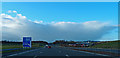
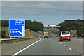
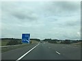
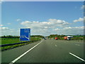
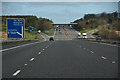
Today, the well sits to the western side of the very busy A74(M). Google Earth images indicate a depression which may, or may not be, the well pool.
If anyone has visited this site, and has photographs or further information about it, please would you add them to this site page? It would be interesting to hear if the water from the well had any special healing and/or restorative properties. Thank you.
You may be viewing yesterday's version of this page. To see the most up to date information please register for a free account.
Do not use the above information on other web sites or publications without permission of the contributor.
Nearby Images from Geograph Britain and Ireland:
©2014(licence)
©2020(licence)
©2019(licence)
©2010(licence)
©2016(licence)
The above images may not be of the site on this page, they are loaded from Geograph.
Please Submit an Image of this site or go out and take one for us!
Click here to see more info for this site
Nearby sites
Key: Red: member's photo, Blue: 3rd party photo, Yellow: other image, Green: no photo - please go there and take one, Grey: site destroyed
Download sites to:
KML (Google Earth)
GPX (GPS waypoints)
CSV (Garmin/Navman)
CSV (Excel)
To unlock full downloads you need to sign up as a Contributory Member. Otherwise downloads are limited to 50 sites.
Turn off the page maps and other distractions
Nearby sites listing. In the following links * = Image available
5.5km SSE 168° Our Lady's Well (St Mungo's Old Church) Holy Well or Sacred Spring (NY1477)
6.8km ESE 122° Burnswark Hillfort* Hillfort (NY18607870)
6.8km ESE 121° Burnswark Hill Cairn* Cairn (NY18697883)
7.1km NW 326° Archwood Hill* Hillfort (NY0911488380)
7.6km NNW 331° Lochbrow Prehistoric Landscape* Ancient Village or Settlement (NY0942389153)
7.7km NNW 333° Lochbrow Cursus* Cursus (NY0951489350)
8.7km E 87° Whiteholme Rig* Stone Circle (NY21718269)
10.2km SSE 150° Hoddom Parish Church* Sculptured Stone (NY1783573516)
10.9km E 82° Newhall Hill (Paddockhole)* Ancient Village or Settlement (NY23808372)
11.0km ENE 58° Whitcastles* Stone Circle (NY22408806)
11.1km NE 56° Kirkslight Rig Stone Circle (NY223885)
12.1km N 351° Skip Knowe* Standing Stone (Menhir) (NY1118094430)
13.1km NNW 328° Crunzierton Wood Scooped Settlement* Ancient Village or Settlement (NY0625093750)
13.5km N 3° Kirkhill* Stone Circle (NY1397895929)
13.9km ESE 119° Fair Helen's Cross (Kirkconnel)* Ancient Cross (NY24987537)
14.0km ESE 119° Fair Helen's Tombstone* Marker Stone (NY25037534)
14.0km N 359° St Cuthbert's Church (Wamphray)* Ancient Cross (NY1307096462)
14.0km N 358° Wamphray Place* Misc. Earthwork (NY12829648)
14.0km N 354° Pumplaburn* Cairn (NY11869644)
14.5km S 190° The Ruthwell Cross* Ancient Cross (NY1005968219)
15.0km NE 56° Bailiehill Fort* Hillfort (NY2558090520)
15.3km NE 46° Castle O'er Fort* Hillfort (NY2419092850)
15.4km NE 49° The Knowe* Ancient Village or Settlement (NY24799226)
15.6km SSW 195° Brow Well (Ruthwell)* Holy Well or Sacred Spring (NY0850567509)
16.0km NE 45° Over Rig* Misc. Earthwork (NY2455693475)
View more nearby sites and additional images


 We would like to know more about this location. Please feel free to add a brief description and any relevant information in your own language.
 Wir möchten mehr über diese Stätte erfahren. Bitte zögern Sie nicht, eine kurze Beschreibung und relevante Informationen in Deutsch hinzuzufügen.
 Nous aimerions en savoir encore un peu sur les lieux. S'il vous plaît n'hesitez pas à ajouter une courte description et tous les renseignements pertinents dans votre propre langue.
 Quisieramos informarnos un poco más de las lugares. No dude en añadir una breve descripción y otros datos relevantes en su propio idioma.