

<< Our Photo Pages >> Rock Park - Holy Well or Sacred Spring in Wales in Powys
Submitted by TimPrevett on Wednesday, 23 July 2008 Page Views: 4425
Springs and Holy WellsSite Name: Rock ParkCountry: Wales
NOTE: This site is 1.92 km away from the location you searched for.
County: Powys Type: Holy Well or Sacred Spring
Nearest Town: Llandrindod Wells
Map Ref: SO055610
Latitude: 52.239049N Longitude: 3.385333W
Condition:
| 5 | Perfect |
| 4 | Almost Perfect |
| 3 | Reasonable but with some damage |
| 2 | Ruined but still recognisable as an ancient site |
| 1 | Pretty much destroyed, possibly visible as crop marks |
| 0 | No data. |
| -1 | Completely destroyed |
| 5 | Superb |
| 4 | Good |
| 3 | Ordinary |
| 2 | Not Good |
| 1 | Awful |
| 0 | No data. |
| 5 | Can be driven to, probably with disabled access |
| 4 | Short walk on a footpath |
| 3 | Requiring a bit more of a walk |
| 2 | A long walk |
| 1 | In the middle of nowhere, a nightmare to find |
| 0 | No data. |
| 5 | co-ordinates taken by GPS or official recorded co-ordinates |
| 4 | co-ordinates scaled from a detailed map |
| 3 | co-ordinates scaled from a bad map |
| 2 | co-ordinates of the nearest village |
| 1 | co-ordinates of the nearest town |
| 0 | no data |
Internal Links:
External Links:
")
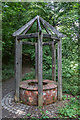
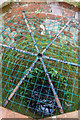
A marble surround with a spout from which flows water rich in chalybeate in Rock Park, Llandrindod Wells. Very salty tasting, and does not keep well.
You may be viewing yesterday's version of this page. To see the most up to date information please register for a free account.
")
")
Do not use the above information on other web sites or publications without permission of the contributor.
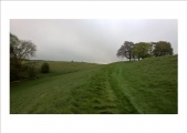
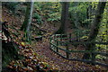
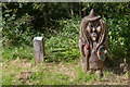
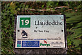
Nearby Images from Geograph Britain and Ireland:
©2014(licence)
©2013(licence)
©2013(licence)
©2013(licence)
©2013(licence)
The above images may not be of the site on this page, they are loaded from Geograph.
Please Submit an Image of this site or go out and take one for us!
Click here to see more info for this site
Nearby sites
Key: Red: member's photo, Blue: 3rd party photo, Yellow: other image, Green: no photo - please go there and take one, Grey: site destroyed
Download sites to:
KML (Google Earth)
GPX (GPS waypoints)
CSV (Garmin/Navman)
CSV (Excel)
To unlock full downloads you need to sign up as a Contributory Member. Otherwise downloads are limited to 50 sites.
Turn off the page maps and other distractions
Nearby sites listing. In the following links * = Image available
492m ENE 77° The Temple, Llandrindod Wells* Stone Circle (SO0598261105)
796m ESE 103° Llandrindod Wells* Holy Well or Sacred Spring (SO0627460806)
1.5km ESE 110° Little Hill Cairn (SO0692960454)
2.0km E 91° Pantpurlas* Round Barrow(s) (SO0752460940)
2.0km ESE 106° The Beacon (Powys)* Ring Cairn (SO0744660403)
2.1km ESE 122° Broomy Hill North* Standing Stone (Menhir) (SO07235988)
2.2km SE 131° Broomy Hill Centre* Standing Stone (Menhir) (SO07165953)
2.3km SE 125° Little Hill Cairn 1* Cairn (SO0736159643)
2.3km E 83° Bongam Bank* Cairn (SO0779761255)
2.3km SE 142° Broomy Hill South* Standing Stone (Menhir) (SO06905913)
2.4km SE 129° Little Hill Cairn (III)* Cairn (SO07345943)
3.0km ESE 111° Carreg Gwiber 2* Standing Stone (Menhir) (SO08295988)
3.1km ESE 106° Carredwiber Bank* Standing Stone (Menhir) (SO08436009)
3.1km ESE 114° Carregwiber Bank* Cairn (SO08325970)
3.1km ENE 78° Cefnllys Burnt Mound* Misc. Earthwork (SO086616)
3.3km ESE 117° Careg-Wiber* Ancient Village or Settlement (SO08395948)
3.3km ESE 114° Carreg Gwiber 1* Standing Stone (Menhir) (SO08515960)
3.5km E 81° Cefnllys Castle* Hillfort (SO08936146)
3.6km W 275° Dol Y Fan Cairn* Cairn (SO01946135)
3.7km SW 233° Newmead Farm* Natural Stone / Erratic / Other Natural Feature (SO025588)
3.8km NW 309° Gwynfan Ring Cairn* Cairn (SO02566344)
4.4km ESE 120° Gelli Hill Cairn B* Cairn (SO09305870)
4.7km ESE 123° Gelli Hill Standing Stone* Standing Stone (Menhir) (SO09425837)
4.7km SSE 149° Upper House Cairns I,II & III* Cairn (SO079569)
4.8km ESE 123° Gelli Hill Circle* Stone Circle (SO095583)
View more nearby sites and additional images


 We would like to know more about this location. Please feel free to add a brief description and any relevant information in your own language.
 Wir möchten mehr über diese Stätte erfahren. Bitte zögern Sie nicht, eine kurze Beschreibung und relevante Informationen in Deutsch hinzuzufügen.
 Nous aimerions en savoir encore un peu sur les lieux. S'il vous plaît n'hesitez pas à ajouter une courte description et tous les renseignements pertinents dans votre propre langue.
 Quisieramos informarnos un poco más de las lugares. No dude en añadir una breve descripción y otros datos relevantes en su propio idioma.