


<< Text Pages >> Mynydd Brith-Weunydd - Cairn in Wales in West Glamorgan
Submitted by coldrum on Thursday, 04 February 2010 Page Views: 4644
Neolithic and Bronze AgeSite Name: Mynydd Brith-WeunyddCountry: Wales
NOTE: This site is 3.987 km away from the location you searched for.
County: West Glamorgan Type: Cairn
Map Ref: ST00279263
Latitude: 51.623622N Longitude: 3.442058W
Condition:
| 5 | Perfect |
| 4 | Almost Perfect |
| 3 | Reasonable but with some damage |
| 2 | Ruined but still recognisable as an ancient site |
| 1 | Pretty much destroyed, possibly visible as crop marks |
| 0 | No data. |
| -1 | Completely destroyed |
| 5 | Superb |
| 4 | Good |
| 3 | Ordinary |
| 2 | Not Good |
| 1 | Awful |
| 0 | No data. |
| 5 | Can be driven to, probably with disabled access |
| 4 | Short walk on a footpath |
| 3 | Requiring a bit more of a walk |
| 2 | A long walk |
| 1 | In the middle of nowhere, a nightmare to find |
| 0 | No data. |
| 5 | co-ordinates taken by GPS or official recorded co-ordinates |
| 4 | co-ordinates scaled from a detailed map |
| 3 | co-ordinates scaled from a bad map |
| 2 | co-ordinates of the nearest village |
| 1 | co-ordinates of the nearest town |
| 0 | no data |
Be the first person to rate this site - see the 'Contribute!' box in the right hand menu.
Internal Links:
External Links:
Cairn in West Glamorgan
"A ruined round cairn, 10m in diameter and 0.5m high, with possible cist elements exposed centrally."
Source: Coflein.
You may be viewing yesterday's version of this page. To see the most up to date information please register for a free account.
Do not use the above information on other web sites or publications without permission of the contributor.
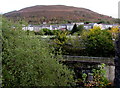
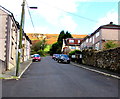
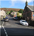
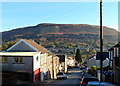
Nearby Images from Geograph Britain and Ireland:
©2017(licence)
©2017(licence)
©2017(licence)
©2011(licence)
©2017(licence)
The above images may not be of the site on this page, they are loaded from Geograph.
Please Submit an Image of this site or go out and take one for us!
Click here to see more info for this site
Nearby sites
Key: Red: member's photo, Blue: 3rd party photo, Yellow: other image, Green: no photo - please go there and take one, Grey: site destroyed
Download sites to:
KML (Google Earth)
GPX (GPS waypoints)
CSV (Garmin/Navman)
CSV (Excel)
To unlock full downloads you need to sign up as a Contributory Member. Otherwise downloads are limited to 50 sites.
Turn off the page maps and other distractions
Nearby sites listing. In the following links * = Image available
1.9km N 353° St Mary's Well (West Glamorgan)* Holy Well or Sacred Spring (ST00079455)
2.1km SW 224° Carn-Y-Celyn* Cairn (SS98779114)
3.2km WNW 298° Mynydd Y Gelli* Stone Circle (SS975942)
3.6km SW 225° Mynydd Maes-Teg Cairn (SS97699014)
4.7km WSW 257° Garn Fach Cairn (SS957917)
5.0km W 270° Garn Fawr (Ogmore Valley)* Cairn (SS95229271)
5.1km SW 233° Mynydd Maendy Cairn (SS96168964)
5.1km NNW 332° Tarren Maerdy Cairn 1 Cairn (SS97959720)
5.6km WNW 282° Craig y Geifr Cairn (SS94809395)
5.6km NW 307° Treorchy Gorsedd Circle* Modern Stone Circle etc (SS9585596145)
5.9km WNW 291° Bwlch y Clawdd Cairn Cairn (SS948948)
6.2km WSW 244° Bryn-Y-Cae Cairn (SS94689002)
6.5km WNW 286° Bwlch y Clawdd* Modern Stone Circle etc (SS94039450)
6.9km W 269° Burry Holms Fort Hillfort (SS933926)
7.3km SE 137° Tarren Deusant* Holy Well or Sacred Spring (ST05208721)
8.0km ESE 106° Coed-Pen-Maen Common* Ring Cairn (ST07989031)
8.2km SSW 200° Mynydd y Gaer* Hillfort (SS97358495)
8.3km S 172° Mynydd Meiros Cairn* Cairn (ST0121084423)
8.3km W 274° Carn-Y-Hyrddod* Cairn (SS91999339)
8.3km ESE 107° Carreg Siglio* Modern Stone Circle etc (ST082901)
8.4km SW 215° Mynnydd y Gaer* Cairn (SS95378584)
8.6km WSW 252° Garn Lwyd* Ring Cairn (SS9199090146)
8.7km WNW 287° Crugyrafan* Round Barrow(s) (SS920954)
8.8km S 169° Llanharan Beacons* Cairn (ST0170783980)
9.1km W 279° The Werfa Round Barrow(s) (SS913942)
View more nearby sites and additional images


 We would like to know more about this location. Please feel free to add a brief description and any relevant information in your own language.
 Wir möchten mehr über diese Stätte erfahren. Bitte zögern Sie nicht, eine kurze Beschreibung und relevante Informationen in Deutsch hinzuzufügen.
 Nous aimerions en savoir encore un peu sur les lieux. S'il vous plaît n'hesitez pas à ajouter une courte description et tous les renseignements pertinents dans votre propre langue.
 Quisieramos informarnos un poco más de las lugares. No dude en añadir una breve descripción y otros datos relevantes en su propio idioma.