


<< Our Photo Pages >> Witchis Stane - Standing Stone (Menhir) in Scotland in Midlothian
Submitted by vicky on Sunday, 22 December 2002 Page Views: 8693
Neolithic and Bronze AgeSite Name: Witchis Stane Alternative Name: South Platt HillCountry: Scotland
NOTE: This site is 0.632 km away from the location you searched for.
County: Midlothian Type: Standing Stone (Menhir)
Nearest Town: Ratho Nearest Village: Platt Hill
Map Ref: NT13177104 Landranger Map Number: 65
Latitude: 55.924568N Longitude: 3.391104W
Condition:
| 5 | Perfect |
| 4 | Almost Perfect |
| 3 | Reasonable but with some damage |
| 2 | Ruined but still recognisable as an ancient site |
| 1 | Pretty much destroyed, possibly visible as crop marks |
| 0 | No data. |
| -1 | Completely destroyed |
| 5 | Superb |
| 4 | Good |
| 3 | Ordinary |
| 2 | Not Good |
| 1 | Awful |
| 0 | No data. |
| 5 | Can be driven to, probably with disabled access |
| 4 | Short walk on a footpath |
| 3 | Requiring a bit more of a walk |
| 2 | A long walk |
| 1 | In the middle of nowhere, a nightmare to find |
| 0 | No data. |
| 5 | co-ordinates taken by GPS or official recorded co-ordinates |
| 4 | co-ordinates scaled from a detailed map |
| 3 | co-ordinates scaled from a bad map |
| 2 | co-ordinates of the nearest village |
| 1 | co-ordinates of the nearest town |
| 0 | no data |
Be the first person to rate this site - see the 'Contribute!' box in the right hand menu.
Internal Links:
External Links:
")
This site is recorded as Canmore ID 50744, which describes the site of an ancient encampment, the stone of which were used for building the walls of the Ratho Hall property. A stone from one of the cists now forms a seat on top of the hill. Canmore also describes the tradition of a woman having been burned here for witchcraft, and a quantity of burned ashes were found in the 19th century. The Canmore entry also includes details of an excavation carried out in 2013, prior to the building of a house.
This standing stone is featured on The Ancient Stones: A Guide to Standing Stones and Stone Circles in the South of Scotland - see their entry for the Witchis Stane, Platt Hill, Ratho, which includes a description, directions for finding this stone (near to the trig point) together with nearby parking, folklore and fieldnotes.
You may be viewing yesterday's version of this page. To see the most up to date information please register for a free account.
")
Do not use the above information on other web sites or publications without permission of the contributor.
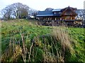
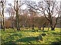
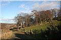
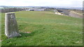
Nearby Images from Geograph Britain and Ireland:
©2015(licence)
©2006(licence)
©2012(licence)
©2008(licence)
©2006(licence)
The above images may not be of the site on this page, they are loaded from Geograph.
Please Submit an Image of this site or go out and take one for us!
Click here to see more info for this site
Nearby sites
Key: Red: member's photo, Blue: 3rd party photo, Yellow: other image, Green: no photo - please go there and take one, Grey: site destroyed
Download sites to:
KML (Google Earth)
GPX (GPS waypoints)
CSV (Garmin/Navman)
CSV (Excel)
To unlock full downloads you need to sign up as a Contributory Member. Otherwise downloads are limited to 50 sites.
Turn off the page maps and other distractions
Nearby sites listing. In the following links * = Image available
1.4km SSW 197° Witches' Stone (Ratho)* Rock Art (NT12736973)
1.4km S 190° Tormain Hill* Rock Art (NT12906967)
1.7km NNW 341° Lochend menhir* Standing Stone (Menhir) (NT12667263)
1.8km NNW 331° Huly Hill Standing Stones* Standing Stones (NT1234272610)
1.8km NNW 331° Huly Hill Cairn* Round Cairn (NT1234272610)
2.5km ENE 66° Gogar Stone* Standing Stone (Menhir) (NT15487199)
3.4km SE 140° Newhouse Standing Stone Standing Stone (Menhir) (NT15296838)
3.6km N 9° Carlowrie (Kirkliston) Rock Art (NT138746)
3.7km NNE 26° Cat Stane (Kirkliston)* Standing Stone (Menhir) (NT1489374373)
4.1km S 174° Dalmahoy Hill Hillfort (NT135669)
4.5km SSW 202° Kirknewton stone Sculptured Stone (NT11426693)
4.5km S 181° Kaimes Standing Stones (NT130665)
5.6km NE 49° Cammo Stone* Standing Stone (Menhir) (NT1747774681)
6.1km ESE 122° St Mungo's Well (Edinburgh)* Holy Well or Sacred Spring (NT18346773)
6.6km ENE 76° Physic Well (Corstorphine)* Holy Well or Sacred Spring (NT19597252)
6.6km ENE 75° Lady Well* Holy Well or Sacred Spring (NT196726)
7.1km NNE 13° Crossall Hill (South Queensferry)* Ancient Cross (NT14907791)
7.4km N 356° Bell Stane (Queensferry) Standing Stone (Menhir) (NT12827840)
8.3km NW 321° Justice Stone Standing Stone (Menhir) (NT08087759)
8.3km NE 43° Cramond Ancient Village or Settlement (NT18957706)
9.5km NNW 327° Abercorn Sculptured Stone (NT08147910)
9.7km E 95° Craiglockart Hill Vitrified Fort Hillfort (NT22827006)
10.0km ENE 74° Succoth Place Double Cist Burial Cist (NT22897362)
11.3km E 91° Hanging Stanes (Braid Road)* Marker Stone (NT24517061)
11.3km E 86° The Bore Stone* Marker Stone (NT2450871568)
View more nearby sites and additional images


 We would like to know more about this location. Please feel free to add a brief description and any relevant information in your own language.
 Wir möchten mehr über diese Stätte erfahren. Bitte zögern Sie nicht, eine kurze Beschreibung und relevante Informationen in Deutsch hinzuzufügen.
 Nous aimerions en savoir encore un peu sur les lieux. S'il vous plaît n'hesitez pas à ajouter une courte description et tous les renseignements pertinents dans votre propre langue.
 Quisieramos informarnos un poco más de las lugares. No dude en añadir una breve descripción y otros datos relevantes en su propio idioma.