


<< Text Pages >> Gilcrux Holy Well - Holy Well or Sacred Spring in England in Cumbria
Submitted by Anne T on Monday, 18 July 2022 Page Views: 1100
Springs and Holy WellsSite Name: Gilcrux Holy Well Alternative Name: Tommy Tack Well (Gilcrux); Funny Jack Well (Gilcrux)Country: England
NOTE: This site is 2.307 km away from the location you searched for.
County: Cumbria Type: Holy Well or Sacred Spring
Nearest Town: Aspatria Nearest Village: Gilcrux
Map Ref: NY1210038270
Latitude: 54.731697N Longitude: 3.366543W
Condition:
| 5 | Perfect |
| 4 | Almost Perfect |
| 3 | Reasonable but with some damage |
| 2 | Ruined but still recognisable as an ancient site |
| 1 | Pretty much destroyed, possibly visible as crop marks |
| 0 | No data. |
| -1 | Completely destroyed |
| 5 | Superb |
| 4 | Good |
| 3 | Ordinary |
| 2 | Not Good |
| 1 | Awful |
| 0 | No data. |
| 5 | Can be driven to, probably with disabled access |
| 4 | Short walk on a footpath |
| 3 | Requiring a bit more of a walk |
| 2 | A long walk |
| 1 | In the middle of nowhere, a nightmare to find |
| 0 | No data. |
| 5 | co-ordinates taken by GPS or official recorded co-ordinates |
| 4 | co-ordinates scaled from a detailed map |
| 3 | co-ordinates scaled from a bad map |
| 2 | co-ordinates of the nearest village |
| 1 | co-ordinates of the nearest town |
| 0 | no data |
Be the first person to rate this site - see the 'Contribute!' box in the right hand menu.
Internal Links:
External Links:
Holy Well or Sacred Spring in Cumbria
This well is classified in the Cumbria Historic Environment Record, number 3721, as a holy well. This tells us: "There is a salt spring called Tommy Tack or Funny Jack in a field east of Gilcrux village. Once highly esteemed for its medicinal properties. Listed as a holy well [by McIntyre, in his 1944 publication 'Holy Wells of Cumbria' (p9)]".
This well also features in the Old Cumbria Gazetteer; see their entry for Tommy Tack Saline Spring, Gilcrux, which also includes a photograph from about 2013. A note below the photograph reads: "This spring was hard to find as there is another spring nearby, but fresh water. The saline spring was discharging into a patch of muddy ground in a field so it was not visually obvious. We only found it because we had a conductivity meter."
The well is also mentioned in the Mysterious Britain website, which tells us: "No trace of Tommy Tack [2018] now exists though the following two 19th century accounts refer to the wells medicinal properties:
“This Parish is perhaps the most remarkable of any in England for the fineness and number of its springs. In the village a fine spring rises at almost every door, and when united form a considerable stream. In a field a little eastward from the village are two springs about 40 or 50 yards asunder, the one fresh and the other salt water, having medicinal properties; the salt spring is denominated ‘Tommy Tack’.” [The Gazetteer and Directory of Cumberland, 1847]; and:
‘In a field a little to the east of the village of Gilcrux there are two springs some fifty yards apart; one has fresh water, and the other salt and of medicinal qualities. The salt water well is named the “Tommy Tack,” but by some “Funny Jack.” [The Legendary Lore of the Holy Wells of England by Robert Charles Hope (1893)]"
Google Earth images show two small circular patches of earth some 55m apart in the pasture field mentioned, so this might possibly be the two wells, one saline, one fresh, mentioned above.
Does anyone know what medicinal properties the water of this holy/medicinal well had? Have you visited this site and have any photographs to add?
You may be viewing yesterday's version of this page. To see the most up to date information please register for a free account.
Do not use the above information on other web sites or publications without permission of the contributor.
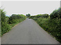
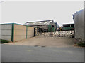
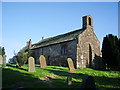
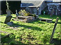
Nearby Images from Geograph Britain and Ireland:
©2016(licence)
©2016(licence)
©2007(licence)
©2007(licence)
©2010(licence)
The above images may not be of the site on this page, they are loaded from Geograph.
Please Submit an Image of this site or go out and take one for us!
Click here to see more info for this site
Nearby sites
Key: Red: member's photo, Blue: 3rd party photo, Yellow: other image, Green: no photo - please go there and take one, Grey: site destroyed
Download sites to:
KML (Google Earth)
GPX (GPS waypoints)
CSV (Garmin/Navman)
CSV (Excel)
To unlock full downloads you need to sign up as a Contributory Member. Otherwise downloads are limited to 50 sites.
Turn off the page maps and other distractions
Nearby sites listing. In the following links * = Image available
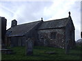
377m WSW 254° St Mary's Church (Gilcrux)* Ancient Cross (NY1173438176)
396m WSW 249° The Hatching Well (Gilcrux)* Holy Well or Sacred Spring (NY1172638137)
4.4km NE 35° St Patrick's Well (Aspatria)* Holy Well or Sacred Spring (NY147418)
4.4km SE 140° Covered Well (Blindcrake)* Holy Well or Sacred Spring (NY14863482)
4.5km NE 35° St Kentigern (Aspatria)* Ancient Cross (NY1475541910)
4.6km S 185° St Bridget's Church (Bridekirk)* Ancient Cross (NY1164133689)
5.2km WSW 248° St Mungo's Dearham* Ancient Cross (NY0724636396)
5.2km W 277° St John The Evangelist (Crosscanonby)* Ancient Cross (NY0691939004)
5.5km WNW 291° Swarthy Hill Multivallate Hillfort Promontory Fort / Cliff Castle (NY0692940323)
6.4km SE 139° St Michael and All Angels (Isel)* Ancient Cross (NY1624133312)
6.6km ENE 59° Blennerhasset Cross* Ancient Cross (NY1783141517)
7.5km E 93° The Battery Enclosure* Misc. Earthwork (NY19653775)
8.0km SSW 204° Nun's Well (Brigham) Holy Well or Sacred Spring (NY0872031040)
8.1km SSW 204° St Bridget's Church (Brigham)* Ancient Cross (NY0858030920)
8.3km SSW 205° Chantry Well (Brigham)* Holy Well or Sacred Spring (NY08463083)
8.3km W 262° Maryport Roman Fortress* Ancient Village or Settlement (NY03873721)
8.6km SE 138° Elvaplain* Stone Circle (NY1770131716)
10.3km E 83° Ireby Old Church* Ancient Cross (NY2238839305)
10.3km NNE 31° St Mungo's Church (Bromfield)* Ancient Cross (NY1758247034)
10.4km NNE 31° St Mungo's Well (Bromfield)* Holy Well or Sacred Spring (NY1760747131)
10.9km SE 132° Castle How Fort Hillfort (NY201308)
11.3km SSE 169° Stanger Spa* Holy Well or Sacred Spring (NY14122716)
11.3km E 96° High Ireby Standing Stone* Standing Stone (Menhir) (NY234369)
13.6km E 92° Green How Enclosure* Causewayed Enclosure (NY25753751)
13.8km E 87° Daleside Tumulus* Round Barrow(s) (NY259387)
View more nearby sites and additional images


 We would like to know more about this location. Please feel free to add a brief description and any relevant information in your own language.
 Wir möchten mehr über diese Stätte erfahren. Bitte zögern Sie nicht, eine kurze Beschreibung und relevante Informationen in Deutsch hinzuzufügen.
 Nous aimerions en savoir encore un peu sur les lieux. S'il vous plaît n'hesitez pas à ajouter une courte description et tous les renseignements pertinents dans votre propre langue.
 Quisieramos informarnos un poco más de las lugares. No dude en añadir una breve descripción y otros datos relevantes en su propio idioma.