


<< Text Pages >> Cwm Maen Gwynedd Stone Row I - Stone Row / Alignment in Wales in Denbighshire
Submitted by coldrum on Wednesday, 08 July 2009 Page Views: 3581
Neolithic and Bronze AgeSite Name: Cwm Maen Gwynedd Stone Row ICountry: Wales County: Denbighshire Type: Stone Row / Alignment
Map Ref: SJ0881132142
Latitude: 52.878986N Longitude: 3.356444W
Condition:
| 5 | Perfect |
| 4 | Almost Perfect |
| 3 | Reasonable but with some damage |
| 2 | Ruined but still recognisable as an ancient site |
| 1 | Pretty much destroyed, possibly visible as crop marks |
| 0 | No data. |
| -1 | Completely destroyed |
| 5 | Superb |
| 4 | Good |
| 3 | Ordinary |
| 2 | Not Good |
| 1 | Awful |
| 0 | No data. |
| 5 | Can be driven to, probably with disabled access |
| 4 | Short walk on a footpath |
| 3 | Requiring a bit more of a walk |
| 2 | A long walk |
| 1 | In the middle of nowhere, a nightmare to find |
| 0 | No data. |
| 5 | co-ordinates taken by GPS or official recorded co-ordinates |
| 4 | co-ordinates scaled from a detailed map |
| 3 | co-ordinates scaled from a bad map |
| 2 | co-ordinates of the nearest village |
| 1 | co-ordinates of the nearest town |
| 0 | no data |
Be the first person to rate this site - see the 'Contribute!' box in the right hand menu.
Internal Links:
External Links:
Stone Row / Alignment in Denbighshire (Sir Ddinbych)
"Row of stones, 5 equally spaced (about 5 m apart), another one far off the end, stone size: about 1m. "
From Coflein:
https://www.coflein.gov.uk/en/site/295066
You may be viewing yesterday's version of this page. To see the most up to date information please register for a free account.
Do not use the above information on other web sites or publications without permission of the contributor.
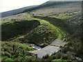
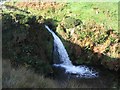
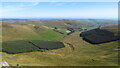
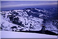
Nearby Images from Geograph Britain and Ireland:
©2006(licence)
©2006(licence)
©2020(licence)
©2020(licence)
©2012(licence)
The above images may not be of the site on this page, they are loaded from Geograph.
Please Submit an Image of this site or go out and take one for us!
Click here to see more info for this site
Nearby sites
Key: Red: member's photo, Blue: 3rd party photo, Yellow: other image, Green: no photo - please go there and take one, Grey: site destroyed
Download sites to:
KML (Google Earth)
GPX (GPS waypoints)
CSV (Garmin/Navman)
CSV (Excel)
To unlock full downloads you need to sign up as a Contributory Member. Otherwise downloads are limited to 50 sites.
Turn off the page maps and other distractions
Nearby sites listing. In the following links * = Image available
105m NNE 22° Cwm Maen Gwynedd Stone Row II Stone Row / Alignment (SJ0885332238)
1.6km NW 320° Berwyn mountains Marker stones* Marker Stone (SJ078334)
1.7km W 280° Cader Berwyn Cairn 2* Cairn (SJ07173245)
1.7km WNW 288° Cadair Berwyn* Cairn (SJ072327)
1.7km NNW 329° Bwlch Maen Gwynedd* Cairn (SJ07953364)
2.2km W 263° Moel Sych* Cairn (SJ066319)
2.8km NNW 335° Bwrdd Arthur* Cairn (SJ077347)
3.0km SW 215° Afon Disgynfa* Cairn (SJ07042971)
3.3km WSW 239° Cwm Rhiwiau* Stone Circle (SJ059305)
3.6km SW 236° Rhos Y Beddau (Circle)* Stone Circle (SJ058302)
3.6km SW 236° Rhos y Beddau (Rows)* Multiple Stone Rows / Avenue (SJ0579530205)
4.1km WNW 285° Pennant* Round Cairn (SJ04823331)
4.3km WNW 287° Cwm Tywyll* Ring Cairn (SJ04683346)
4.4km N 3° Careg-Y-Caws* Cairn (SJ09133650)
4.5km W 279° Nant Esgeiriau* Round Cairn (SJ044329)
4.6km N 355° Pen Bwlch Llandrillo Cairn (SJ08513674)
4.7km SSW 200° Glan Hafon cairn* Cairn (SJ07152776)
4.9km WNW 285° Cefn Penagored Ridge Cairns* Cairn (SJ041335)
5.0km NW 323° Cerrig Bwlch Y Fedw* Stone Circle (SJ05873615)
5.1km WNW 285° Cefn Penagored Cairn and Ring Cairn* Cairn (SJ039336)
5.1km SW 215° Bedd Crynddyn* Cairn (SJ058280)
5.6km W 281° Rhyd y Gethin Standing Stone (Menhir) (SJ03303330)
5.8km W 275° Yr Aran* Barrow Cemetery (SJ03053279)
5.8km WNW 291° Penagored Standing Stone* Standing Stone (Menhir) (SJ034343)
6.0km NNW 327° Moel Ty Uchaf* Stone Circle (SJ05613717)
View more nearby sites and additional images


 We would like to know more about this location. Please feel free to add a brief description and any relevant information in your own language.
 Wir möchten mehr über diese Stätte erfahren. Bitte zögern Sie nicht, eine kurze Beschreibung und relevante Informationen in Deutsch hinzuzufügen.
 Nous aimerions en savoir encore un peu sur les lieux. S'il vous plaît n'hesitez pas à ajouter une courte description et tous les renseignements pertinents dans votre propre langue.
 Quisieramos informarnos un poco más de las lugares. No dude en añadir una breve descripción y otros datos relevantes en su propio idioma.