

, Aubrey Burl")
<< Text Pages >> Necrópolis Peña San Clemente - Barrow Cemetery in Spain in Castilla y León
Submitted by holger_rix on Thursday, 03 December 2015 Page Views: 648
Neolithic and Bronze AgeSite Name: Necrópolis Peña San ClementeCountry: Spain
NOTE: This site is 3.255 km away from the location you searched for.
Region: Castilla y León Type: Barrow Cemetery
Nearest Village: Quintana María
Latitude: 42.781120N Longitude: 3.3185W
Condition:
| 5 | Perfect |
| 4 | Almost Perfect |
| 3 | Reasonable but with some damage |
| 2 | Ruined but still recognisable as an ancient site |
| 1 | Pretty much destroyed, possibly visible as crop marks |
| 0 | No data. |
| -1 | Completely destroyed |
| 5 | Superb |
| 4 | Good |
| 3 | Ordinary |
| 2 | Not Good |
| 1 | Awful |
| 0 | No data. |
| 5 | Can be driven to, probably with disabled access |
| 4 | Short walk on a footpath |
| 3 | Requiring a bit more of a walk |
| 2 | A long walk |
| 1 | In the middle of nowhere, a nightmare to find |
| 0 | No data. |
| 5 | co-ordinates taken by GPS or official recorded co-ordinates |
| 4 | co-ordinates scaled from a detailed map |
| 3 | co-ordinates scaled from a bad map |
| 2 | co-ordinates of the nearest village |
| 1 | co-ordinates of the nearest town |
| 0 | no data |
Be the first person to rate this site - see the 'Contribute!' box in the right hand menu.
Internal Links:
External Links:
Barrow Cemetery in Castilla y León
You may be viewing yesterday's version of this page. To see the most up to date information please register for a free account.
Do not use the above information on other web sites or publications without permission of the contributor.
Nearby Images from Flickr

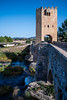
The above images may not be of the site on this page, but were taken nearby. They are loaded from Flickr so please click on them for image credits.
Click here to see more info for this site
Nearby sites
Click here to view sites on an interactive map of the areaKey: Red: member's photo, Blue: 3rd party photo, Yellow: other image, Green: no photo - please go there and take one, Grey: site destroyed
Download sites to:
KML (Google Earth)
GPX (GPS waypoints)
CSV (Garmin/Navman)
CSV (Excel)
To unlock full downloads you need to sign up as a Contributory Member. Otherwise downloads are limited to 50 sites.
Turn off the page maps and other distractions
Nearby sites listing. In the following links * = Image available
10.7km NE 40° Ribera Tumulua Round Barrow(s)
11.3km NE 51° Ampo Tumulua Round Barrow(s)
11.3km NE 51° Ampo Trikuharria Burial Chamber or Dolmen
11.7km ENE 68° Villafria Zutarria Standing Stone (Menhir)
11.7km NE 37° La Cruz De San Miguel Tumulua Round Barrow(s)
12.1km ENE 57° Villafria Tumulua Round Barrow(s)
12.2km NNE 20° San Lorenzo 2 Tumulua Round Barrow(s)
12.3km NNE 19° Campullido 1 Tumulua Round Barrow(s)
12.3km NNE 18° Campullido 2 Tumulua Round Barrow(s)
12.3km NNE 18° Campullido 3 Tumulua Round Barrow(s)
12.4km NNE 18° Campullido Zutarria Standing Stone (Menhir)
12.4km NNE 24° San Lorenzo 1 Tumulua Round Barrow(s)
12.8km NE 51° El Mojon Tumulua Round Barrow(s)
13.1km NE 48° Santa Gadea Tumulua Round Barrow(s)
13.3km NNE 21° La Barrera 1 Tumulua Round Barrow(s)
13.4km NNE 21° La Barrera 2 Tumulua Round Barrow(s)
13.5km NNE 27° El Castrillo Zutarria Standing Stone (Menhir)
13.5km NNE 26° El Castrillo Tumulua Round Barrow(s)
13.5km NNE 14° El Paso De Campullido Tumulua Round Barrow(s)
13.6km NNE 26° El Castrillo Eremu Tumularra Barrow Cemetery
14.8km NNE 24° El Gustal Zutarria* Standing Stone (Menhir)
15.2km NNE 24° Leron 1 Tumulua Round Barrow(s)
15.3km NNE 22° Leron 2 Tumulua Round Barrow(s)
16.3km NE 38° Ribota Zutarria* Standing Stone (Menhir)
17.6km NE 42° El Manzanal Eremu Tumularra Barrow Cemetery
View more nearby sites and additional images


 We would like to know more about this location. Please feel free to add a brief description and any relevant information in your own language.
 Wir möchten mehr über diese Stätte erfahren. Bitte zögern Sie nicht, eine kurze Beschreibung und relevante Informationen in Deutsch hinzuzufügen.
 Nous aimerions en savoir encore un peu sur les lieux. S'il vous plaît n'hesitez pas à ajouter une courte description et tous les renseignements pertinents dans votre propre langue.
 Quisieramos informarnos un poco más de las lugares. No dude en añadir una breve descripción y otros datos relevantes en su propio idioma.