


<< Our Photo Pages >> St Decumen's Well - Holy Well or Sacred Spring in England in Somerset
Submitted by holywell on Tuesday, 12 September 2006 Page Views: 11165
Springs and Holy WellsSite Name: St Decumen's WellCountry: England County: Somerset Type: Holy Well or Sacred Spring
Nearest Village: Watchet
Map Ref: ST064426
Latitude: 51.174950N Longitude: 3.34032W
Condition:
| 5 | Perfect |
| 4 | Almost Perfect |
| 3 | Reasonable but with some damage |
| 2 | Ruined but still recognisable as an ancient site |
| 1 | Pretty much destroyed, possibly visible as crop marks |
| 0 | No data. |
| -1 | Completely destroyed |
| 5 | Superb |
| 4 | Good |
| 3 | Ordinary |
| 2 | Not Good |
| 1 | Awful |
| 0 | No data. |
| 5 | Can be driven to, probably with disabled access |
| 4 | Short walk on a footpath |
| 3 | Requiring a bit more of a walk |
| 2 | A long walk |
| 1 | In the middle of nowhere, a nightmare to find |
| 0 | No data. |
| 5 | co-ordinates taken by GPS or official recorded co-ordinates |
| 4 | co-ordinates scaled from a detailed map |
| 3 | co-ordinates scaled from a bad map |
| 2 | co-ordinates of the nearest village |
| 1 | co-ordinates of the nearest town |
| 0 | no data |
Internal Links:
External Links:
I have visited· I would like to visit
bishop_pam visited on 23rd Feb 2024 - their rating: Cond: 5 Amb: 5 Access: 4
")
St Decumen was a missionary Celtic Christian who on his cloak and accompanied by his trusty cow, reached the coast of Somerset from Wales. However his missionary teachings were not welcome to the old heathen leaders, and so they plotted to remove him. Thus he was attacked whilst in prayer and summarily decapitated (other authorities say it was by pagan robbers).
However his decapitation did not stop his missionary zeal and he picked up his head and washed in the nearby stream. After which he replaced it back on his own body and carried on. Others say that the spring itself arose where the head fell. A common motif.
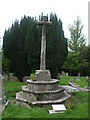
In 1914 the structure surrounding the well consisted of : "great stones set on end, having a third forming a roof on top of them. As the water runs down sharply sloping field it flows into a number of stone basins, one below another".
Today the structure appears to have repaired and the side walls consist of a number of slates, however the cover is still one large piece. The water still flows into three stone basins, although they are a little clogged with sediment. A series of steps (somewhat eroded) reach the well. A great deal of clear water remains in the well, and according to Horne, it was still sought after in 1914, although it would appear that bar a few coins, there is now no evidence of this.
Tofind this side take the road to Watchet off the A39 and then take the church road on the left. Park at the church and take the side lane to the well (it is signposted). A white gate leads down to the well. It is a delightful site.
You may be viewing yesterday's version of this page. To see the most up to date information please register for a free account.
")
")
")
")
Do not use the above information on other web sites or publications without permission of the contributor.
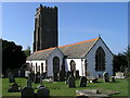
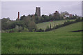
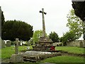
Nearby Images from Geograph Britain and Ireland:
©2005(licence)
©2010(licence)
©2011(licence)
©2011(licence)
©2020(licence)
The above images may not be of the site on this page, they are loaded from Geograph.
Please Submit an Image of this site or go out and take one for us!
Click here to see more info for this site
Nearby sites
Key: Red: member's photo, Blue: 3rd party photo, Yellow: other image, Green: no photo - please go there and take one, Grey: site destroyed
Download sites to:
KML (Google Earth)
GPX (GPS waypoints)
CSV (Garmin/Navman)
CSV (Excel)
To unlock full downloads you need to sign up as a Contributory Member. Otherwise downloads are limited to 50 sites.
Turn off the page maps and other distractions
Nearby sites listing. In the following links * = Image available
1.1km NE 39° Watchet Market House Museum* Museum (ST0710043439)
1.4km SE 132° Battlegore* Round Barrow(s) (ST07454162)
3.5km SW 216° St Pancras Well* Holy Well or Sacred Spring (ST043398)
5.6km SE 136° Curdon Camp Hillfort (ST102385)
6.2km ESE 104° Beacon Hill Platform Cairn* Barrow Cemetery (ST12434101)
6.3km ESE 120° Trendle Ring* Ancient Village or Settlement (ST118394)
7.1km ESE 116° Thorncombe Barrow* Cairn (ST12733942)
7.2km SW 223° Langridge Wood Cist* Burial Chamber or Dolmen (ST01403740)
7.6km W 266° Bat's Castle* Hillfort (SS988422)
7.6km ESE 116° Thorncombe Hill Cairns* Barrow Cemetery (ST13183914)
7.9km SW 233° Druids Combe wood boundary stone Marker Stone (SS99923799)
8.0km W 278° St. Leonard's Well (Dunster)* Holy Well or Sacred Spring (SS9850443867)
8.0km ESE 102° Holford Standing Stone* Standing Stone (Menhir) (ST142408)
8.2km ESE 116° Halsway Tumuli* Barrow Cemetery (ST137389)
8.8km S 175° Elworthy Barrows hillfort* Hillfort (ST070338)
9.0km ESE 119° Hurley Beacon Tumulus* Cairn (ST14223808)
9.1km SSW 202° Huish Champflower Barrow* Round Barrow(s) (ST0286234167)
9.3km ESE 117° Black Hill Tumuli* Barrow Cemetery (ST14653819)
9.5km SSW 210° Naked Boy stone* Standing Stone (Menhir) (ST01493447)
9.7km SW 216° Wiveliscombe Barrow* Round Barrow(s) (ST00553486)
9.9km ESE 116° Wilmots Pool Cairn* Cairn (ST15303813)
10.2km ESE 109° Dowsborough Castle* Hillfort (ST160392)
10.2km ESE 123° Fire Beacon Cairn* Cairn (ST14913697)
10.3km SW 226° Leather Barrow Round Barrow(s) (SS98903553)
10.5km ESE 120° West Hill Platform Cairn* Cairn (ST15423717)
View more nearby sites and additional images


 We would like to know more about this location. Please feel free to add a brief description and any relevant information in your own language.
 Wir möchten mehr über diese Stätte erfahren. Bitte zögern Sie nicht, eine kurze Beschreibung und relevante Informationen in Deutsch hinzuzufügen.
 Nous aimerions en savoir encore un peu sur les lieux. S'il vous plaît n'hesitez pas à ajouter une courte description et tous les renseignements pertinents dans votre propre langue.
 Quisieramos informarnos un poco más de las lugares. No dude en añadir una breve descripción y otros datos relevantes en su propio idioma.