 with our Megalithic Portal iPhone app")

<< Our Photo Pages >> Gordonstoun Ogston Cross - Ancient Cross in Scotland in Moray
Submitted by cosmic on Sunday, 28 September 2008 Page Views: 7187
Early Medieval (Dark Age)Site Name: Gordonstoun Ogston Cross Alternative Name: Michael Kirk Cross, Gordonstoun CrossCountry: Scotland
NOTE: This site is 1.051 km away from the location you searched for.
County: Moray Type: Ancient Cross
Nearest Town: Elgin Nearest Village: Lossiemouth
Map Ref: NJ19276892
Latitude: 57.702810N Longitude: 3.356251W
Condition:
| 5 | Perfect |
| 4 | Almost Perfect |
| 3 | Reasonable but with some damage |
| 2 | Ruined but still recognisable as an ancient site |
| 1 | Pretty much destroyed, possibly visible as crop marks |
| 0 | No data. |
| -1 | Completely destroyed |
| 5 | Superb |
| 4 | Good |
| 3 | Ordinary |
| 2 | Not Good |
| 1 | Awful |
| 0 | No data. |
| 5 | Can be driven to, probably with disabled access |
| 4 | Short walk on a footpath |
| 3 | Requiring a bit more of a walk |
| 2 | A long walk |
| 1 | In the middle of nowhere, a nightmare to find |
| 0 | No data. |
| 5 | co-ordinates taken by GPS or official recorded co-ordinates |
| 4 | co-ordinates scaled from a detailed map |
| 3 | co-ordinates scaled from a bad map |
| 2 | co-ordinates of the nearest village |
| 1 | co-ordinates of the nearest town |
| 0 | no data |
Internal Links:
External Links:
")
Ancient Cross situated within the churchyard of Michael Kirk within the grounds of Gordonstoun School. Seek permission to view cross at the Gate House.
You may be viewing yesterday's version of this page. To see the most up to date information please register for a free account.
")
")
")
")
Do not use the above information on other web sites or publications without permission of the contributor.
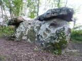
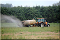
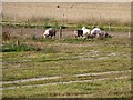
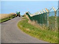
Nearby Images from Geograph Britain and Ireland:
©2016(licence)
©2013(licence)
©2013(licence)
©2013(licence)
©2014(licence)
The above images may not be of the site on this page, they are loaded from Geograph.
Please Submit an Image of this site or go out and take one for us!
Click here to see more info for this site
Nearby sites
Key: Red: member's photo, Blue: 3rd party photo, Yellow: other image, Green: no photo - please go there and take one, Grey: site destroyed
Download sites to:
KML (Google Earth)
GPX (GPS waypoints)
CSV (Garmin/Navman)
CSV (Excel)
To unlock full downloads you need to sign up as a Contributory Member. Otherwise downloads are limited to 50 sites.
Turn off the page maps and other distractions
Nearby sites listing. In the following links * = Image available
867m W 268° Gordounstoun Class II Pictish Symbol Stone (NJ184689)
2.5km NW 314° Sculptor's Cave* Class I Pictish Symbol Stone (NJ175707)
3.1km E 80° Drainie 3, 13, 26 Class III Pictish Cross Slab (NJ223694)
3.5km WNW 289° Clasach Cove* Class I Pictish Symbol Stone (NJ16007013)
3.9km W 266° Inverugie* Round Cairn (NJ154687)
4.0km W 261° Camus Stone* Standing Stone (Menhir) (NJ15306840)
4.0km W 261° Inverugie Cup marked stone* Rock Art (NJ15296838)
4.5km W 260° Inverugie Souterrain* Souterrain (Fogou, Earth House) (NJ148682)
4.6km W 260° Inverugie Cup and Ring Marked rocks* Rock Art (NJ147682)
5.0km WSW 250° Tappoch of Roseisle Round Cairn (NJ145673)
5.9km S 186° Quarry Wood* Henge (NJ185631)
6.4km SW 228° Easterton of Roseisle* Class I Pictish Symbol Stone (NJ144647)
6.5km SSE 152° Elgin symbol stone* Class II Pictish Symbol Stone (NJ2219263057)
6.6km SSE 156° Elgin Museum* Museum (NJ218628)
6.8km SSW 205° Alves Stone Circle* Stone Circle (NJ162628)
7.2km W 270° St Ethan's Well (Burghead) Holy Well or Sacred Spring (NJ12076906)
8.2km W 270° Burghead 8 Class III Pictish Cross Slab (NJ11026915)
8.3km W 270° Burghead Pictish Symbol Stones (class I) and Pictish Fort* Class I Pictish Symbol Stone (NJ109691)
8.3km W 271° Burghead Holy Well* Holy Well or Sacred Spring (NJ109692)
8.4km ESE 121° Urquart Stones* Stone Circle (NJ26456450)
8.4km W 271° Burghead* Hillfort (NJ10826918)
8.4km W 270° Burghead 5 and 9 Class III Pictish Cross Slab (NJ108691)
10.3km S 171° Birnie Pictish Stone* Class I Pictish Symbol Stone (NJ20645872)
10.5km S 169° Birnie Roundhouses* Misc. Earthwork (NJ210585)
10.8km ESE 116° Innesmill* Stone Circle (NJ28956407)
View more nearby sites and additional images


 We would like to know more about this location. Please feel free to add a brief description and any relevant information in your own language.
 Wir möchten mehr über diese Stätte erfahren. Bitte zögern Sie nicht, eine kurze Beschreibung und relevante Informationen in Deutsch hinzuzufügen.
 Nous aimerions en savoir encore un peu sur les lieux. S'il vous plaît n'hesitez pas à ajouter une courte description et tous les renseignements pertinents dans votre propre langue.
 Quisieramos informarnos un poco más de las lugares. No dude en añadir una breve descripción y otros datos relevantes en su propio idioma.