


<< Text Pages >> Whiteglen Standing Stone - Standing Stone (Menhir) in Scotland in Orkney
Submitted by Anonymous on Friday, 03 February 2023 Page Views: 378
Neolithic and Bronze AgeSite Name: Whiteglen Standing StoneCountry: Scotland
NOTE: This site is 1.396 km away from the location you searched for.
County: Orkney Type: Standing Stone (Menhir)
Nearest Town: Stromness Nearest Village: Lyness
Map Ref: HY24350221
Latitude: 58.900515N Longitude: 3.314704W
Condition:
| 5 | Perfect |
| 4 | Almost Perfect |
| 3 | Reasonable but with some damage |
| 2 | Ruined but still recognisable as an ancient site |
| 1 | Pretty much destroyed, possibly visible as crop marks |
| 0 | No data. |
| -1 | Completely destroyed |
| 5 | Superb |
| 4 | Good |
| 3 | Ordinary |
| 2 | Not Good |
| 1 | Awful |
| 0 | No data. |
| 5 | Can be driven to, probably with disabled access |
| 4 | Short walk on a footpath |
| 3 | Requiring a bit more of a walk |
| 2 | A long walk |
| 1 | In the middle of nowhere, a nightmare to find |
| 0 | No data. |
| 5 | co-ordinates taken by GPS or official recorded co-ordinates |
| 4 | co-ordinates scaled from a detailed map |
| 3 | co-ordinates scaled from a bad map |
| 2 | co-ordinates of the nearest village |
| 1 | co-ordinates of the nearest town |
| 0 | no data |
Internal Links:
External Links:
Standing Stone (Menhir) in Orkney
A small unrecorded standing stone' noted in 1880 immediately below the road, has been removed, leaving no trace, before the 1903 map revision.
https://canmore.org.uk/event/643728
Also noted on old 6 inch OS maps.
You may be viewing yesterday's version of this page. To see the most up to date information please register for a free account.
Do not use the above information on other web sites or publications without permission of the contributor.
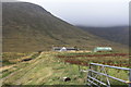
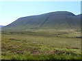
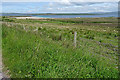
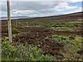
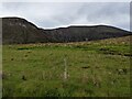
Nearby Images from Geograph Britain and Ireland:
©2010(licence)
©2011(licence)
©2018(licence)
©2023(licence)
©2023(licence)
The above images may not be of the site on this page, they are loaded from Geograph.
Please Submit an Image of this site or go out and take one for us!
Click here to see more info for this site
Nearby sites
Key: Red: member's photo, Blue: 3rd party photo, Yellow: other image, Green: no photo - please go there and take one, Grey: site destroyed
Download sites to:
KML (Google Earth)
GPX (GPS waypoints)
CSV (Garmin/Navman)
CSV (Excel)
To unlock full downloads you need to sign up as a Contributory Member. Otherwise downloads are limited to 50 sites.
Turn off the page maps and other distractions
Nearby sites listing. In the following links * = Image available
903m NE 45° Quoyness, Greenhill Broch* Broch or Nuraghe (HY25000284)
1.8km S 180° Dwarfie Stane* Rock Cut Tomb (HY24300043)
4.3km NW 314° Braebister* Promontory Fort / Cliff Castle (HY21300522)
6.3km N 354° Warebeth* Chambered Tomb (HY238085)
6.4km NE 51° Sower Castle* Ancient Village or Settlement (HY29400620)
7.0km NNE 17° Quoyelsh* Ancient Village or Settlement (HY265089)
7.1km N 2° Haley Hole Well (Brownstown) Holy Well or Sacred Spring (HY2477609314)
7.2km NNW 349° Leafea* Standing Stones (HY23060927)
7.3km NNW 344° Broch of Breckness* Broch or Nuraghe (HY225093)
7.5km N 349° Brockan* Ancient Village or Settlement (HY231096)
8.9km NNE 26° Corn Hillock* Cairn (HY28481015)
9.0km NNE 30° The Cairns* Cairn (HY29050987)
9.0km ENE 77° Harproo* Standing Stone (Menhir) (HY33190413)
9.0km NNE 24° Cummi Howe* Broch or Nuraghe (HY282104)
9.3km NNE 19° Howe Chambered Tomb* Chambered Tomb (HY276109)
9.4km ENE 75° Orphir Round Church* Class I Pictish Symbol Stone (HY3349604429)
9.9km NNE 13° Deepdale Cottages* Standing Stones (HY267118)
9.9km ENE 74° Gyre* Barrow Cemetery (HY340047)
10.0km NNE 15° Deepdale Stones* Standing Stone (Menhir) (HY272118)
10.3km NNE 21° Unstan* Chambered Cairn (HY28291172)
10.3km NNE 21° Diamond Cottage* Promontory Fort / Cliff Castle (HY28211176)
10.3km N 2° Una* Artificial Mound (HY24841254)
10.5km ENE 73° Konger's Knowe* Artificial Mound (HY34460513)
11.1km NNE 31° Standing Stones Hotel* Chambered Cairn (HY30251165)
11.3km ENE 74° The Hillock of Breakna Ancient Village or Settlement (HY35330508)
View more nearby sites and additional images


 We would like to know more about this location. Please feel free to add a brief description and any relevant information in your own language.
 Wir möchten mehr über diese Stätte erfahren. Bitte zögern Sie nicht, eine kurze Beschreibung und relevante Informationen in Deutsch hinzuzufügen.
 Nous aimerions en savoir encore un peu sur les lieux. S'il vous plaît n'hesitez pas à ajouter une courte description et tous les renseignements pertinents dans votre propre langue.
 Quisieramos informarnos un poco más de las lugares. No dude en añadir una breve descripción y otros datos relevantes en su propio idioma.