 with our Megalithic Portal iPhone app")


<< Text Pages >> Castles Camp - Hillfort in England in Somerset
Submitted by WBond on Wednesday, 27 January 2016 Page Views: 1819
Iron Age and Later PrehistorySite Name: Castles Camp Alternative Name: Bathealton HillfortCountry: England
NOTE: This site is 5.218 km away from the location you searched for.
County: Somerset Type: Hillfort
Nearest Town: Wiveliscombe Nearest Village: Bathealton
Map Ref: ST057244
Latitude: 51.011224N Longitude: 3.345572W
Condition:
| 5 | Perfect |
| 4 | Almost Perfect |
| 3 | Reasonable but with some damage |
| 2 | Ruined but still recognisable as an ancient site |
| 1 | Pretty much destroyed, possibly visible as crop marks |
| 0 | No data. |
| -1 | Completely destroyed |
| 5 | Superb |
| 4 | Good |
| 3 | Ordinary |
| 2 | Not Good |
| 1 | Awful |
| 0 | No data. |
| 5 | Can be driven to, probably with disabled access |
| 4 | Short walk on a footpath |
| 3 | Requiring a bit more of a walk |
| 2 | A long walk |
| 1 | In the middle of nowhere, a nightmare to find |
| 0 | No data. |
| 5 | co-ordinates taken by GPS or official recorded co-ordinates |
| 4 | co-ordinates scaled from a detailed map |
| 3 | co-ordinates scaled from a bad map |
| 2 | co-ordinates of the nearest village |
| 1 | co-ordinates of the nearest town |
| 0 | no data |
Internal Links:
External Links:
Hillfort in Somerset
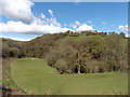
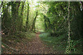
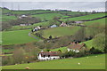
This is a Univallate hillfort with a slightly inturned entrance. It's 225m above sea level high in the hills Southwest of Wiveliscombe. It's on private farmland and has no public access, although there is a public footpath (West Deane Way) that runs past it through the valley (roughly) 200 meters to the west.
You may be viewing yesterday's version of this page. To see the most up to date information please register for a free account.
")
")
Do not use the above information on other web sites or publications without permission of the contributor.
Nearby Images from Geograph Britain and Ireland:
©2016(licence)
©2005(licence)
©2014(licence)
©2014(licence)
©2014(licence)
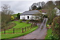
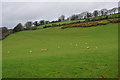
The above images may not be of the site on this page, they are loaded from Geograph.
Please Submit an Image of this site or go out and take one for us!
Click here to see more info for this site
Nearby sites
Key: Red: member's photo, Blue: 3rd party photo, Yellow: other image, Green: no photo - please go there and take one, Grey: site destroyed
Download sites to:
KML (Google Earth)
GPX (GPS waypoints)
CSV (Garmin/Navman)
CSV (Excel)
To unlock full downloads you need to sign up as a Contributory Member. Otherwise downloads are limited to 50 sites.
Turn off the page maps and other distractions
Nearby sites listing. In the following links * = Image available
5.5km NE 45° Kings Castle Hillfort (ST097282)
9.3km SW 224° Huntsham Castle* Misc. Earthwork (SS99111784)
9.5km N 7° Elworthy Barrows hillfort* Hillfort (ST070338)
9.5km NNW 335° Dun's Stone Natural Stone / Erratic / Other Natural Feature (ST018331)
10.2km NNW 343° Huish Champflower Barrow* Round Barrow(s) (ST0286234167)
10.9km NNW 336° Naked Boy stone* Standing Stone (Menhir) (ST01493447)
11.7km NNW 333° Wiveliscombe Barrow* Round Barrow(s) (ST00553486)
12.3km ENE 63° Devil's Whispering Well* Holy Well or Sacred Spring (ST1671029841)
12.6km SSW 213° Craze Lowman Mound* Round Barrow(s) (SS98611399)
13.0km NNW 328° Leather Barrow Round Barrow(s) (SS98903553)
13.5km WSW 242° Castle Close* Misc. Earthwork (SS937182)
13.7km NNW 341° Langridge Wood Cist* Burial Chamber or Dolmen (ST01403740)
14.0km E 81° Norton Fitzwarren* Hillfort (ST196263)
14.6km NW 320° Cutcombe Barrow* Round Barrow(s) (SS9649635711)
14.7km ENE 58° St. Agnes Well* Holy Well or Sacred Spring (ST18423186)
14.8km NNW 336° Druids Combe wood boundary stone Marker Stone (SS99923799)
14.8km NNE 17° Curdon Camp Hillfort (ST102385)
15.2km WNW 283° Oldberry Castle Hillfort (SS90932820)
15.2km NE 44° Wills Neck* Barrow Cemetery (ST16533516)
15.5km NE 39° Great Hill Platform cairn* Barrow Cemetery (ST15653625)
15.5km N 354° St Pancras Well* Holy Well or Sacred Spring (ST043398)
15.6km NE 35° Fire Beacon Cairn* Cairn (ST14913697)
15.7km NE 42° Triscombe Stone* Standing Stone (Menhir) (ST16363592)
15.9km SW 217° Cranmore Castle Hillfort (SS959119)
16.0km NE 36° West Hill Platform Cairn* Cairn (ST15423717)
View more nearby sites and additional images


 We would like to know more about this location. Please feel free to add a brief description and any relevant information in your own language.
 Wir möchten mehr über diese Stätte erfahren. Bitte zögern Sie nicht, eine kurze Beschreibung und relevante Informationen in Deutsch hinzuzufügen.
 Nous aimerions en savoir encore un peu sur les lieux. S'il vous plaît n'hesitez pas à ajouter une courte description et tous les renseignements pertinents dans votre propre langue.
 Quisieramos informarnos un poco más de las lugares. No dude en añadir una breve descripción y otros datos relevantes en su propio idioma.