

<< Text Pages >> Mecklin Park - Cairn in England in Cumbria
Submitted by vicky on Wednesday, 18 September 2002 Page Views: 6848
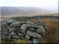
Neolithic and Bronze AgeSite Name: Mecklin ParkCountry: England
NOTE: This site is 3.267 km away from the location you searched for.
County: Cumbria Type: Cairn
Nearest Town: Egremont Nearest Village: Nether Wasdale
Map Ref: NY126079 Landranger Map Number: 89
Latitude: 54.458932N Longitude: 3.349725W
Condition:
| 5 | Perfect |
| 4 | Almost Perfect |
| 3 | Reasonable but with some damage |
| 2 | Ruined but still recognisable as an ancient site |
| 1 | Pretty much destroyed, possibly visible as crop marks |
| 0 | No data. |
| -1 | Completely destroyed |
| 5 | Superb |
| 4 | Good |
| 3 | Ordinary |
| 2 | Not Good |
| 1 | Awful |
| 0 | No data. |
| 5 | Can be driven to, probably with disabled access |
| 4 | Short walk on a footpath |
| 3 | Requiring a bit more of a walk |
| 2 | A long walk |
| 1 | In the middle of nowhere, a nightmare to find |
| 0 | No data. |
| 5 | co-ordinates taken by GPS or official recorded co-ordinates |
| 4 | co-ordinates scaled from a detailed map |
| 3 | co-ordinates scaled from a bad map |
| 2 | co-ordinates of the nearest village |
| 1 | co-ordinates of the nearest town |
| 0 | no data |
Internal Links:
External Links:
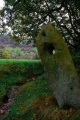
Cairn in Cumbria
Have you visited this site? Please add a comment below.
You may be viewing yesterday's version of this page. To see the most up to date information please register for a free account.
Do not use the above information on other web sites or publications without permission of the contributor.
Nearby Images from Geograph Britain and Ireland:
©2010(licence)
©2010(licence)

©2010(licence)
©2010(licence)
©2010(licence)
The above images may not be of the site on this page, they are loaded from Geograph.
Please Submit an Image of this site or go out and take one for us!
Click here to see more info for this site
Nearby sites
Key: Red: member's photo, Blue: 3rd party photo, Yellow: other image, Green: no photo - please go there and take one, Grey: site destroyed
Download sites to:
KML (Google Earth)
GPX (GPS waypoints)
CSV (Garmin/Navman)
CSV (Excel)
To unlock full downloads you need to sign up as a Contributory Member. Otherwise downloads are limited to 50 sites.
Turn off the page maps and other distractions
Nearby sites listing. In the following links * = Image available
2.5km W 276° Stockdale Moor* Cairn (NY101082)
2.8km W 271° Sampson's Bratfull* Long Barrow (NY098080)
5.4km W 278° Thornholme farm* Ancient Village or Settlement (NY0727008760)
5.5km WNW 288° Tongue How Settlement* Ancient Village or Settlement (NY074097)
5.5km W 263° Birrel Sike Ancient Village or Settlement (NY071073)
5.9km WNW 288° Tongue How Cairn* Ring Cairn (NY070098)
6.0km S 179° Irton Pike Ring Cairn Ring Cairn (NY1261601907)
6.0km WNW 297° Capelcrag Beck* Ring Cairn (NY07231072)
6.3km E 82° Viking Timbers at St Olaf's Church Wasdale Head* Museum (NY18830869)
6.4km ESE 112° Maiden Castle (Eskdale)* Cairn (NY18480543)
6.8km SW 232° Gosforth Holy Well* Holy Well or Sacred Spring (NY07190383)
6.8km SE 131° Boat How Enclosure* Ancient Village or Settlement (NY17620330)
6.9km SE 137° Low Longrigg NE* Stone Circle (NY172028)
6.9km SE 127° Eskdale Moor Stone* Standing Stone (Menhir) (NY1801903675)
6.9km SW 230° Gosforth Cross* Ancient Cross (NY07230357)
6.9km SE 137° Low Longrigg SW* Stone Circle (NY172027)
7.1km WNW 287° Friar's Well Barrow Cemetery (NY058101)
7.2km SE 139° White Moss SW* Stone Circle (NY17250239)
7.2km SE 138° White Moss NE* Stone Circle (NY17300241)
7.3km SE 138° Brat's Hill* Stone Circle (NY17370234)
7.4km WNW 300° Swarth Fell funerary cairn* Round Cairn (NY06241167)
7.8km SE 139° Boot cairn circle* Cairn (NY17630189)
8.0km WSW 237° Gretigate C Stone Circle (NY058037)
8.0km WSW 237° Gretigate B Stone Circle (NY058037)
8.1km WSW 237° Gretigate A Stone Circle (NY057036)
View more nearby sites and additional images


 We would like to know more about this location. Please feel free to add a brief description and any relevant information in your own language.
 Wir möchten mehr über diese Stätte erfahren. Bitte zögern Sie nicht, eine kurze Beschreibung und relevante Informationen in Deutsch hinzuzufügen.
 Nous aimerions en savoir encore un peu sur les lieux. S'il vous plaît n'hesitez pas à ajouter une courte description et tous les renseignements pertinents dans votre propre langue.
 Quisieramos informarnos un poco más de las lugares. No dude en añadir una breve descripción y otros datos relevantes en su propio idioma.