


<< Our Photo Pages >> Pen-Y-Wenallt - Hillfort in Wales in Powys
Submitted by coldrum on Monday, 18 October 2010 Page Views: 4334
Iron Age and Later PrehistorySite Name: Pen-Y-WenalltCountry: Wales
NOTE: This site is 0.813 km away from the location you searched for.
County: Powys Type: Hillfort
Map Ref: SO11162095
Latitude: 51.880011N Longitude: 3.292036W
Condition:
| 5 | Perfect |
| 4 | Almost Perfect |
| 3 | Reasonable but with some damage |
| 2 | Ruined but still recognisable as an ancient site |
| 1 | Pretty much destroyed, possibly visible as crop marks |
| 0 | No data. |
| -1 | Completely destroyed |
| 5 | Superb |
| 4 | Good |
| 3 | Ordinary |
| 2 | Not Good |
| 1 | Awful |
| 0 | No data. |
| 5 | Can be driven to, probably with disabled access |
| 4 | Short walk on a footpath |
| 3 | Requiring a bit more of a walk |
| 2 | A long walk |
| 1 | In the middle of nowhere, a nightmare to find |
| 0 | No data. |
| 5 | co-ordinates taken by GPS or official recorded co-ordinates |
| 4 | co-ordinates scaled from a detailed map |
| 3 | co-ordinates scaled from a bad map |
| 2 | co-ordinates of the nearest village |
| 1 | co-ordinates of the nearest town |
| 0 | no data |
Be the first person to rate this site - see the 'Contribute!' box in the right hand menu.
Internal Links:
External Links:
I have visited· I would like to visit
geoffstickland has visited here
")
"The partly bulldozed, sub-rectangular enclosure at Pen-y-Wenallt measures 55m N-S by 42m, and is defined by scarps, or banks, and ditches."
Source: Coflein
You may be viewing yesterday's version of this page. To see the most up to date information please register for a free account.
Do not use the above information on other web sites or publications without permission of the contributor.
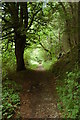
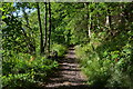
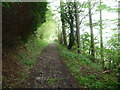
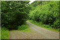
Nearby Images from Geograph Britain and Ireland:
©2009(licence)
©2017(licence)
©2012(licence)
©2022(licence)
©2022(licence)
The above images may not be of the site on this page, they are loaded from Geograph.
Please Submit an Image of this site or go out and take one for us!
Click here to see more info for this site
Nearby sites
Key: Red: member's photo, Blue: 3rd party photo, Yellow: other image, Green: no photo - please go there and take one, Grey: site destroyed
Download sites to:
KML (Google Earth)
GPX (GPS waypoints)
CSV (Garmin/Navman)
CSV (Excel)
To unlock full downloads you need to sign up as a Contributory Member. Otherwise downloads are limited to 50 sites.
Turn off the page maps and other distractions
Nearby sites listing. In the following links * = Image available
567m NNE 13° Tump Wood* Hillfort (SO113215)
1.6km WNW 298° Tyle Clydach Hillfort (SO09742175)
1.8km ESE 113° The Llanddetty Stone Ancient Cross (SO12802023)
2.5km SW 234° Nant Tarthwyni Hillfort (SO09111951)
2.6km S 185° Bryn Melyn Hillfort* Hillfort (SO10881839)
2.8km N 9° Gileston* Standing Stone (Menhir) (SO11672374)
3.4km NNE 18° Allt yr Esgair 3 Hillfort (SO123242)
3.7km NNE 22° Allt-Yr-Yscrin* Cairn (SO12612435)
4.0km SSE 147° Carreg Wen Fawr Y Rugos Stone Row* Stone Row / Alignment (SO1328417568)
4.0km ENE 75° Bwlch Standing Stone* Standing Stone (Menhir) (SO15052195)
4.0km SSE 161° House Platforms by Y Neuadd Ancient Village or Settlement (SO124171)
4.0km NNE 17° Allt yr Esgair* Hillfort (SO124248)
4.0km NNE 17° Allt yr Esgair 2 Hillfort (SO124248)
4.1km ESE 108° Castle Farm Stone* Standing Stone (Menhir) (SO1507319635)
4.2km SSE 152° Carreg Wen Fawr Y Rugos Cairns* Cairn (SO131172)
4.2km WSW 258° Carn Pica* Cairn (SO06982015)
4.3km S 170° Nant-y-Wern* Stone Row / Alignment (SO1184816732)
4.4km SSE 165° Pant Serthfa Cairn Cairn (SO122167)
4.5km E 96° Llwyn-Y-Fedwen* Standing Stone (Menhir) (SO15622039)
4.6km SSE 154° Carreg Wen Fawr Y Rugos Cairn Cairn (SO131168)
4.6km SSE 157° Carn Caws Cairn Cairn (SO129167)
4.6km SSE 153° Carreg Wen Fawr Y Rugos 2 Cairn Cairn (SO132168)
4.7km ENE 64° Bwlch Ring Cairn* Ring Cairn (SO154229)
4.9km S 175° Clo Cadno 2 Cairn Cairn (SO115161)
4.9km S 174° Clo Cadno Cairn Cairn (SO116161)
View more nearby sites and additional images


 We would like to know more about this location. Please feel free to add a brief description and any relevant information in your own language.
 Wir möchten mehr über diese Stätte erfahren. Bitte zögern Sie nicht, eine kurze Beschreibung und relevante Informationen in Deutsch hinzuzufügen.
 Nous aimerions en savoir encore un peu sur les lieux. S'il vous plaît n'hesitez pas à ajouter une courte description et tous les renseignements pertinents dans votre propre langue.
 Quisieramos informarnos un poco más de las lugares. No dude en añadir una breve descripción y otros datos relevantes en su propio idioma.