


<< Text Pages >> Vianshill - Round Barrow(s) in Wales in South Glamorgan
Submitted by coldrum on Wednesday, 27 June 2007 Page Views: 4309
Neolithic and Bronze AgeSite Name: VianshillCountry: Wales
NOTE: This site is 1.183 km away from the location you searched for.
County: South Glamorgan Type: Round Barrow(s)
Nearest Town: Cardiff
Map Ref: ST10717401
Latitude: 51.458000N Longitude: 3.286559W
Condition:
| 5 | Perfect |
| 4 | Almost Perfect |
| 3 | Reasonable but with some damage |
| 2 | Ruined but still recognisable as an ancient site |
| 1 | Pretty much destroyed, possibly visible as crop marks |
| 0 | No data. |
| -1 | Completely destroyed |
| 5 | Superb |
| 4 | Good |
| 3 | Ordinary |
| 2 | Not Good |
| 1 | Awful |
| 0 | No data. |
| 5 | Can be driven to, probably with disabled access |
| 4 | Short walk on a footpath |
| 3 | Requiring a bit more of a walk |
| 2 | A long walk |
| 1 | In the middle of nowhere, a nightmare to find |
| 0 | No data. |
| 5 | co-ordinates taken by GPS or official recorded co-ordinates |
| 4 | co-ordinates scaled from a detailed map |
| 3 | co-ordinates scaled from a bad map |
| 2 | co-ordinates of the nearest village |
| 1 | co-ordinates of the nearest town |
| 0 | no data |
Internal Links:
External Links:
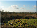
Round Barrow of possible Bronze Age date. The mound is about 18-21m in diameter and 0.3m high.
A nearby mound about 10m in diameter and 0.1m high, was excavated in 1965.
RCAHMW Coflein record:
VIANSHILL.
You may be viewing yesterday's version of this page. To see the most up to date information please register for a free account.
Do not use the above information on other web sites or publications without permission of the contributor.
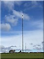
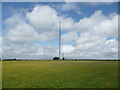
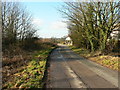
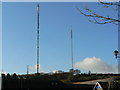
Nearby Images from Geograph Britain and Ireland:
©2023(licence)
©2011(licence)
©2009(licence)
©2009(licence)
©2009(licence)
The above images may not be of the site on this page, they are loaded from Geograph.
Please Submit an Image of this site or go out and take one for us!
Click here to see more info for this site
Nearby sites
Key: Red: member's photo, Blue: 3rd party photo, Yellow: other image, Green: no photo - please go there and take one, Grey: site destroyed
Download sites to:
KML (Google Earth)
GPX (GPS waypoints)
CSV (Garmin/Navman)
CSV (Excel)
To unlock full downloads you need to sign up as a Contributory Member. Otherwise downloads are limited to 50 sites.
Turn off the page maps and other distractions
Nearby sites listing. In the following links * = Image available
340m S 179° St Lythans Down Round Barrow* Round Barrow(s) (ST10717367)
699m SE 133° Marsyd Round Barrow(s) (ST11217352)
888m ESE 116° Quarrymen Stone* Modern Stone Circle etc (ST115736)
1.7km WSW 244° Tinkinswood* Chambered Cairn (ST09217330)
1.8km SSW 199° St Lythans* Chambered Tomb (ST10097230)
2.0km WNW 294° St Nicholas' Well (Glamorgan)* Holy Well or Sacred Spring (ST08937484)
2.1km S 174° Goldsland Wood Cave Cave or Rock Shelter (ST109719)
2.6km E 90° Coed-y Cymdda Hillfort (ST13297398)
2.6km W 264° Coed-Y-Cwm* Chambered Cairn (ST08117378)
2.7km W 271° Cottrell Park Standing Stone* Standing Stone (Menhir) (ST0804574124)
2.8km ENE 69° Caerau (Cardiff)* Hillfort (ST13377498)
2.9km W 265° Redland Farm Standing Stone (Menhir) (ST07817382)
3.3km ESE 102° Cwrt-yr-ala Hillfort (ST139733)
3.3km NNE 20° St Fagan's Well Holy Well or Sacred Spring (ST11917712)
3.3km NNE 16° Museum of Welsh Life, St Fagans* Museum (ST117772)
4.3km SSE 154° Pencoetre Wood Barrow Round Barrow(s) (ST125701)
4.3km N 351° Sant-Y-Nyll Round Barrow(s) (ST10077829)
4.7km E 83° Leckwith Round Barrow(s) (ST154745)
4.8km WNW 292° Ffynnon Deilo* Holy Well or Sacred Spring (ST0633975904)
6.3km NE 49° St Teilo's Well, Llandaff* Holy Well or Sacred Spring (ST15567805)
6.3km SW 228° Castle Ditches Fort* Hillfort (ST059699)
6.4km NNE 28° Pistyll Golau Holy Well or Sacred Spring (ST13787962)
6.6km NNE 23° Radyr Woods Burnt Mound* Artificial Mound (ST13438003)
6.9km S 183° Barry Gorsedd Circle* Modern Stone Circle etc (ST1018967130)
7.0km NNW 347° Craig-y-Parc Ancient Village or Settlement (ST09298084)
View more nearby sites and additional images


 We would like to know more about this location. Please feel free to add a brief description and any relevant information in your own language.
 Wir möchten mehr über diese Stätte erfahren. Bitte zögern Sie nicht, eine kurze Beschreibung und relevante Informationen in Deutsch hinzuzufügen.
 Nous aimerions en savoir encore un peu sur les lieux. S'il vous plaît n'hesitez pas à ajouter une courte description et tous les renseignements pertinents dans votre propre langue.
 Quisieramos informarnos un poco más de las lugares. No dude en añadir una breve descripción y otros datos relevantes en su propio idioma.