


<< Other Photo Pages >> Bunz Dolmen - Burial Chamber or Dolmen in France in Bretagne:Morbihan (56)
Submitted by TheCaptain on Monday, 03 January 2005 Page Views: 2646
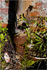
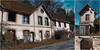
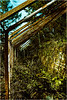
Neolithic and Bronze AgeSite Name: Bunz Dolmen Alternative Name: Les dolmens du BuCountry: France Département: Bretagne:Morbihan (56) Type: Burial Chamber or Dolmen
Nearest Town: Lorient Nearest Village: Inzinzac-Lochrist
Latitude: 47.832600N Longitude: 3.2491W
Condition:
| 5 | Perfect |
| 4 | Almost Perfect |
| 3 | Reasonable but with some damage |
| 2 | Ruined but still recognisable as an ancient site |
| 1 | Pretty much destroyed, possibly visible as crop marks |
| 0 | No data. |
| -1 | Completely destroyed |
| 5 | Superb |
| 4 | Good |
| 3 | Ordinary |
| 2 | Not Good |
| 1 | Awful |
| 0 | No data. |
| 5 | Can be driven to, probably with disabled access |
| 4 | Short walk on a footpath |
| 3 | Requiring a bit more of a walk |
| 2 | A long walk |
| 1 | In the middle of nowhere, a nightmare to find |
| 0 | No data. |
| 5 | co-ordinates taken by GPS or official recorded co-ordinates |
| 4 | co-ordinates scaled from a detailed map |
| 3 | co-ordinates scaled from a bad map |
| 2 | co-ordinates of the nearest village |
| 1 | co-ordinates of the nearest town |
| 0 | no data |
Be the first person to rate this site - see the 'Contribute!' box in the right hand menu.
Internal Links:
External Links:
")
You may be viewing yesterday's version of this page. To see the most up to date information please register for a free account.
")
Do not use the above information on other web sites or publications without permission of the contributor.
Nearby Images from Flickr
The above images may not be of the site on this page, but were taken nearby. They are loaded from Flickr so please click on them for image credits.
Click here to see more info for this site
Nearby sites
Click here to view sites on an interactive map of the areaKey: Red: member's photo, Blue: 3rd party photo, Yellow: other image, Green: no photo - please go there and take one, Grey: site destroyed
Download sites to:
KML (Google Earth)
GPX (GPS waypoints)
CSV (Garmin/Navman)
CSV (Excel)
To unlock full downloads you need to sign up as a Contributory Member. Otherwise downloads are limited to 50 sites.
Turn off the page maps and other distractions
Nearby sites listing. In the following links * = Image available
4.3km SSE 160° Tri-Men-de-Castello* Burial Chamber or Dolmen
5.4km WSW 256° Dolmen de Saint-Coner Burial Chamber or Dolmen
6.5km WSW 249° Dolmen de Mané Guillo* Burial Chamber or Dolmen
7.0km WSW 253° Menhir du Monument* Standing Stone (Menhir)
7.3km SE 127° Dolmen de la Colline de Kermarhic Burial Chamber or Dolmen
7.9km ESE 102° Kervréhan menhir* Standing Stone (Menhir)
8.0km ENE 63° Allée couverte de Mane Nestrean Passage Grave
8.3km WNW 302° Dolmen de Kerpendu Burial Chamber or Dolmen
8.9km NW 304° Menhir de Keranroué Standing Stone (Menhir)
9.6km SSW 211° Cupules de Saint-Guénhaël Rock Art
9.9km WSW 258° Dolmen de Nelhouët* Burial Chamber or Dolmen
10.0km ENE 72° Menhir de Kerhel Standing Stone (Menhir)
10.1km ENE 65° Menhir de Kerdanué* Standing Stone (Menhir)
10.3km ENE 72° Menhir de Kerzerho Standing Stone (Menhir)
10.7km ENE 63° Menhir de Kerdoret* Standing Stone (Menhir)
10.9km SSE 155° Alignement de Rongouët* Stone Row / Alignment
10.9km SSE 154° Dolmens de Rongouet* Burial Chamber or Dolmen
11.4km WSW 237° Sac'h Quéven menhir* Standing Stone (Menhir)
12.1km WSW 253° Dolmen de Kerscant Burial Chamber or Dolmen
12.2km ENE 70° Allée Couverte de Kerscoul Passage Grave
12.2km WSW 244° Dolmen de Kerloës Burial Chamber or Dolmen
12.5km SSW 194° Dolmen de Locjean Burial Chamber or Dolmen
12.7km E 85° Dolmen de Kersolan Burial Chamber or Dolmen
12.7km E 84° Soldats-de-Saint-Cornély* Stone Row / Alignment
12.7km S 180° Alignements Pen-er-Pont* Stone Row / Alignment
View more nearby sites and additional images


 We would like to know more about this location. Please feel free to add a brief description and any relevant information in your own language.
 Wir möchten mehr über diese Stätte erfahren. Bitte zögern Sie nicht, eine kurze Beschreibung und relevante Informationen in Deutsch hinzuzufügen.
 Nous aimerions en savoir encore un peu sur les lieux. S'il vous plaît n'hesitez pas à ajouter une courte description et tous les renseignements pertinents dans votre propre langue.
 Quisieramos informarnos un poco más de las lugares. No dude en añadir una breve descripción y otros datos relevantes en su propio idioma.