 with our Megalithic Portal iPhone app")


<< Our Photo Pages >> St Barruc's Holy Well (Barry Island) - Holy Well or Sacred Spring in Wales in South Glamorgan
Submitted by Sunny100 on Tuesday, 15 March 2011 Page Views: 11098
Springs and Holy WellsSite Name: St Barruc's Holy Well (Barry Island) Alternative Name: Ffynnon Barruc, St Baruch's WellCountry: Wales County: South Glamorgan Type: Holy Well or Sacred Spring
Nearest Town: Barry Island
Map Ref: ST12006643
Latitude: 51.390062N Longitude: 3.266112W
Condition:
| 5 | Perfect |
| 4 | Almost Perfect |
| 3 | Reasonable but with some damage |
| 2 | Ruined but still recognisable as an ancient site |
| 1 | Pretty much destroyed, possibly visible as crop marks |
| 0 | No data. |
| -1 | Completely destroyed |
| 5 | Superb |
| 4 | Good |
| 3 | Ordinary |
| 2 | Not Good |
| 1 | Awful |
| 0 | No data. |
| 5 | Can be driven to, probably with disabled access |
| 4 | Short walk on a footpath |
| 3 | Requiring a bit more of a walk |
| 2 | A long walk |
| 1 | In the middle of nowhere, a nightmare to find |
| 0 | No data. |
| 5 | co-ordinates taken by GPS or official recorded co-ordinates |
| 4 | co-ordinates scaled from a detailed map |
| 3 | co-ordinates scaled from a bad map |
| 2 | co-ordinates of the nearest village |
| 1 | co-ordinates of the nearest town |
| 0 | no data |
Internal Links:
External Links:
I have visited· I would like to visit
lucasn visited on 30th Jun 2021 - their rating: Cond: 2 Amb: 4 Access: 5
geoffstickland GenineNeale have visited here
 (PID:252607)")
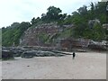
Long ago pilgrims visited the well to partake of the water for its renowned healing qualities. They would leave a piece of rag on nearby trees and bushes as a votive offering, or drop a pin into the well. According to E.Lhuyd (1910-11) the water was said to be a curative for headaches, sore eyes and agues. Carlisle (1811) said that "the well was visited by women who washed their eyes in it on Holy Thursday". A description of the well long ago said "it contains clear spring water which filled when the tide went out, but emptied when the tide came in". The well had a stone flagged floor.
When the nearby holiday camp was built the well water was diverted and the basin capped. However, the old ruined chapel of St Barruc still stands and apparently used to house the saint's shrine dated from the 10-11th century CE, and his body perhaps buried beneath the floor. The shrine is long gone. Some of the stones that make up the chapel were re-used Roman stones.
You may be viewing yesterday's version of this page. To see the most up to date information please register for a free account.
 (PID:199797)")
 (PID:199796)")
Do not use the above information on other web sites or publications without permission of the contributor.
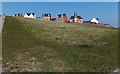
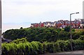
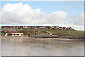
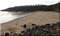
Nearby Images from Geograph Britain and Ireland:
©2014(licence)
©2010(licence)
©2012(licence)
©2013(licence)
©2021(licence)
The above images may not be of the site on this page, they are loaded from Geograph.
Please Submit an Image of this site or go out and take one for us!
Click here to see more info for this site
Nearby sites
Key: Red: member's photo, Blue: 3rd party photo, Yellow: other image, Green: no photo - please go there and take one, Grey: site destroyed
Download sites to:
KML (Google Earth)
GPX (GPS waypoints)
CSV (Garmin/Navman)
CSV (Excel)
To unlock full downloads you need to sign up as a Contributory Member. Otherwise downloads are limited to 50 sites.
Turn off the page maps and other distractions
Nearby sites listing. In the following links * = Image available
1.0km WSW 243° Barry Island Cairns* Cairn (ST11076598)
1.7km WSW 257° Cold Knap Round Barrow* Cairn (ST10306607)
1.9km WNW 290° Barry Gorsedd Circle* Modern Stone Circle etc (ST1018967130)
2.9km W 278° Westward Corner Round Barrow* Round Barrow(s) (ST0916266901)
3.7km N 7° Pencoetre Wood Barrow Round Barrow(s) (ST125701)
3.8km W 281° Lower Porthkerry House Platform Ancient Village or Settlement (ST083672)
4.9km E 83° Sully Island Promontory Fort Promontory Fort / Cliff Castle (ST16876697)
4.9km E 83° Sully Island Mound Round Barrow(s) (ST16936692)
5.6km NNW 348° Goldsland Wood Cave Cave or Rock Shelter (ST109719)
5.9km ENE 75° St Marys Well Holy Well or Sacred Spring (ST17796785)
6.2km NNW 341° St Lythans* Chambered Tomb (ST10097230)
7.0km WNW 299° Castle Ditches Fort* Hillfort (ST059699)
7.1km NNE 14° Cwrt-yr-ala Hillfort (ST139733)
7.1km N 353° Marsyd Round Barrow(s) (ST11217352)
7.2km N 355° Quarrymen Stone* Modern Stone Circle etc (ST115736)
7.2km WNW 292° Pen Onn Farmstead Ancient Village or Settlement (ST053692)
7.4km N 349° St Lythans Down Round Barrow* Round Barrow(s) (ST10717367)
7.4km NNW 337° Tinkinswood* Chambered Cairn (ST09217330)
7.7km N 9° Coed-y Cymdda Hillfort (ST13297398)
7.7km N 349° Vianshill Round Barrow(s) (ST10717401)
8.3km NNW 331° Coed-Y-Cwm* Chambered Cairn (ST08117378)
8.5km NNW 330° Redland Farm Standing Stone (Menhir) (ST07817382)
8.6km NNW 332° Cottrell Park Standing Stone* Standing Stone (Menhir) (ST0804574124)
8.7km N 8° Caerau (Cardiff)* Hillfort (ST13377498)
8.8km NNE 22° Leckwith Round Barrow(s) (ST154745)
View more nearby sites and additional images


 We would like to know more about this location. Please feel free to add a brief description and any relevant information in your own language.
 Wir möchten mehr über diese Stätte erfahren. Bitte zögern Sie nicht, eine kurze Beschreibung und relevante Informationen in Deutsch hinzuzufügen.
 Nous aimerions en savoir encore un peu sur les lieux. S'il vous plaît n'hesitez pas à ajouter une courte description et tous les renseignements pertinents dans votre propre langue.
 Quisieramos informarnos un poco más de las lugares. No dude en añadir una breve descripción y otros datos relevantes en su propio idioma.