 with our Megalithic Portal iPhone app")

<< Text Pages >> Vivod Mountain - Cairn in Wales in Denbighshire
Submitted by TimPrevett on Sunday, 23 April 2006 Page Views: 7375
Neolithic and Bronze AgeSite Name: Vivod MountainCountry: Wales County: Denbighshire Type: Cairn
Nearest Town: Llangollen
Map Ref: SJ16964000
Latitude: 52.950929N Longitude: 3.2374W
Condition:
| 5 | Perfect |
| 4 | Almost Perfect |
| 3 | Reasonable but with some damage |
| 2 | Ruined but still recognisable as an ancient site |
| 1 | Pretty much destroyed, possibly visible as crop marks |
| 0 | No data. |
| -1 | Completely destroyed |
| 5 | Superb |
| 4 | Good |
| 3 | Ordinary |
| 2 | Not Good |
| 1 | Awful |
| 0 | No data. |
| 5 | Can be driven to, probably with disabled access |
| 4 | Short walk on a footpath |
| 3 | Requiring a bit more of a walk |
| 2 | A long walk |
| 1 | In the middle of nowhere, a nightmare to find |
| 0 | No data. |
| 5 | co-ordinates taken by GPS or official recorded co-ordinates |
| 4 | co-ordinates scaled from a detailed map |
| 3 | co-ordinates scaled from a bad map |
| 2 | co-ordinates of the nearest village |
| 1 | co-ordinates of the nearest town |
| 0 | no data |
Internal Links:
External Links:
Cairn in Denbighshire (Sir Ddinbych)
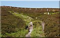
A cairn 60 feet + in diameter, 3 feet + high, on the mountain summit near the Denbighshire / Powys border.
You may be viewing yesterday's version of this page. To see the most up to date information please register for a free account.
Do not use the above information on other web sites or publications without permission of the contributor.
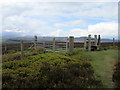
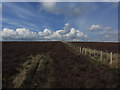
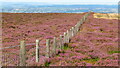
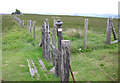
Nearby Images from Geograph Britain and Ireland:
©2019(licence)
©2014(licence)
©2023(licence)
©2006(licence)
©2010(licence)
The above images may not be of the site on this page, they are loaded from Geograph.
Please Submit an Image of this site or go out and take one for us!
Click here to see more info for this site
Nearby sites
Key: Red: member's photo, Blue: 3rd party photo, Yellow: other image, Green: no photo - please go there and take one, Grey: site destroyed
Download sites to:
KML (Google Earth)
GPX (GPS waypoints)
CSV (Garmin/Navman)
CSV (Excel)
To unlock full downloads you need to sign up as a Contributory Member. Otherwise downloads are limited to 50 sites.
Turn off the page maps and other distractions
Nearby sites listing. In the following links * = Image available
595m ENE 58° Nant-Y-Bache Round Barrow(s) (SJ17474031)
1.3km ENE 66° Blaen Nant* Round Barrow(s) (SJ18144051)
2.0km SSW 201° Tomen y Meirw* Round Barrow(s) (SJ162381)
2.8km ENE 68° Ffynnon Las Round Barrow(s) (SJ19574099)
4.0km SSW 196° Carnedd Rhys Goch* Cairn (SJ15763613)
4.5km S 172° Tomen y Gwyddel* Round Cairn (SJ175355)
5.0km ENE 64° Llangollen Museum Museum (SJ2145642103)
5.1km ENE 70° Plas Newydd Gorsedd Stone circle* Modern Stone Circle etc (SJ2181041661)
5.2km NW 305° Owain Glyndwr's House (Site of)* Rock Art (SJ12754309)
5.3km ESE 105° Llwynmawr* Standing Stone (Menhir) (SJ2211138530)
5.4km E 91° Careg y Big (Llangollen)* Standing Stone (Menhir) (SJ224398)
5.6km NE 35° Pillar of Eliseg* Early Christian Sculptured Stone (SJ20264452)
6.1km ENE 59° Dinas Bran* Hillfort (SJ2224043060)
6.2km SSW 196° Cerrig Gwynion (Wrexham)* Hillfort (SJ152341)
6.4km N 357° Moel-y-Gaer (Llangollen)* Hillfort (SJ16704636)
6.5km N 5° Moel Gamelin* Cairn (SJ17624651)
7.0km NE 49° Eglwyseg Plantation Barrow* Round Barrow(s) (SJ22364446)
7.2km W 262° Nant Croes Y Wernen* Stone Circle (SJ09813906)
7.2km NE 46° Creigiau Eglwyseg 1* Round Barrow(s) (SJ22214495)
7.3km NE 56° Eglwyseg Plantation Cairn 1* Cairn (SJ23074403)
7.4km NE 49° Eglwyseg Stone* Natural Stone / Erratic / Other Natural Feature (SJ22574478)
7.4km ENE 59° Bryngolen Cairn 1* Cairn (SJ23374372)
7.6km NE 56° Eglwyseg Plantation Cairn 2 Cairn (SJ23344414)
7.6km NE 49° Eglwyseg stone (2)* Standing Stone (Menhir) (SJ22774494)
7.7km NE 47° Eglwyseg Kerb Cairn A* Cairn (SJ22704509)
View more nearby sites and additional images


 We would like to know more about this location. Please feel free to add a brief description and any relevant information in your own language.
 Wir möchten mehr über diese Stätte erfahren. Bitte zögern Sie nicht, eine kurze Beschreibung und relevante Informationen in Deutsch hinzuzufügen.
 Nous aimerions en savoir encore un peu sur les lieux. S'il vous plaît n'hesitez pas à ajouter une courte description et tous les renseignements pertinents dans votre propre langue.
 Quisieramos informarnos un poco más de las lugares. No dude en añadir una breve descripción y otros datos relevantes en su propio idioma.