


<< Our Photo Pages >> Holford Standing Stone - Standing Stone (Menhir) in England in Somerset
Submitted by TimPrevett on Thursday, 25 July 2002 Page Views: 6591
Neolithic and Bronze AgeSite Name: Holford Standing StoneCountry: England
NOTE: This site is 2.651 km away from the location you searched for.
County: Somerset Type: Standing Stone (Menhir)
Nearest Town: Williton Nearest Village: Holford
Map Ref: ST142408 Landranger Map Number: 181
Latitude: 51.159993N Longitude: 3.22834W
Condition:
| 5 | Perfect |
| 4 | Almost Perfect |
| 3 | Reasonable but with some damage |
| 2 | Ruined but still recognisable as an ancient site |
| 1 | Pretty much destroyed, possibly visible as crop marks |
| 0 | No data. |
| -1 | Completely destroyed |
| 5 | Superb |
| 4 | Good |
| 3 | Ordinary |
| 2 | Not Good |
| 1 | Awful |
| 0 | No data. |
| 5 | Can be driven to, probably with disabled access |
| 4 | Short walk on a footpath |
| 3 | Requiring a bit more of a walk |
| 2 | A long walk |
| 1 | In the middle of nowhere, a nightmare to find |
| 0 | No data. |
| 5 | co-ordinates taken by GPS or official recorded co-ordinates |
| 4 | co-ordinates scaled from a detailed map |
| 3 | co-ordinates scaled from a bad map |
| 2 | co-ordinates of the nearest village |
| 1 | co-ordinates of the nearest town |
| 0 | no data |
Be the first person to rate this site - see the 'Contribute!' box in the right hand menu.
Internal Links:
External Links:
 (PID:1468)")
I discovered this little stone while out for a general walk when we stopped for a couple nights at Holford Youth Hostel. Situated on the north edge of the Quantock Hills, overlooking the Bristol Channel, with views across to South Wales, it is a beautiful area.
As for accessing the stone, the grid reference is approximate; if you were ever to visit the Holford Youth Hostel, take a ramble up on to the hills (using one of the small OS maps they loan out). Given that the stone, as far as I know, is not marked on a map, and the numerous paths, finding this stone may be difficult!
You may be viewing yesterday's version of this page. To see the most up to date information please register for a free account.
")
")
")
Do not use the above information on other web sites or publications without permission of the contributor.
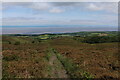
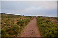
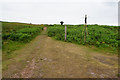
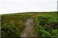
Nearby Images from Geograph Britain and Ireland:
©2021(licence)
©2019(licence)
©2017(licence)
©2017(licence)
©2019(licence)
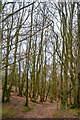
The above images may not be of the site on this page, they are loaded from Geograph.
Please Submit an Image of this site or go out and take one for us!
Click here to see more info for this site
Nearby sites
Key: Red: member's photo, Blue: 3rd party photo, Yellow: other image, Green: no photo - please go there and take one, Grey: site destroyed
Download sites to:
KML (Google Earth)
GPX (GPS waypoints)
CSV (Garmin/Navman)
CSV (Excel)
To unlock full downloads you need to sign up as a Contributory Member. Otherwise downloads are limited to 50 sites.
Turn off the page maps and other distractions
Nearby sites listing. In the following links * = Image available
1.8km W 276° Beacon Hill Platform Cairn* Barrow Cemetery (ST12434101)
1.9km SSW 211° Thorncombe Hill Cairns* Barrow Cemetery (ST13183914)
2.0km SSW 194° Halsway Tumuli* Barrow Cemetery (ST137389)
2.0km SW 226° Thorncombe Barrow* Cairn (ST12733942)
2.4km SE 131° Dowsborough Castle* Hillfort (ST160392)
2.6km S 169° Black Hill Tumuli* Barrow Cemetery (ST14653819)
2.7km S 179° Hurley Beacon Tumulus* Cairn (ST14223808)
2.8km WSW 239° Trendle Ring* Ancient Village or Settlement (ST118394)
2.9km SSE 157° Wilmots Pool Cairn* Cairn (ST15303813)
3.4km SE 143° Dead Woman's Ditch* Misc. Earthwork (ST162381)
3.8km SSE 161° West Hill Platform Cairn* Cairn (ST15423717)
3.9km SSE 169° Fire Beacon Cairn* Cairn (ST14913697)
4.6km WSW 239° Curdon Camp Hillfort (ST102385)
4.8km SSE 161° Great Hill Platform cairn* Barrow Cemetery (ST15653625)
5.3km SSE 155° Triscombe Stone* Standing Stone (Menhir) (ST16363592)
6.1km SSE 157° Wills Neck* Barrow Cemetery (ST16533516)
6.2km SE 136° Plainsfield Camp* Misc. Earthwork (ST18433622)
6.3km ENE 70° St Andrew's Well (Stogursey)* Holy Well or Sacred Spring (ST20224282)
6.8km W 276° Battlegore* Round Barrow(s) (ST07454162)
7.6km WNW 289° Watchet Market House Museum* Museum (ST0710043439)
8.0km WNW 282° St Decumen's Well* Holy Well or Sacred Spring (ST064426)
9.9km SSE 154° St. Agnes Well* Holy Well or Sacred Spring (ST18423186)
9.9km W 263° St Pancras Well* Holy Well or Sacred Spring (ST043398)
10.0km SW 225° Elworthy Barrows hillfort* Hillfort (ST070338)
10.4km E 91° Cannington Camp* Hillfort (ST246405)
View more nearby sites and additional images


 We would like to know more about this location. Please feel free to add a brief description and any relevant information in your own language.
 Wir möchten mehr über diese Stätte erfahren. Bitte zögern Sie nicht, eine kurze Beschreibung und relevante Informationen in Deutsch hinzuzufügen.
 Nous aimerions en savoir encore un peu sur les lieux. S'il vous plaît n'hesitez pas à ajouter une courte description et tous les renseignements pertinents dans votre propre langue.
 Quisieramos informarnos un poco más de las lugares. No dude en añadir una breve descripción y otros datos relevantes en su propio idioma.