


<< Our Photo Pages >> Alignements Pen-er-Pont - Stone Row / Alignment in France in Bretagne:Morbihan (56)
Submitted by TheCaptain on Monday, 03 January 2005 Page Views: 2521
Neolithic and Bronze AgeSite Name: Alignements Pen-er-PontCountry: France
NOTE: This site is 2.033 km away from the location you searched for.
Département: Bretagne:Morbihan (56) Type: Stone Row / Alignment
Nearest Town: Lorient Nearest Village: Plouhinec
Latitude: 47.718120N Longitude: 3.2484W
Condition:
| 5 | Perfect |
| 4 | Almost Perfect |
| 3 | Reasonable but with some damage |
| 2 | Ruined but still recognisable as an ancient site |
| 1 | Pretty much destroyed, possibly visible as crop marks |
| 0 | No data. |
| -1 | Completely destroyed |
| 5 | Superb |
| 4 | Good |
| 3 | Ordinary |
| 2 | Not Good |
| 1 | Awful |
| 0 | No data. |
| 5 | Can be driven to, probably with disabled access |
| 4 | Short walk on a footpath |
| 3 | Requiring a bit more of a walk |
| 2 | A long walk |
| 1 | In the middle of nowhere, a nightmare to find |
| 0 | No data. |
| 5 | co-ordinates taken by GPS or official recorded co-ordinates |
| 4 | co-ordinates scaled from a detailed map |
| 3 | co-ordinates scaled from a bad map |
| 2 | co-ordinates of the nearest village |
| 1 | co-ordinates of the nearest town |
| 0 | no data |
Internal Links:
External Links:
I have visited· I would like to visit
johnstone visited on 4th Jul 2005 - their rating: Cond: 3 Amb: 3 Access: 4
")
The most impressive section remaining consists of about 20 blocks in 4 lines oriented northeast to southwest, with one stone being 4.5 metres in height.
You may be viewing yesterday's version of this page. To see the most up to date information please register for a free account.
")
")
Do not use the above information on other web sites or publications without permission of the contributor.
Nearby Images from Flickr
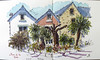
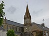
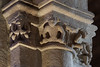
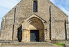
The above images may not be of the site on this page, but were taken nearby. They are loaded from Flickr so please click on them for image credits.
Click here to see more info for this site
Nearby sites
Click here to view sites on an interactive map of the areaKey: Red: member's photo, Blue: 3rd party photo, Yellow: other image, Green: no photo - please go there and take one, Grey: site destroyed
Download sites to:
KML (Google Earth)
GPX (GPS waypoints)
CSV (Garmin/Navman)
CSV (Excel)
To unlock full downloads you need to sign up as a Contributory Member. Otherwise downloads are limited to 50 sites.
Turn off the page maps and other distractions
Nearby sites listing. In the following links * = Image available
288m SE 145° Kerfourcher 2 menhir* Standing Stone (Menhir)
524m SSE 156° Menhir de Kerfourcher* Standing Stone (Menhir)
1.0km SSE 168° Dolmen de Roc'h Kerouaren Burial Chamber or Dolmen
2.8km S 189° Menhir du Bourg (Plouhinec)* Standing Stone (Menhir)
2.9km W 263° Dolmen de Kerporhel* Burial Chamber or Dolmen
3.0km WNW 282° Dolmen de Locjean Burial Chamber or Dolmen
3.1km SSE 160° Salonique Menhir* Standing Stone (Menhir)
3.4km S 184° Alignements de Gueldro* Stone Row / Alignment
3.7km S 176° Keroué Alignement Stone Row / Alignment
3.8km SSW 199° Dolmens de Kerliscouet Burial Chamber or Dolmen
4.3km S 171° Menhir de Kerabus* Stone Row / Alignment
5.0km SE 130° Ilot de Nestadio menhir* Standing Stone (Menhir)
5.3km ENE 58° Alignement de Rongouët* Stone Row / Alignment
5.5km ENE 59° Dolmens de Rongouet* Burial Chamber or Dolmen
6.0km SSE 161° Rhun menhir* Standing Stone (Menhir)
6.3km SE 133° Kerguerhan Dolmen* Burial Chamber or Dolmen
6.5km SE 128° Dolmen du Moulin des Oies* Burial Chamber or Dolmen
6.6km SE 140° Kerdruelland Alignements* Stone Row / Alignment
6.7km NW 312° Cupules de Saint-Guénhaël Rock Art
6.8km SE 134° Dolmen de Mané er Run Burial Chamber or Dolmen
6.9km SE 126° Kerhuen Dolmens* Burial Chamber or Dolmen
7.0km E 88° Kegil Berhed* Standing Stone (Menhir)
7.0km SE 134° Kerlutu Dolmen* Burial Chamber or Dolmen
7.5km SE 141° Dolmens de Kerbrevost* Burial Chamber or Dolmen
7.6km SE 136° Dolmen de Kergallan* Burial Chamber or Dolmen
View more nearby sites and additional images


 We would like to know more about this location. Please feel free to add a brief description and any relevant information in your own language.
 Wir möchten mehr über diese Stätte erfahren. Bitte zögern Sie nicht, eine kurze Beschreibung und relevante Informationen in Deutsch hinzuzufügen.
 Nous aimerions en savoir encore un peu sur les lieux. S'il vous plaît n'hesitez pas à ajouter une courte description et tous les renseignements pertinents dans votre propre langue.
 Quisieramos informarnos un poco más de las lugares. No dude en añadir una breve descripción y otros datos relevantes en su propio idioma.