


<< Our Photo Pages >> Bookan Stones - Standing Stones in Scotland in Orkney
Submitted by howar on Monday, 23 August 2004 Page Views: 5025
Neolithic and Bronze AgeSite Name: Bookan StonesCountry: Scotland
NOTE: This site is 1.257 km away from the location you searched for.
County: Orkney Type: Standing Stones
Nearest Town: Finstown Nearest Village: Stenness
Map Ref: HY28921406
Latitude: 59.007691N Longitude: 3.239221W
Condition:
| 5 | Perfect |
| 4 | Almost Perfect |
| 3 | Reasonable but with some damage |
| 2 | Ruined but still recognisable as an ancient site |
| 1 | Pretty much destroyed, possibly visible as crop marks |
| 0 | No data. |
| -1 | Completely destroyed |
| 5 | Superb |
| 4 | Good |
| 3 | Ordinary |
| 2 | Not Good |
| 1 | Awful |
| 0 | No data. |
| 5 | Can be driven to, probably with disabled access |
| 4 | Short walk on a footpath |
| 3 | Requiring a bit more of a walk |
| 2 | A long walk |
| 1 | In the middle of nowhere, a nightmare to find |
| 0 | No data. |
| 5 | co-ordinates taken by GPS or official recorded co-ordinates |
| 4 | co-ordinates scaled from a detailed map |
| 3 | co-ordinates scaled from a bad map |
| 2 | co-ordinates of the nearest village |
| 1 | co-ordinates of the nearest town |
| 0 | no data |
Internal Links:
External Links:
")
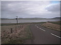
Coming down onto the Brodgar peninsula as I passed the point where a track goes up to Bookan Chambered Tomb I took note of a flatface-aligned standing stone gatepost pair on the left .
A mirrored knife-shaped pair probably relatively modern, though you can never be sure. The standard 0.4m wide and 0.9-1m high, the RH one of the pair now leaning sideways.
You may be viewing yesterday's version of this page. To see the most up to date information please register for a free account.
Do not use the above information on other web sites or publications without permission of the contributor.
Nearby Images from Geograph Britain and Ireland:
©2017(licence)
©2017(licence)
©2010(licence)
©2010(licence)
©2007(licence)
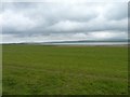
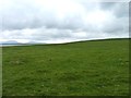
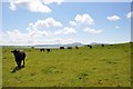
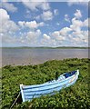
The above images may not be of the site on this page, they are loaded from Geograph.
Please Submit an Image of this site or go out and take one for us!
Click here to see more info for this site
Nearby sites
Key: Red: member's photo, Blue: 3rd party photo, Yellow: other image, Green: no photo - please go there and take one, Grey: site destroyed
Download sites to:
KML (Google Earth)
GPX (GPS waypoints)
CSV (Garmin/Navman)
CSV (Excel)
To unlock full downloads you need to sign up as a Contributory Member. Otherwise downloads are limited to 50 sites.
Turn off the page maps and other distractions
Nearby sites listing. In the following links * = Image available
142m SW 230° Wasbister Cairn* Cairn (HY28811397)
161m S 186° Bookan Cairns* Cairn (HY289139)
282m S 171° Wasbister Burnt Mound* Artificial Mound (HY28961378)
321m W 276° Bookan* Chambered Tomb (HY286141)
360m S 182° Wasbister Disc Barrow* Round Barrow(s) (HY289137)
360m S 182° Dyke o'Sean* Ancient Village or Settlement (HY289137)
399m NW 306° The Brecks* Cairn (HY286143)
758m WNW 296° Skae Frue* Round Barrow(s) (HY28241440)
758m NW 304° Ring of Bookan* Henge (HY283145)
804m SE 133° Plumcake Mound* Round Barrow(s) (HY295135)
848m SSE 152° Salt Knowe* Round Barrow(s) (HY293133)
884m SE 142° Ring of Brodgar* Stone Circle (HY29451335)
919m SSE 147° South Knowe* Artificial Mound (HY29411328)
952m SE 134° Fresh Knowe* Long Barrow (HY29601339)
1.0km SE 135° Comet Stone (Orkney)* Standing Stone (Menhir) (HY2963413318)
1.2km SSE 154° Fairy Well (Stenness)* Holy Well or Sacred Spring (HY2943212982)
1.2km SSE 159° Possible large stone circle in Loch of Stenness Stone Circle (HY2933112934)
1.7km SE 131° Brodgar Farm Chambered Tomb Chambered Tomb (HY302129)
1.7km SE 129° Ness of Brodgar* Ancient Village or Settlement (HY3024312941)
1.9km SE 131° Brodgar Farm Standing Stones* Standing Stones (HY303128)
1.9km SE 129° Lochview Mound* Cairn (HY304128)
2.1km E 85° Campston (Grimeston)* Broch or Nuraghe (HY310142)
2.1km E 85° Grimston Broch* Broch or Nuraghe (HY310142)
2.1km WNW 299° Stackrue* Broch or Nuraghe (HY271151)
2.1km WNW 300° Stackrue-Lyking Mound* Misc. Earthwork (HY27121514)
View more nearby sites and additional images


 We would like to know more about this location. Please feel free to add a brief description and any relevant information in your own language.
 Wir möchten mehr über diese Stätte erfahren. Bitte zögern Sie nicht, eine kurze Beschreibung und relevante Informationen in Deutsch hinzuzufügen.
 Nous aimerions en savoir encore un peu sur les lieux. S'il vous plaît n'hesitez pas à ajouter une courte description et tous les renseignements pertinents dans votre propre langue.
 Quisieramos informarnos un poco más de las lugares. No dude en añadir una breve descripción y otros datos relevantes en su propio idioma.