


<< Text Pages >> Formal (Bridge of Craigisla) - Standing Stone (Menhir) in Scotland in Angus
Submitted by Anne T on Tuesday, 24 October 2017 Page Views: 1384
Neolithic and Bronze AgeSite Name: Formal (Bridge of Craigisla)Country: Scotland
NOTE: This site is 0.374 km away from the location you searched for.
County: Angus Type: Standing Stone (Menhir)
Nearest Town: Lintrathen Nearest Village: Bridge of Craigisla
Map Ref: NO2561854024
Latitude: 56.672040N Longitude: 3.215393W
Condition:
| 5 | Perfect |
| 4 | Almost Perfect |
| 3 | Reasonable but with some damage |
| 2 | Ruined but still recognisable as an ancient site |
| 1 | Pretty much destroyed, possibly visible as crop marks |
| 0 | No data. |
| -1 | Completely destroyed |
| 5 | Superb |
| 4 | Good |
| 3 | Ordinary |
| 2 | Not Good |
| 1 | Awful |
| 0 | No data. |
| 5 | Can be driven to, probably with disabled access |
| 4 | Short walk on a footpath |
| 3 | Requiring a bit more of a walk |
| 2 | A long walk |
| 1 | In the middle of nowhere, a nightmare to find |
| 0 | No data. |
| 5 | co-ordinates taken by GPS or official recorded co-ordinates |
| 4 | co-ordinates scaled from a detailed map |
| 3 | co-ordinates scaled from a bad map |
| 2 | co-ordinates of the nearest village |
| 1 | co-ordinates of the nearest town |
| 0 | no data |
Be the first person to rate this site - see the 'Contribute!' box in the right hand menu.
Internal Links:
External Links:
Standing Stone (Menhir) in Angus
This prehistoric standing stone at Formal Farm is recorded as Canmore ID 31046. "This stone, now recumbent, is almost buried in the ground. It measures 2.1m in length x 1.0m broad x c. 0.3m thick."
The Northern Antiquarian (TNA) also feature a page for this stone - see their entry for Formal, Bridge of Craigisla, Lintrathen, Angus, which gives directions for finding the stone together with the stone shown on the 1865 OS map, photographs and a brief archaeology & history. TNA add: "The stone isn’t lying in its original upright position. It used to stand nearly 10 yards east of here, and was knocked down and rolled into its present spot when an earlier adjacent building was erected. Another large boulder in the corner where the walls meet (at NO 25585 54044), just through the gates, may also have had some megalithic relationship with the fallen monolith."
Note: Have you visited this site? Do you have any photographs or information to add?
You may be viewing yesterday's version of this page. To see the most up to date information please register for a free account.
Do not use the above information on other web sites or publications without permission of the contributor.
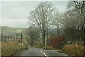
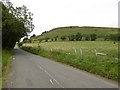
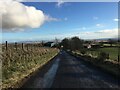
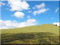
Nearby Images from Geograph Britain and Ireland:
©2008(licence)
©2016(licence)
©2024(licence)
©2010(licence)
©2009(licence)
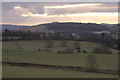
The above images may not be of the site on this page, they are loaded from Geograph.
Please Submit an Image of this site or go out and take one for us!
Click here to see more info for this site
Nearby sites
Key: Red: member's photo, Blue: 3rd party photo, Yellow: other image, Green: no photo - please go there and take one, Grey: site destroyed
Download sites to:
KML (Google Earth)
GPX (GPS waypoints)
CSV (Garmin/Navman)
CSV (Excel)
To unlock full downloads you need to sign up as a Contributory Member. Otherwise downloads are limited to 50 sites.
Turn off the page maps and other distractions
Nearby sites listing. In the following links * = Image available
1.4km WNW 289° Kilry* Standing Stone (Menhir) (NO24325449)
3.0km SSW 212° Shealwalls* Stone Circle (NO23965150)
3.0km SSW 213° Shealwalls Enclosure (Alyth) Ancient Village or Settlement (NO2392251484)
3.1km NE 36° Pitmudie* Stone Row / Alignment (NO2744956473)
3.8km S 170° Barry Hillfort Hillfort (NO262503)
4.1km SE 143° Shanzie Standing Stone (Menhir) (NO280507)
4.1km SE 143° Drumderrach* Standing Stones (NO280507)
4.1km NE 49° Strone Hill Stone Circle (NO288567)
4.8km ENE 66° Brankam Hill SE Stone Circle (NO300559)
4.8km ENE 66° Brankam Hill NW Stone Circle (NO300559)
4.9km SE 136° Bruceton* Class I Pictish Symbol Stone (NO290504)
5.2km S 180° Pitcrocknie* Standing Stone (Menhir) (NO2554648860)
5.4km SSW 193° Alyth* Class II Pictish Symbol Stone (NO24324878)
5.5km SSE 160° Balloch Mill Cairn (NO27384885)
5.8km W 260° Alyth Burn Hut Circles Ancient Village or Settlement (NO199531)
6.0km NE 43° Auldallan* Standing Stones (NO298583)
6.1km E 88° Meikle Kenny A* Stone Circle (NO31765415)
6.2km SE 131° Philpie Stones* Standing Stone (Menhir) (NO302499)
6.2km E 88° Meikle Kenny B* Stone Circle (NO31805417)
6.2km E 88° Meikle Kenny C* Stone Circle (NO31825418)
6.6km WSW 247° Parkneuk* Stone Circle (NO195515)
6.6km WSW 243° Heatheryhaugh (Bendochy) Rock Art (NO1963951153)
6.7km WSW 246° Tullymurdoch* Stone Circle (NO194514)
7.1km W 277° Drumderg 1 (Tullymurdoch) Rock Art (NO18525497)
7.5km ESE 119° Airlie* Standing Stone (Menhir) (NO3208450249)
View more nearby sites and additional images


 We would like to know more about this location. Please feel free to add a brief description and any relevant information in your own language.
 Wir möchten mehr über diese Stätte erfahren. Bitte zögern Sie nicht, eine kurze Beschreibung und relevante Informationen in Deutsch hinzuzufügen.
 Nous aimerions en savoir encore un peu sur les lieux. S'il vous plaît n'hesitez pas à ajouter une courte description et tous les renseignements pertinents dans votre propre langue.
 Quisieramos informarnos un poco más de las lugares. No dude en añadir una breve descripción y otros datos relevantes en su propio idioma.