 with our Megalithic Portal iPhone app")
, Aubrey Burl")
<< Our Photo Pages >> Kirkton Manor - Standing Stone (Menhir) in Scotland in Scottish Borders
Submitted by austenjohnreid on Sunday, 22 December 2002 Page Views: 10399
Neolithic and Bronze AgeSite Name: Kirkton ManorCountry: Scotland
NOTE: This site is 1.621 km away from the location you searched for.
County: Scottish Borders Type: Standing Stone (Menhir)
Nearest Town: Peebles Nearest Village: Kirkton Manor
Map Ref: NT22693863 Landranger Map Number: 73
Latitude: 55.635058N Longitude: 3.229594W
Condition:
| 5 | Perfect |
| 4 | Almost Perfect |
| 3 | Reasonable but with some damage |
| 2 | Ruined but still recognisable as an ancient site |
| 1 | Pretty much destroyed, possibly visible as crop marks |
| 0 | No data. |
| -1 | Completely destroyed |
| 5 | Superb |
| 4 | Good |
| 3 | Ordinary |
| 2 | Not Good |
| 1 | Awful |
| 0 | No data. |
| 5 | Can be driven to, probably with disabled access |
| 4 | Short walk on a footpath |
| 3 | Requiring a bit more of a walk |
| 2 | A long walk |
| 1 | In the middle of nowhere, a nightmare to find |
| 0 | No data. |
| 5 | co-ordinates taken by GPS or official recorded co-ordinates |
| 4 | co-ordinates scaled from a detailed map |
| 3 | co-ordinates scaled from a bad map |
| 2 | co-ordinates of the nearest village |
| 1 | co-ordinates of the nearest town |
| 0 | no data |
Internal Links:
External Links:
")
Information can be found on Canmore ID 51284, which says: "the standing stone that is built into the wall bordering the NW side of the public road halfway between Manor Bridge and Kirkton Manor is not in its original position ..... The stone measures 6 ft 3 in. in height and 4 ft 9 in. by 1 ft 9 in. at ground level. On both the NW and SE faces there are a number of natural hollows which have sometimes been mistaken for prehistoric cup-marks ..... the original position of this stone may be calculated at about NT 2262 3870."
Note: Have you visited this site? Can you leave a comment or add a photograph(s)?
You may be viewing yesterday's version of this page. To see the most up to date information please register for a free account.
")
Do not use the above information on other web sites or publications without permission of the contributor.
SteveDut has found this location on Google Street View:
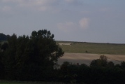
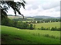
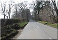
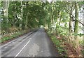
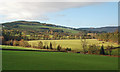
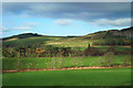
Nearby Images from Geograph Britain and Ireland:
©2006(licence)
©2009(licence)
©2019(licence)
©2014(licence)
©2014(licence)
The above images may not be of the site on this page, they are loaded from Geograph.
Please Submit an Image of this site or go out and take one for us!
Click here to see more info for this site
Nearby sites
Key: Red: member's photo, Blue: 3rd party photo, Yellow: other image, Green: no photo - please go there and take one, Grey: site destroyed
Download sites to:
KML (Google Earth)
GPX (GPS waypoints)
CSV (Garmin/Navman)
CSV (Excel)
To unlock full downloads you need to sign up as a Contributory Member. Otherwise downloads are limited to 50 sites.
Turn off the page maps and other distractions
Nearby sites listing. In the following links * = Image available
1.6km S 187° Cademuir Hill* Hillfort (NT22473708)
2.8km NW 308° Meldon Bridge Timber Circle (NT205404)
3.0km WNW 298° Sheriff Muir Standing Stones* Standing Stones (NT20094005)
3.4km ENE 58° Whitestone (Peebles)* Marker Stone (NT256404)
4.3km NNW 348° White Meldon* Round Cairn (NT21894284)
4.5km NNW 342° Druids Circle (Eddleston)* Henge (NT21404290)
4.5km WSW 257° Stobo Kirk standing stone* Standing Stone (Menhir) (NT1826037655)
5.0km NNW 344° Green Knowe Round Cairn (NT21384351)
5.3km NE 51° Soonhope Rock Art Rock Art (NT269419)
6.5km NE 38° Soonhope cairn* Chambered Cairn (NT268437)
6.7km NNW 332° Harehope Rings* Hillfort (NT1962644573)
7.3km E 86° Cardrona* Standing Stone (Menhir) (NT30003895)
7.5km WSW 246° Altar Stone, Stobo* Standing Stone (Menhir) (NT15703573)
9.3km WSW 249° Drumelzier Haugh* Standing Stone (Menhir) (NT13933542)
9.5km WSW 243° Tinnis Castle* Hillfort (NT14153444)
10.2km WSW 251° Dreva Hill West (Broughton)* Ancient Village or Settlement (NT12923553)
10.4km SSW 203° Nethertown Stone Circle (NT185291)
10.5km SSW 195° Manorhead Standing Stone (Menhir) (NT19862850)
10.5km WSW 251° Dreva Craig* Hillfort (NT12673533)
10.6km NW 313° Henderland Hill* Hillfort (NT14964597)
10.7km WSW 252° Dreva Craig* Standing Stone (Menhir) (NT12453545)
10.7km SSE 156° Bught Rig Standing Stones (NT26852876)
10.8km SSE 154° Douglas Water SE Stone Circle (NT273288)
10.8km SSE 154° Douglas Water NW* Stone Circle (NT273288)
11.1km NNE 15° Northshield Rings* Hillfort (NT25734934)
View more nearby sites and additional images


 We would like to know more about this location. Please feel free to add a brief description and any relevant information in your own language.
 Wir möchten mehr über diese Stätte erfahren. Bitte zögern Sie nicht, eine kurze Beschreibung und relevante Informationen in Deutsch hinzuzufügen.
 Nous aimerions en savoir encore un peu sur les lieux. S'il vous plaît n'hesitez pas à ajouter une courte description et tous les renseignements pertinents dans votre propre langue.
 Quisieramos informarnos un poco más de las lugares. No dude en añadir una breve descripción y otros datos relevantes en su propio idioma.