

, Aubrey Burl")
<< Text Pages >> Knowe of Taft - Broch or Nuraghe in Scotland in Orkney
Submitted by SolarMegalith on Friday, 20 January 2012 Page Views: 2486
Iron Age and Later PrehistorySite Name: Knowe of TaftCountry: Scotland County: Orkney Type: Broch or Nuraghe
Map Ref: HY28362226
Latitude: 59.081218N Longitude: 3.251643W
Condition:
| 5 | Perfect |
| 4 | Almost Perfect |
| 3 | Reasonable but with some damage |
| 2 | Ruined but still recognisable as an ancient site |
| 1 | Pretty much destroyed, possibly visible as crop marks |
| 0 | No data. |
| -1 | Completely destroyed |
| 5 | Superb |
| 4 | Good |
| 3 | Ordinary |
| 2 | Not Good |
| 1 | Awful |
| 0 | No data. |
| 5 | Can be driven to, probably with disabled access |
| 4 | Short walk on a footpath |
| 3 | Requiring a bit more of a walk |
| 2 | A long walk |
| 1 | In the middle of nowhere, a nightmare to find |
| 0 | No data. |
| 5 | co-ordinates taken by GPS or official recorded co-ordinates |
| 4 | co-ordinates scaled from a detailed map |
| 3 | co-ordinates scaled from a bad map |
| 2 | co-ordinates of the nearest village |
| 1 | co-ordinates of the nearest town |
| 0 | no data |
Internal Links:
External Links:
Broch in Orkney
Ruins of a ground-galleried broch which were excavated in 1882. Traces of 10 m long passage (gallery?) running around the broch wall were discovered, as well as sherds of Samian ware.
MacKie, E. 2002. Roundhouses, Brochs and Wheelhouses of Atlantic Scotland c. 700 BC – AD 500. Part I: The Orkney and Shetland Isles. Oxford: Archaeopress. (p. 224)
You may be viewing yesterday's version of this page. To see the most up to date information please register for a free account.
Do not use the above information on other web sites or publications without permission of the contributor.
Nearby Images from Geograph Britain and Ireland:
©2021(licence)
©2021(licence)
©2013(licence)
©2021(licence)
©2021(licence)
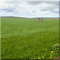
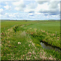
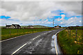
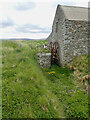
The above images may not be of the site on this page, they are loaded from Geograph.
Please Submit an Image of this site or go out and take one for us!
Click here to see more info for this site
Nearby sites
Key: Red: member's photo, Blue: 3rd party photo, Yellow: other image, Green: no photo - please go there and take one, Grey: site destroyed
Download sites to:
KML (Google Earth)
GPX (GPS waypoints)
CSV (Garmin/Navman)
CSV (Excel)
To unlock full downloads you need to sign up as a Contributory Member. Otherwise downloads are limited to 50 sites.
Turn off the page maps and other distractions
Nearby sites listing. In the following links * = Image available
1.9km WSW 252° Knowes of Howana Barrow Cemetery (HY26542169)
2.7km SSE 168° Hourston* Crannog (HY28891957)
2.9km SE 132° Holodyke Cairn (HY30482028)
3.0km N 353° Loch of Boardhouse* Standing Stone (Menhir) (HY28052520)
3.0km SSW 192° Hackland* Standing Stone (Menhir) (HY27691936)
3.1km NNW 329° Queenafjold* Barrow Cemetery (HY268250)
3.3km SE 131° North Bigging* Broch or Nuraghe (HY3082420003)
3.5km SE 144° Laxhowe* Artificial Mound (HY30361943)
3.5km WSW 258° Holy Kirk Stones Chambered Cairn (HY249216)
3.7km NW 308° Spurdagove Standing Stones (HY255246)
3.8km SE 143° Knowe of Browsky* Artificial Mound (HY306192)
3.9km SE 143° Foldarol's Hole* Artificial Mound (HY30631909)
4.1km SE 126° Nisthouse Barrow Cemetery (HY31631983)
4.1km WSW 238° Russel Howe* Cairn (HY24842016)
4.1km SSE 161° Burrian (Russland)* Broch or Nuraghe (HY29641835)
4.2km SE 142° Uvigar* Artificial Mound (HY30951888)
4.3km W 265° Vestrafiold* Ancient Mine, Quarry or other Industry (HY241220)
4.4km W 263° Vestra Fiold Chambered Cairn (HY240218)
4.7km SE 132° Howen Broch Broch or Nuraghe (HY318191)
4.9km SE 125° Burrian (Corrigall)* Broch or Nuraghe (HY32351937)
5.0km NW 322° Stone 'O Quoybune* Standing Stone (Menhir) (HY25312629)
5.3km SE 144° Overbrough* Broch or Nuraghe (HY31361790)
5.3km WSW 250° Upper Garson* Standing Stones (HY233205)
5.4km SSW 211° Hurkisgarth* Round Barrow(s) (HY25451770)
5.4km NW 325° Oxtro* Broch or Nuraghe (HY25372678)
View more nearby sites and additional images


 We would like to know more about this location. Please feel free to add a brief description and any relevant information in your own language.
 Wir möchten mehr über diese Stätte erfahren. Bitte zögern Sie nicht, eine kurze Beschreibung und relevante Informationen in Deutsch hinzuzufügen.
 Nous aimerions en savoir encore un peu sur les lieux. S'il vous plaît n'hesitez pas à ajouter une courte description et tous les renseignements pertinents dans votre propre langue.
 Quisieramos informarnos un poco más de las lugares. No dude en añadir una breve descripción y otros datos relevantes en su propio idioma.