 with our Megalithic Portal iPhone app")


<< Text Pages >> Chapel Well, Smardale - Holy Well or Sacred Spring in England in Cumbria
Submitted by Anne T on Thursday, 14 July 2022 Page Views: 968
Springs and Holy WellsSite Name: Chapel Well, Smardale Alternative Name: Smardale Chapel Holy WellCountry: England
NOTE: This site is 2.274 km away from the location you searched for.
County: Cumbria Type: Holy Well or Sacred Spring
Nearest Town: Kirkby Stephen Nearest Village: Crosby Garrett / Smardale
Map Ref: NY2350008550
Latitude: 54.466534N Longitude: 3.181794W
Condition:
| 5 | Perfect |
| 4 | Almost Perfect |
| 3 | Reasonable but with some damage |
| 2 | Ruined but still recognisable as an ancient site |
| 1 | Pretty much destroyed, possibly visible as crop marks |
| 0 | No data. |
| -1 | Completely destroyed |
| 5 | Superb |
| 4 | Good |
| 3 | Ordinary |
| 2 | Not Good |
| 1 | Awful |
| 0 | No data. |
| 5 | Can be driven to, probably with disabled access |
| 4 | Short walk on a footpath |
| 3 | Requiring a bit more of a walk |
| 2 | A long walk |
| 1 | In the middle of nowhere, a nightmare to find |
| 0 | No data. |
| 5 | co-ordinates taken by GPS or official recorded co-ordinates |
| 4 | co-ordinates scaled from a detailed map |
| 3 | co-ordinates scaled from a bad map |
| 2 | co-ordinates of the nearest village |
| 1 | co-ordinates of the nearest town |
| 0 | no data |
Be the first person to rate this site - see the 'Contribute!' box in the right hand menu.
Internal Links:
External Links:
Holy Well or Sacred Spring in Cumbria
Information about this well is recorded as Cumbria Historic Environment Record HER 1985, and the location of the well shown on the Historic England Map Search, alongside the now ruined Smardale Chapel.
The HER description reads: "Site of chapel. Chapel well still remains. See also SMR 3935, Smardale Deserted Medieval Village. The chapel site is no longer obvious; some stones piled around the base of a tree at the bottom of the field may have come from it. Further up the field there are traces of lynchets(ploughing ridges) in reasonable condition. In the field below, nearest the stream, are traces of what is probably Chapel Well, a natural spring."
The location of the well is shown on the National Library of Scotland 25 inch OS map of 1898 - see Westmorland XXIII.13 [link shared under their Creative Commons licence CC-BY], but it is not possible to see the well on Google Earth images (it ngr positions it to the western side of Scandal Beck).
Do you know anything about this well and are able to confirm its holy associations? If so, do you know if its waters were used for baptisms at the chapel, or for healing and/or restorative purposes?
Have you visited this site? Do you have any photographs you can add? Thank you.
You may be viewing yesterday's version of this page. To see the most up to date information please register for a free account.
Do not use the above information on other web sites or publications without permission of the contributor.
Nearby Images from Geograph Britain and Ireland:
©2013(licence)
©2010(licence)
©2011(licence)
©2011(licence)
©2011(licence)
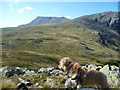
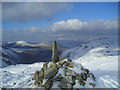
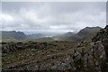
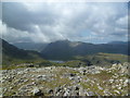
The above images may not be of the site on this page, they are loaded from Geograph.
Please Submit an Image of this site or go out and take one for us!
Click here to see more info for this site
Nearby sites
Key: Red: member's photo, Blue: 3rd party photo, Yellow: other image, Green: no photo - please go there and take one, Grey: site destroyed
Download sites to:
KML (Google Earth)
GPX (GPS waypoints)
CSV (Garmin/Navman)
CSV (Excel)
To unlock full downloads you need to sign up as a Contributory Member. Otherwise downloads are limited to 50 sites.
Turn off the page maps and other distractions
Nearby sites listing. In the following links * = Image available
3.4km N 2° Cappel-Crag/Seathwaite wall structure Misc. Earthwork (NY237119)
3.9km N 359° Borrowdale Stone Monument* Standing Stones (NY235125)
4.1km ESE 108° Langdale Axe Factory* Ancient Mine, Quarry or other Industry (NY274072)
4.7km W 271° Viking Timbers at St Olaf's Church Wasdale Head* Museum (NY18830869)
5.9km WSW 237° Maiden Castle (Eskdale)* Cairn (NY18480543)
5.9km ESE 119° Great Langdale* Rock Art (NY28650560)
7.1km ENE 78° Grasmere - Far Easedale* Natural Stone / Erratic / Other Natural Feature (NY305099)
7.3km SSW 192° Hardknott Roman Fort (MEDIOBOGDUM)* Promontory Fort / Cliff Castle (NY2184001469)
7.3km SW 227° Eskdale Moor Stone* Standing Stone (Menhir) (NY1801903675)
7.4km SSW 193° Hardknott Round Cairn* Round Cairn (NY2171701328)
7.5km N 10° Castle Crag Hillfort* Hillfort (NY249159)
7.9km SW 227° Boat How Enclosure* Ancient Village or Settlement (NY17620330)
8.0km NNE 13° Pocklington's Druid Stone* Modern Stone Circle etc (NY2539116369)
8.1km NNE 13° Bowder Stone* Natural Stone / Erratic / Other Natural Feature (NY255164)
8.1km SE 129° Castle Howe (Little Langdale)* Hillfort (NY29730328)
8.3km ESE 108° Copt Howe* Rock Art (NY31400583)
8.5km SW 227° Low Longrigg NE* Stone Circle (NY172028)
8.6km SW 226° Low Longrigg SW* Stone Circle (NY172027)
8.7km SW 224° White Moss NE* Stone Circle (NY17300241)
8.7km SW 224° Brat's Hill* Stone Circle (NY17370234)
8.8km SW 224° White Moss SW* Stone Circle (NY17250239)
8.9km SW 220° Boot cairn circle* Cairn (NY17630189)
9.5km ESE 119° Little Langdale Cup-Marked Stone* Rock Art (NY317038)
9.7km S 170° Ring Cairn, Tarn Brow, Seathwaite Tarn Ring Cairn (SD250990)
9.7km SSE 166° Round Cairn at Raven Nest Howe, Seathwaite Tarn Ring Cairn (SD257991)
View more nearby sites and additional images


 We would like to know more about this location. Please feel free to add a brief description and any relevant information in your own language.
 Wir möchten mehr über diese Stätte erfahren. Bitte zögern Sie nicht, eine kurze Beschreibung und relevante Informationen in Deutsch hinzuzufügen.
 Nous aimerions en savoir encore un peu sur les lieux. S'il vous plaît n'hesitez pas à ajouter une courte description et tous les renseignements pertinents dans votre propre langue.
 Quisieramos informarnos un poco más de las lugares. No dude en añadir una breve descripción y otros datos relevantes en su propio idioma.