

<< Text Pages >> Green Hill of Scarton - Broch or Nuraghe in Scotland in Orkney
Submitted by SolarMegalith on Friday, 20 January 2012 Page Views: 2390
Iron Age and Later PrehistorySite Name: Green Hill of ScartonCountry: Scotland
NOTE: This site is 6.932 km away from the location you searched for.
County: Orkney Type: Broch or Nuraghe
Map Ref: ND33789005
Latitude: 58.792894N Longitude: 3.147461W
Condition:
| 5 | Perfect |
| 4 | Almost Perfect |
| 3 | Reasonable but with some damage |
| 2 | Ruined but still recognisable as an ancient site |
| 1 | Pretty much destroyed, possibly visible as crop marks |
| 0 | No data. |
| -1 | Completely destroyed |
| 5 | Superb |
| 4 | Good |
| 3 | Ordinary |
| 2 | Not Good |
| 1 | Awful |
| 0 | No data. |
| 5 | Can be driven to, probably with disabled access |
| 4 | Short walk on a footpath |
| 3 | Requiring a bit more of a walk |
| 2 | A long walk |
| 1 | In the middle of nowhere, a nightmare to find |
| 0 | No data. |
| 5 | co-ordinates taken by GPS or official recorded co-ordinates |
| 4 | co-ordinates scaled from a detailed map |
| 3 | co-ordinates scaled from a bad map |
| 2 | co-ordinates of the nearest village |
| 1 | co-ordinates of the nearest town |
| 0 | no data |
Internal Links:
External Links:
I have visited· I would like to visit
h_fenton has visited here
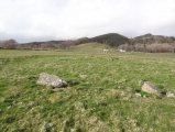
Possible broch preserved as a 2 m high grassy mound.
MacKie, E. 2002. Roundhouses, Brochs and Wheelhouses of Atlantic Scotland c. 700 BC – AD 500. Part I: The Orkney and Shetland Isles. Oxford: Archaeopress. (p. 260)
You may be viewing yesterday's version of this page. To see the most up to date information please register for a free account.
Do not use the above information on other web sites or publications without permission of the contributor.
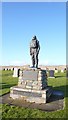
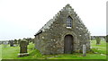
Nearby Images from Geograph Britain and Ireland:
©2011(licence)
©2008(licence)
©2008(licence)
©2009(licence)
©2019(licence)
The above images may not be of the site on this page, they are loaded from Geograph.
Please Submit an Image of this site or go out and take one for us!
Click here to see more info for this site
Nearby sites
Key: Red: member's photo, Blue: 3rd party photo, Yellow: other image, Green: no photo - please go there and take one, Grey: site destroyed
Download sites to:
KML (Google Earth)
GPX (GPS waypoints)
CSV (Garmin/Navman)
CSV (Excel)
To unlock full downloads you need to sign up as a Contributory Member. Otherwise downloads are limited to 50 sites.
Turn off the page maps and other distractions
Nearby sites listing. In the following links * = Image available
540m WSW 241° Burrowstone Broch or Nuraghe (ND333898)
663m SE 134° Outer Green Hill Broch Chambered Cairn (ND34258958)
999m S 181° Green Hill of Hestigeo Broch or Nuraghe (ND33758905)
1.0km SSE 149° Cantick Head Bowl Barrow Round Barrow(s) (ND34318915)
7.8km E 87° Harra Brough* Broch or Nuraghe (ND41579038)
9.5km ENE 64° Little Howe of Hoxa* Ancient Village or Settlement (ND42439403)
9.5km ENE 64° Little Howe of Hoxa* Ancient Village or Settlement (ND4243694026)
9.5km ENE 65° Howe of Hoxa* Broch or Nuraghe (ND425940)
9.7km E 96° Weems Castle Broch or Nuraghe (ND434889)
9.7km E 92° Clouduhall Cairn* Round Cairn (ND43498958)
9.7km E 92° Clouduhall Stone* Standing Stone (Menhir) (ND43538957)
10.1km ENE 75° Oyce of Quindry* Standing Stone (Menhir) (ND436925)
10.1km ENE 69° The Wart* Chambered Cairn (ND433935)
11.7km ESE 119° Ladykirk Stone* Rock Art (ND44008428)
12.3km ESE 102° The Cairns Windwick Bay* Broch or Nuraghe (ND4578987256)
12.7km E 94° Stews* Standing Stone (Menhir) (ND465890)
13.1km E 83° Eastside* Standing Stone (Menhir) (ND469914)
13.2km E 85° Kirkhouse* Round Cairn (ND470909)
13.6km E 84° Kirk Ness* Round Cairn (ND47389117)
13.6km E 84° Kirk Ness Dyke* Ancient Village or Settlement (ND474912)
13.7km S 178° Castle Mestag* Hillfort (ND33977633)
13.7km ESE 118° Banks Chambered Tomb* Chambered Cairn (ND45808339)
13.9km ESE 116° Tomb of the Eagles Museum Museum (ND4619783807)
14.0km ESE 114° Isbister: Bronze Age House* Ancient Village or Settlement (ND46468411)
14.0km ESE 114° Liddel 2 Burnt Mound Ancient Village or Settlement (ND46498416)
View more nearby sites and additional images


 We would like to know more about this location. Please feel free to add a brief description and any relevant information in your own language.
 Wir möchten mehr über diese Stätte erfahren. Bitte zögern Sie nicht, eine kurze Beschreibung und relevante Informationen in Deutsch hinzuzufügen.
 Nous aimerions en savoir encore un peu sur les lieux. S'il vous plaît n'hesitez pas à ajouter une courte description et tous les renseignements pertinents dans votre propre langue.
 Quisieramos informarnos un poco más de las lugares. No dude en añadir una breve descripción y otros datos relevantes en su propio idioma.