


<< Text Pages >> Welshpool A Cursus - Cursus in Wales in Powys
Submitted by EssexMan on Wednesday, 07 April 2010 Page Views: 3970
Neolithic and Bronze AgeSite Name: Welshpool A CursusCountry: Wales
NOTE: This site is 1.176 km away from the location you searched for.
County: Powys Type: Cursus
Nearest Town: Welshpool Nearest Village: Welshpool
Map Ref: SJ21640480 Landranger Map Number: 126
Latitude: 52.635269N Longitude: 3.159316W
Condition:
| 5 | Perfect |
| 4 | Almost Perfect |
| 3 | Reasonable but with some damage |
| 2 | Ruined but still recognisable as an ancient site |
| 1 | Pretty much destroyed, possibly visible as crop marks |
| 0 | No data. |
| -1 | Completely destroyed |
| 5 | Superb |
| 4 | Good |
| 3 | Ordinary |
| 2 | Not Good |
| 1 | Awful |
| 0 | No data. |
| 5 | Can be driven to, probably with disabled access |
| 4 | Short walk on a footpath |
| 3 | Requiring a bit more of a walk |
| 2 | A long walk |
| 1 | In the middle of nowhere, a nightmare to find |
| 0 | No data. |
| 5 | co-ordinates taken by GPS or official recorded co-ordinates |
| 4 | co-ordinates scaled from a detailed map |
| 3 | co-ordinates scaled from a bad map |
| 2 | co-ordinates of the nearest village |
| 1 | co-ordinates of the nearest town |
| 0 | no data |
Internal Links:
External Links:
Cruciform Long Enclosure in Powys
Status: Certain
NMR No. PRN 3482
Extent: 380mx12m
Terminal type: Unknown
Date: 3960-3630 cal BC 95% confidence terminus post quem
Note: This location marks one terminal (end) of a cursus monument. The location of the other terminal can be found in the Nearby Site list below.
The Northern Antiquarian (TNA) features a short general page on this cursus - see their entry for Sarn-y-Bryn-Caled, Belan, Montgomeryshire.
You may be viewing yesterday's version of this page. To see the most up to date information please register for a free account.
Do not use the above information on other web sites or publications without permission of the contributor.
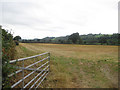
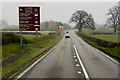
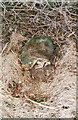
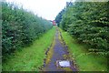
Nearby Images from Geograph Britain and Ireland:
©2009(licence)
©2017(licence)

©2012(licence)
©2019(licence)
©2012(licence)
The above images may not be of the site on this page, they are loaded from Geograph.
Please Submit an Image of this site or go out and take one for us!
Click here to see more info for this site
Nearby sites
Key: Red: member's photo, Blue: 3rd party photo, Yellow: other image, Green: no photo - please go there and take one, Grey: site destroyed
Download sites to:
KML (Google Earth)
GPX (GPS waypoints)
CSV (Garmin/Navman)
CSV (Excel)
To unlock full downloads you need to sign up as a Contributory Member. Otherwise downloads are limited to 50 sites.
Turn off the page maps and other distractions
Nearby sites listing. In the following links * = Image available
247m NE 46° Welshpool A Cursus Cursus (SJ21820497)
278m ENE 68° Sarn-y-Bryn-Caled* Timber Circle (SJ219049)
314m NE 36° Sarn-y-bryn-caled II Cursus Cursus (SJ21830505)
541m NE 37° Sarn-y-bryn-caled II Cursus Cursus (SJ21970523)
2.7km NNE 20° Powysland Museum* Museum (SJ226073)
2.7km NNE 25° Welshpool Eisteddfod Circle* Modern Stone Circle etc (SJ2286307263)
2.9km NNE 16° Maen Llog* Standing Stone (Menhir) (SJ225076)
3.6km SSW 199° Dyffryn Lane, Berriew* Henge (SJ2044101409)
3.7km SSW 200° Maen Beuno* Standing Stone (Menhir) (SJ2029201303)
4.9km SW 215° St Beuno (Berriew)* Natural Stone / Erratic / Other Natural Feature (SJ18780082)
4.9km ENE 77° Beacon Ring* Hillfort (SJ265058)
5.8km ENE 58° Trinity Well, Cletterwood Holy Well or Sacred Spring (SJ26650780)
7.3km SSE 150° Chirbury* Henge (SO25189838)
7.9km S 179° Ffridd Faldwyn* Hillfort (SO217969)
8.2km N 1° Trinity Well, Guilsfield Holy Well or Sacred Spring (SJ21881297)
8.2km N 4° Gaer Fawr (Guilsfield)* Hillfort (SJ223130)
8.5km E 83° Walton Camp* Hillfort (SJ301057)
8.8km NW 313° Ffynnon y Clawdd Llesg* Holy Well or Sacred Spring (SJ153109)
10.0km SE 125° Middleton Hall* Standing Stone (Menhir) (SO297989)
10.3km NE 42° Trinity Well (Trewern) Holy Well or Sacred Spring (SJ287123)
10.4km NW 323° Meifod* Ancient Cross (SJ155132)
10.5km SE 125° Middleton Hill Round Barrow(s) (SO302987)
10.5km SSE 147° Calcot Camp* Hillfort (SO273959)
10.7km ESE 113° Castle Ring (Rorrington)* Hillfort (SJ315005)
10.9km SE 125° Mitchell's Fold* Stone Circle (SO30429837)
View more nearby sites and additional images


 We would like to know more about this location. Please feel free to add a brief description and any relevant information in your own language.
 Wir möchten mehr über diese Stätte erfahren. Bitte zögern Sie nicht, eine kurze Beschreibung und relevante Informationen in Deutsch hinzuzufügen.
 Nous aimerions en savoir encore un peu sur les lieux. S'il vous plaît n'hesitez pas à ajouter une courte description et tous les renseignements pertinents dans votre propre langue.
 Quisieramos informarnos un poco más de las lugares. No dude en añadir una breve descripción y otros datos relevantes en su propio idioma.