


<< Our Photo Pages >> Bogleys - Standing Stone (Menhir) in Scotland in Fife
Submitted by Nick on Wednesday, 10 November 2004 Page Views: 13803
Neolithic and Bronze AgeSite Name: BogleysCountry: Scotland
NOTE: This site is 4.093 km away from the location you searched for.
County: Fife Type: Standing Stone (Menhir)
Nearest Town: Kirkcaldy Nearest Village: Gallatown
Map Ref: NT296951 Landranger Map Number: 59
Latitude: 56.143385N Longitude: 3.134566W
Condition:
| 5 | Perfect |
| 4 | Almost Perfect |
| 3 | Reasonable but with some damage |
| 2 | Ruined but still recognisable as an ancient site |
| 1 | Pretty much destroyed, possibly visible as crop marks |
| 0 | No data. |
| -1 | Completely destroyed |
| 5 | Superb |
| 4 | Good |
| 3 | Ordinary |
| 2 | Not Good |
| 1 | Awful |
| 0 | No data. |
| 5 | Can be driven to, probably with disabled access |
| 4 | Short walk on a footpath |
| 3 | Requiring a bit more of a walk |
| 2 | A long walk |
| 1 | In the middle of nowhere, a nightmare to find |
| 0 | No data. |
| 5 | co-ordinates taken by GPS or official recorded co-ordinates |
| 4 | co-ordinates scaled from a detailed map |
| 3 | co-ordinates scaled from a bad map |
| 2 | co-ordinates of the nearest village |
| 1 | co-ordinates of the nearest town |
| 0 | no data |
Internal Links:
External Links:
")
It is a large lump of sandstone standing just under 2m high, 1m wide, and about 0.6m thick, aligned E-W. There is one small cup mark high on the north face of the stone. According to the old Statistical Accounts, it marks the traditional site of a battle with the Danes about AD. 874.
Note: Stone is removed to make way for development!!! See comment below.
You may be viewing yesterday's version of this page. To see the most up to date information please register for a free account.
")
Do not use the above information on other web sites or publications without permission of the contributor.
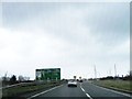
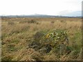
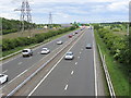
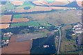
Nearby Images from Geograph Britain and Ireland:
©2013(licence)
©2021(licence)
©2015(licence)
©2019(licence)
©2019(licence)
The above images may not be of the site on this page, they are loaded from Geograph.
Please Submit an Image of this site or go out and take one for us!
Click here to see more info for this site
Nearby sites
Key: Red: member's photo, Blue: 3rd party photo, Yellow: other image, Green: no photo - please go there and take one, Grey: site destroyed
Download sites to:
KML (Google Earth)
GPX (GPS waypoints)
CSV (Garmin/Navman)
CSV (Excel)
To unlock full downloads you need to sign up as a Contributory Member. Otherwise downloads are limited to 50 sites.
Turn off the page maps and other distractions
Nearby sites listing. In the following links * = Image available
3.3km NE 44° Earlseat* Standing Stone (Menhir) (NT3197797452)
5.0km ENE 68° Court Cave* Cave or Rock Shelter (NT34279694)
5.1km ENE 67° West Doo Cave* Cave or Rock Shelter (NT3433097007)
5.1km ENE 67° Jonathan’s Cave* Cave or Rock Shelter (NT344970)
5.3km ENE 67° Well Cave Cave or Rock Shelter (NT345971)
5.4km ENE 66° Sloping Cave* Cave or Rock Shelter (NT34619727)
6.2km WNW 285° Dogton* Class III Pictish Cross Slab (NT2360996863)
7.9km N 352° Balbirnie* Stone Circle (NO2858702969)
8.1km N 351° Balfarg Riding School mortuary enclosure and henge* Henge (NO28480314)
8.1km N 349° Balfarg Henge* Henge (NO2819803123)
8.5km SW 217° North Glassmount* Standing Stones (NT244884)
9.1km NW 313° Strathhendry* Stone Circle (NO23050145)
10.0km WSW 240° Auchertool Holy Well* Holy Well or Sacred Spring (NT208902)
10.6km SW 219° Binn (Burntisland)* Rock Art (NT2278886891)
10.7km SSW 212° Craigkennockie (Burntisland) Cairn (NT237861)
10.9km W 274° Hare Law (Fife)* Cairn (NT187961)
11.1km NE 44° Balgrummo* Standing Stone (Menhir) (NO375029)
11.6km NE 43° Aithernie (Scoonie) Cairn (NO37690339)
11.9km W 272° Kirkhall, Lochore Stone Circle (NT177958)
12.2km NNW 334° East Lomond Hill Hillfort (NO24400620)
12.9km WNW 300° Scotlandwell* Holy Well or Sacred Spring (NO1847801656)
13.0km NNW 340° Westfield Farm Class I Pictish Symbol Stone (NO25260735)
13.3km NE 54° Lundin Links* Stone Circle (NO40480272)
13.5km WNW 300° Kilmagadwood Early Bronze Age cemetery Barrow Cemetery (NO1805702119)
14.0km SW 225° St Fillan's Well (Aberdour)* Holy Well or Sacred Spring (NT194854)
View more nearby sites and additional images


 We would like to know more about this location. Please feel free to add a brief description and any relevant information in your own language.
 Wir möchten mehr über diese Stätte erfahren. Bitte zögern Sie nicht, eine kurze Beschreibung und relevante Informationen in Deutsch hinzuzufügen.
 Nous aimerions en savoir encore un peu sur les lieux. S'il vous plaît n'hesitez pas à ajouter une courte description et tous les renseignements pertinents dans votre propre langue.
 Quisieramos informarnos un poco más de las lugares. No dude en añadir una breve descripción y otros datos relevantes en su propio idioma.