


<< Text Pages >> Round Cairn at Raven Nest Howe, Seathwaite Tarn - Ring Cairn in England in Cumbria
Submitted by Andy B on Sunday, 04 April 2010 Page Views: 3522
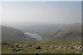
Neolithic and Bronze AgeSite Name: Round Cairn at Raven Nest Howe, Seathwaite TarnCountry: England
NOTE: This site is 0.924 km away from the location you searched for.
County: Cumbria Type: Ring Cairn
Nearest Town: Coniston Nearest Village: Seathwaite
Map Ref: SD257991
Latitude: 54.381951N Longitude: 3.145488W
Condition:
| 5 | Perfect |
| 4 | Almost Perfect |
| 3 | Reasonable but with some damage |
| 2 | Ruined but still recognisable as an ancient site |
| 1 | Pretty much destroyed, possibly visible as crop marks |
| 0 | No data. |
| -1 | Completely destroyed |
| 5 | Superb |
| 4 | Good |
| 3 | Ordinary |
| 2 | Not Good |
| 1 | Awful |
| 0 | No data. |
| 5 | Can be driven to, probably with disabled access |
| 4 | Short walk on a footpath |
| 3 | Requiring a bit more of a walk |
| 2 | A long walk |
| 1 | In the middle of nowhere, a nightmare to find |
| 0 | No data. |
| 5 | co-ordinates taken by GPS or official recorded co-ordinates |
| 4 | co-ordinates scaled from a detailed map |
| 3 | co-ordinates scaled from a bad map |
| 2 | co-ordinates of the nearest village |
| 1 | co-ordinates of the nearest town |
| 0 | no data |
Be the first person to rate this site - see the 'Contribute!' box in the right hand menu.
Internal Links:
External Links:
Ring Cairn in Cumbria
Site of a possible round cairn (a roughly hemispherical mound constructed primarily of stones, normally containing or covering one or more human burials. The mound may be surrounded and partly retained by a low stone kerb) or a ring bank (circular enclosure featuring an enclosing bank with no accompanying ditch) of Prehistoric date.
Possible burial cairn or ring banked structure identified by Peter Rogers.
Source: Lake District National Park HER
You may be viewing yesterday's version of this page. To see the most up to date information please register for a free account.
Do not use the above information on other web sites or publications without permission of the contributor.
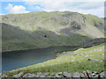
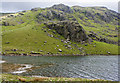
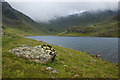
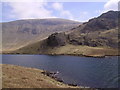
Nearby Images from Geograph Britain and Ireland:
©2012(licence)
©2013(licence)
©2013(licence)
©2007(licence)
©2006(licence)
The above images may not be of the site on this page, they are loaded from Geograph.
Please Submit an Image of this site or go out and take one for us!
Click here to see more info for this site
Nearby sites
Key: Red: member's photo, Blue: 3rd party photo, Yellow: other image, Green: no photo - please go there and take one, Grey: site destroyed
Download sites to:
KML (Google Earth)
GPX (GPS waypoints)
CSV (Garmin/Navman)
CSV (Excel)
To unlock full downloads you need to sign up as a Contributory Member. Otherwise downloads are limited to 50 sites.
Turn off the page maps and other distractions
Nearby sites listing. In the following links * = Image available
705m W 261° Ring Cairn, Tarn Brow, Seathwaite Tarn Ring Cairn (SD250990)
761m SSW 202° Ring Cairn at Woody Crag, Seathwaite Tarn Ring Cairn (SD254984)
1.4km SW 224° Ring Cairn, Lead Pike, Seathwaite Tarn Ring Cairn (SD247981)
1.4km SW 230° Lead Pike, Seathwaite* Ring Cairn (SD246982)
1.5km SW 227° Ring Bank Enclosure, Lead Pike, Seathwaite Tarn Ring Cairn (SD246981)
2.0km SE 132° Old Man of Coniston and Goat Hawes* Cairn (SD272977)
3.3km SSE 154° Torver Beck Homestead* Ancient Village or Settlement (SD271961)
3.6km SE 143° Little Arrow* Stone Circle (SD278962)
3.7km SE 130° Banishead Stone Circle* Stone Circle (SD2846796700)
3.9km SE 128° Heathwaite How* Stone Circle (SD2876396672)
4.2km SSE 165° Bleaberry Enclosure* Ancient Village or Settlement (SD267950)
4.5km S 170° Bleaberry Haws* Stone Circle (SD26449466)
4.5km WNW 301° Hardknott Roman Fort (MEDIOBOGDUM)* Promontory Fort / Cliff Castle (NY2184001469)
4.6km WNW 298° Hardknott Round Cairn* Round Cairn (NY2171701328)
4.7km SSE 151° Hare Crags and Tranearth Beck* Artificial Mound (SD2792395001)
5.8km NE 43° Castle Howe (Little Langdale)* Hillfort (NY29730328)
6.1km ENE 73° Holmes Fell and Uskdale Gap* Cairn (NY316008)
7.0km SSW 192° The Hawk Settlement* Ancient Village or Settlement (SD241923)
7.1km NNE 23° Great Langdale* Rock Art (NY28650560)
7.6km NE 51° Little Langdale Cup-Marked Stone* Rock Art (NY317038)
7.6km W 278° St Catherine's Well (Boot)* Holy Well or Sacred Spring (NY18150030)
7.8km WSW 248° Wormkragg Stiner Stone Row / Alignment (SD184963)
8.0km SW 214° Tarn Hill Cairn* Ring Cairn (SD211925)
8.1km WSW 247° Brown Rigg Round Cairn* Round Cairn (SD1812396059)
8.3km N 11° Langdale Axe Factory* Ancient Mine, Quarry or other Industry (NY274072)
View more nearby sites and additional images


 We would like to know more about this location. Please feel free to add a brief description and any relevant information in your own language.
 Wir möchten mehr über diese Stätte erfahren. Bitte zögern Sie nicht, eine kurze Beschreibung und relevante Informationen in Deutsch hinzuzufügen.
 Nous aimerions en savoir encore un peu sur les lieux. S'il vous plaît n'hesitez pas à ajouter une courte description et tous les renseignements pertinents dans votre propre langue.
 Quisieramos informarnos un poco más de las lugares. No dude en añadir una breve descripción y otros datos relevantes en su propio idioma.