 with our Megalithic Portal iPhone app")
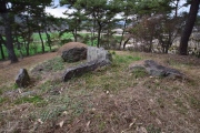

<< Our Photo Pages >> Graig Llwyn Iron Age Fort - Hillfort in Wales in Mid Glamorgan
Submitted by coldrum on Thursday, 12 July 2007 Page Views: 7071
Iron Age and Later PrehistorySite Name: Graig Llwyn Iron Age FortCountry: Wales
NOTE: This site is 3.258 km away from the location you searched for.
County: Mid Glamorgan Type: Hillfort
Nearest Town: Cardiff
Map Ref: ST205840
Latitude: 51.549268N Longitude: 3.147937W
Condition:
| 5 | Perfect |
| 4 | Almost Perfect |
| 3 | Reasonable but with some damage |
| 2 | Ruined but still recognisable as an ancient site |
| 1 | Pretty much destroyed, possibly visible as crop marks |
| 0 | No data. |
| -1 | Completely destroyed |
| 5 | Superb |
| 4 | Good |
| 3 | Ordinary |
| 2 | Not Good |
| 1 | Awful |
| 0 | No data. |
| 5 | Can be driven to, probably with disabled access |
| 4 | Short walk on a footpath |
| 3 | Requiring a bit more of a walk |
| 2 | A long walk |
| 1 | In the middle of nowhere, a nightmare to find |
| 0 | No data. |
| 5 | co-ordinates taken by GPS or official recorded co-ordinates |
| 4 | co-ordinates scaled from a detailed map |
| 3 | co-ordinates scaled from a bad map |
| 2 | co-ordinates of the nearest village |
| 1 | co-ordinates of the nearest town |
| 0 | no data |
Be the first person to rate this site - see the 'Contribute!' box in the right hand menu.
Internal Links:
External Links:
I have visited· I would like to visit
michmax visited on 1st Apr 2017 - their rating: Cond: 3 Amb: 4 Access: 4 We came from the Dutch garden centre end of Graig Llwyn road and parked the car in sharp bend by a field gate. We walked a short distance down the lane and there was an overgrown stile leading onto the hillfort on the right. The ramparts are visible and there are fantastic views over Cardiff, but there are stables right by the fort, and it looks like they are partially built on the site.
")
Iron age fort.
Further information here: Early British Kingdoms
You may be viewing yesterday's version of this page. To see the most up to date information please register for a free account.
Do not use the above information on other web sites or publications without permission of the contributor.
coldrum has found this location on Google Street View:
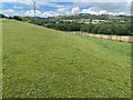
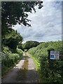
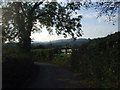
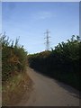
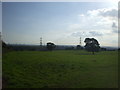
Nearby Images from Geograph Britain and Ireland:
©2022(licence)
©2022(licence)
©2009(licence)
©2009(licence)
©2009(licence)
The above images may not be of the site on this page, they are loaded from Geograph.
Please Submit an Image of this site or go out and take one for us!
Click here to see more info for this site
Nearby sites
Key: Red: member's photo, Blue: 3rd party photo, Yellow: other image, Green: no photo - please go there and take one, Grey: site destroyed
Download sites to:
KML (Google Earth)
GPX (GPS waypoints)
CSV (Garmin/Navman)
CSV (Excel)
To unlock full downloads you need to sign up as a Contributory Member. Otherwise downloads are limited to 50 sites.
Turn off the page maps and other distractions
Nearby sites listing. In the following links * = Image available
3.7km E 98° Druidstone (Michaelstone)* Standing Stone (Menhir) (ST24138342)
5.3km E 80° Graig (Monmouthshire) Cairn (ST258848)
5.4km WSW 256° Wennalt Camp Ancient Village or Settlement (ST15208275)
5.5km E 80° The Mount* Hillfort (ST259849)
5.8km ENE 66° Croes-Carn-Einion Hillfort (ST258863)
5.9km NE 34° Twyn Pant-Teg Cairn (ST239888)
5.9km WNW 297° Gorsedd Stones (Caerphilly)* Modern Stone Circle etc (ST153868)
6.0km NE 35° Twyn Pant-Teg Round Barrow(s) (ST240889)
6.3km ENE 60° Rhiwderin (Newport) Rock Art (ST260870)
6.3km NNE 16° Begwns Cairn (ST22379000)
6.9km NNW 341° Twyn-Yr-Oerfel A* Round Barrow(s) (ST18399058)
6.9km ENE 57° Rhiwderin Camp Hillfort (ST264877)
7.1km NNW 339° Twyn-Yr-Oerfel B* Round Barrow(s) (ST18109068)
7.1km ENE 72° Coed Ffynnon-Oer Hillfort (ST273861)
7.2km E 81° Gwern y Cleppa* Chambered Tomb (ST27648505)
7.3km SSW 192° Replica of St Lythans Tomb* Modern Stone Circle etc (ST1886176913)
7.4km SSW 196° National Museum Cardiff* Museum (ST18357696)
7.4km SSW 196° Gorsedd Circle (National Museum)* Modern Stone Circle etc (ST18387689)
7.7km SW 219° St Teilo's Well, Llandaff* Holy Well or Sacred Spring (ST15567805)
8.0km SSW 199° Gorsedd Circle (Bute Park)* Modern Stone Circle etc (ST178765)
8.0km SW 236° Pistyll Golau Holy Well or Sacred Spring (ST13787962)
8.1km WSW 240° Radyr Woods Burnt Mound* Artificial Mound (ST13438003)
8.1km NNW 336° Twyn Cae-Hugh* Round Barrow(s) (ST17379149)
8.1km NNE 33° Rogerstone 2 Round Barrow(s) (ST250908)
8.2km WSW 255° Lesser Garth Cave* Cave or Rock Shelter (ST125820)
View more nearby sites and additional images


 We would like to know more about this location. Please feel free to add a brief description and any relevant information in your own language.
 Wir möchten mehr über diese Stätte erfahren. Bitte zögern Sie nicht, eine kurze Beschreibung und relevante Informationen in Deutsch hinzuzufügen.
 Nous aimerions en savoir encore un peu sur les lieux. S'il vous plaît n'hesitez pas à ajouter une courte description et tous les renseignements pertinents dans votre propre langue.
 Quisieramos informarnos un poco más de las lugares. No dude en añadir una breve descripción y otros datos relevantes en su propio idioma.