


<< Other Photo Pages >> Stockland Great Castle - Hillfort in England in Devon
Submitted by SolarMegalith on Monday, 09 May 2011 Page Views: 8166
Iron Age and Later PrehistorySite Name: Stockland Great CastleCountry: England
NOTE: This site is 2.881 km away from the location you searched for.
County: Devon Type: Hillfort
Nearest Village: Dalwood
Map Ref: ST22620262
Latitude: 50.817935N Longitude: 3.099813W
Condition:
| 5 | Perfect |
| 4 | Almost Perfect |
| 3 | Reasonable but with some damage |
| 2 | Ruined but still recognisable as an ancient site |
| 1 | Pretty much destroyed, possibly visible as crop marks |
| 0 | No data. |
| -1 | Completely destroyed |
| 5 | Superb |
| 4 | Good |
| 3 | Ordinary |
| 2 | Not Good |
| 1 | Awful |
| 0 | No data. |
| 5 | Can be driven to, probably with disabled access |
| 4 | Short walk on a footpath |
| 3 | Requiring a bit more of a walk |
| 2 | A long walk |
| 1 | In the middle of nowhere, a nightmare to find |
| 0 | No data. |
| 5 | co-ordinates taken by GPS or official recorded co-ordinates |
| 4 | co-ordinates scaled from a detailed map |
| 3 | co-ordinates scaled from a bad map |
| 2 | co-ordinates of the nearest village |
| 1 | co-ordinates of the nearest town |
| 0 | no data |
Internal Links:
External Links:
Hillfort in Devon
An Iron Age hillfort which originally had 3 rings of ditches and ramparts. It's earthworks enclose area of 4 ha.
Read More at Pastscape.
You may be viewing yesterday's version of this page. To see the most up to date information please register for a free account.
Do not use the above information on other web sites or publications without permission of the contributor.
SolarMegalith has found this location on Google Street View:
Nearby Images from Geograph Britain and Ireland:
©2012(licence)
©2012(licence)
©2012(licence)
©2006(licence)
©2006(licence)
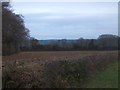
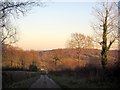
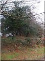
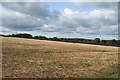
The above images may not be of the site on this page, they are loaded from Geograph.
Please Submit an Image of this site or go out and take one for us!
Click here to see more info for this site
Nearby sites
Key: Red: member's photo, Blue: 3rd party photo, Yellow: other image, Green: no photo - please go there and take one, Grey: site destroyed
Download sites to:
KML (Google Earth)
GPX (GPS waypoints)
CSV (Garmin/Navman)
CSV (Excel)
To unlock full downloads you need to sign up as a Contributory Member. Otherwise downloads are limited to 50 sites.
Turn off the page maps and other distractions
Nearby sites listing. In the following links * = Image available
1.1km NNE 19° Stockland Little Castle Hillfort (ST22980362)
5.2km WNW 285° Dumpdon Great Camp* Hillfort (ST176040)
5.6km E 87° Membury Castle Hillfort (ST282028)
8.0km ESE 119° Axminster Castle* Hillfort (SY296986)
8.8km SSE 166° Colyton Church Cross* Ancient Cross (SY24599409)
9.7km SW 222° Farway Castle Henge (SY1606395499)
9.8km SW 226° Ring-in-the-Mire* Misc. Earthwork (SY1548695932)
9.9km WNW 287° Row Barrow (Devon)* Round Barrow(s) (ST13180561)
10.1km SSW 211° Broad Down* Barrow Cemetery (SY173940)
10.2km SE 146° Musbury Castle* Hillfort (SY282941)
10.2km N 5° Robin Hood's Butts South* Barrow Cemetery (ST237128)
10.3km SW 230° Farway & Gittisham Hill Cemetery* Barrow Cemetery (SY146962)
10.4km NNE 31° Northay Barrow* Long Barrow (ST281115)
10.8km SSW 209° Broad Down Stone Circle (SY172933)
10.8km S 175° Seaton Down Camp* Hillfort (SY23449185)
10.9km SSW 200° Blackbury Camp* Hillfort (SY187924)
11.3km W 272° Hembury Fort* Hillfort (ST113031)
11.7km N 1° Robin Hood's Butts North* Barrow Cemetery (ST230143)
11.8km SSE 161° Hawksdown Camp Hillfort (SY26299143)
11.8km NE 35° Combe Beacon Tumulus* Long Barrow (ST295122)
12.3km SE 141° Shapwick Hill Bowl Barrows Barrow Cemetery (SY303930)
13.1km N 360° Robin Hoods Butt 2 (Somerset) Round Barrow(s) (ST22801575)
13.9km NNE 18° Castle Neroche* Hillfort (ST272158)
14.9km SW 220° Sidbury Castle* Hillfort (SY129913)
15.0km ESE 103° Lambert's Castle* Hillfort (SY372991)
View more nearby sites and additional images


 We would like to know more about this location. Please feel free to add a brief description and any relevant information in your own language.
 Wir möchten mehr über diese Stätte erfahren. Bitte zögern Sie nicht, eine kurze Beschreibung und relevante Informationen in Deutsch hinzuzufügen.
 Nous aimerions en savoir encore un peu sur les lieux. S'il vous plaît n'hesitez pas à ajouter une courte description et tous les renseignements pertinents dans votre propre langue.
 Quisieramos informarnos un poco más de las lugares. No dude en añadir una breve descripción y otros datos relevantes en su propio idioma.