Featured: Hare and Tabor T Shirts for discerning antiquarians

Hare and Tabor T Shirts for discerning antiquarians

Stonehenge Sacred Symbolism - Ancient Beliefs in Britain and Northern Europe

Stonehenge Sacred Symbolism - Ancient Beliefs in Britain and Northern Europe

Who's Online

There are currently, 252 guests and 5 members online.

You are a guest. To join in, please register for free by clicking here

Sponsors

<< Our Photo Pages >> Little Arrow - Stone Circle in England in Cumbria

Submitted by WindC on Tuesday, 20 March 2012  Page Views: 6090

Neolithic and Bronze AgeSite Name: Little Arrow
Country: England
NOTE: This site is 0.49 km away from the location you searched for.

County: Cumbria Type: Stone Circle
Nearest Town: Coniston  Nearest Village: Torver
Map Ref: SD278962
Latitude: 54.356195N  Longitude: 3.112457W
Condition:
5Perfect
4Almost Perfect
3Reasonable but with some damage
2Ruined but still recognisable as an ancient site
1Pretty much destroyed, possibly visible as crop marks
0No data.
-1Completely destroyed
3 Ambience:
5Superb
4Good
3Ordinary
2Not Good
1Awful
0No data.
5 Access:
5Can be driven to, probably with disabled access
4Short walk on a footpath
3Requiring a bit more of a walk
2A long walk
1In the middle of nowhere, a nightmare to find
0No data.
3 Accuracy:
5co-ordinates taken by GPS or official recorded co-ordinates
4co-ordinates scaled from a detailed map
3co-ordinates scaled from a bad map
2co-ordinates of the nearest village
1co-ordinates of the nearest town
0no data
4

Internal Links:
External Links:

Little Arrow
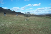
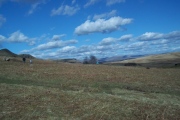
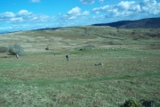
Little Arrow submitted by WindC : Looking eastwards towards Bleathwaite Pasture and Little Arrow Intake. Standing by some only just visible. A small blue racksack is in the middle. A white map marks one it's southerly stones [far right]. 18/3/2012 (Vote or comment on this photo)
Possibly a new found Stone Circle in Cumbria

Aprox. 42 feet across. Most stones are barely visible.
You may be viewing yesterday's version of this page. To see the most up to date information please register for a free account.

Little Arrow
Little Arrow submitted by WindC : This is a shot accidentally taken, I think it shows a octagonal stone to the NW of the circle, the scrub, grass has obscured it's view on the airiel map showing this site. (4 comments - Vote or comment on this photo)

Little Arrow
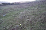
Little Arrow submitted by WindC : tennis ball marks 1, they are marking more. 18/3/12 (1 comment - Vote or comment on this photo)

Little Arrow
Little Arrow submitted by WindC : Astonishingly, Banishead Quarry is a stones throw away. 18/3/2012 (3 comments - Vote or comment on this photo)

Little Arrow
Little Arrow submitted by WindC : Looking South, along it's westerly edge. The tennis ball marks one And they mark 3 of what we finding to be a circle. 18/3/2012. (Vote or comment on this photo)

!Little Arrow
!Little Arrow submitted by WindC : This is just inside the circle's S edge. 18/3/2012 (Vote or comment on this photo)

Little Arrow
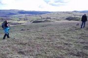
Little Arrow submitted by WindC : They are standing by some barely visible. Is that the cairn to the left?

Little Arrow
Little Arrow submitted by WindC : There is one 1/2 way up between Carol and just to right off the stone 18th of March, 2012

Little Arrow
Little Arrow submitted by WindC : 18th March, 2012 (2 comments)

Little Arrow
Little Arrow submitted by WindC : Viewing Northward's They are standing by 3 of the barely visible There are more. Is that the Cairn to the left? Mothering Sunday, 2012.

Little Arrow
Little Arrow submitted by WindC : Pointing out 2 barely visible, there are more, and they form a perfect circle, well, it might well be eliptical, I cant tell from here. and that stone in the centre of this picture is just within the Circles Southerly edge. Eighteenth of March, 2012

Little Arrow
Little Arrow submitted by WindC : Standing by 2 of the just visible ones. The larger stones are not in the circle. Those larger stones may be part of the partial octagonal pattern seen on the google earth map. 2012 (1 comment)

Little Arrow
Little Arrow submitted by WindC : One of the stones in the circle. 18/3/2012

Little Arrow
Little Arrow submitted by WindC : looking east, along it's south westerly edge. I have noticed these through reading some of Dr David Shepherds papers on stones of the South Pennines, it's the dimensions 116 cm long,60 cm high, 58 cm wide. Very similiar, and also very similiar to recumbent sheep, just a bit bigger. 18/3/2012

Little Arrow
Little Arrow submitted by WindC : Taken from it's westerly edge, viewing westwards. These may form some of the rest of the octagonal pattern, they may have been obscured by scrub at time of aeriel pic. 18/3/2012

Little Arrow
Little Arrow submitted by WindC : This is 1 in the circle. Anyone for tennis ? 18/3/2012

Little Arrow
Little Arrow submitted by WindC : This is in the circle 18/3/2012

Little Arrow
Little Arrow submitted by WindC : Lookin southwards, along it's easterly edge. Possibly 2 larger stones that form a octagon around the circle. The one under that Pike on the skyline would have been hidden by scrub. 18/3/2012.

!Little Arrow
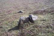
!Little Arrow submitted by WindC : This is just outside it's Westerly edge. 117 cm long, 80 cm wide, 40 cm high. Part of a octagonal shape around the circle? 18/3/2012.

!Little Arrow
!Little Arrow submitted by WindC : Many of the stones are just visible. 18/3/2012

!Little Arrow
!Little Arrow submitted by WindC : Looking northwards. Standing by some just visible. My rucksack by one, far right. A small blue rucksack in the middle. There seems to be a central mound. 18/3/2012

Little Arrow
Little Arrow submitted by WindC : 18th of March, 2012 if I remember rightly, these are in the circle, or very, very close.

Little Arrow
Little Arrow submitted by WindC : 18th of March, 2012 and I am almost quite sure these are in the circle, that bag to right is marking another.

Little Arrow
Little Arrow submitted by WindC : Near the circle's SW edge. the cairn ? 18th March, 2012

Little Arrow
Little Arrow submitted by WindC : Near its SW edge. The Cairn ? from behind. 18th March, 2012 (1 comment)

These are just the first 25 photos of Little Arrow. If you log in with a free user account you will be able to see our entire collection.

Do not use the above information on other web sites or publications without permission of the contributor.
Click here to see more info for this site

Nearby sites

Click here to view sites on an interactive OS map

Key: Red: member's photo, Blue: 3rd party photo, Yellow: other image, Green: no photo - please go there and take one, Grey: site destroyed

Download sites to:
KML (Google Earth)
GPX (GPS waypoints)
CSV (Garmin/Navman)
CSV (Excel)

To unlock full downloads you need to sign up as a Contributory Member. Otherwise downloads are limited to 50 sites.


Turn off the page maps and other distractions

Nearby sites listing. In the following links * = Image available
 705m W 261° Torver Beck Homestead* Ancient Village or Settlement (SD271961)
 832m NE 52° Banishead Stone Circle* Stone Circle (SD2846796700)
 1.1km ENE 63° Heathwaite How* Stone Circle (SD2876396672)
 1.2km S 173° Hare Crags and Tranearth Beck* Artificial Mound (SD2792395001)
 1.6km NNW 337° Old Man of Coniston and Goat Hawes* Cairn (SD272977)
 1.6km SW 222° Bleaberry Enclosure* Ancient Village or Settlement (SD267950)
 2.1km SW 220° Bleaberry Haws* Stone Circle (SD26449466)
 3.2km NW 312° Ring Cairn at Woody Crag, Seathwaite Tarn Ring Cairn (SD254984)
 3.6km NW 323° Round Cairn at Raven Nest Howe, Seathwaite Tarn Ring Cairn (SD257991)
 3.6km WNW 301° Ring Cairn, Lead Pike, Seathwaite Tarn Ring Cairn (SD247981)
 3.7km WNW 300° Ring Bank Enclosure, Lead Pike, Seathwaite Tarn Ring Cairn (SD246981)
 3.8km WNW 301° Lead Pike, Seathwaite* Ring Cairn (SD246982)
 4.0km NW 314° Ring Cairn, Tarn Brow, Seathwaite Tarn Ring Cairn (SD250990)
 5.4km SW 223° The Hawk Settlement* Ancient Village or Settlement (SD241923)
 5.8km S 184° Blawith Fells and Tarn Riggs (near Beacon Tarn) Cairn (SD2725490383)
 6.0km NE 39° Holmes Fell and Uskdale Gap* Cairn (NY316008)
 7.0km SSE 148° Bethecar Moor Round Cairn* Round Cairn (SD3142090164)
 7.3km NNE 14° Castle Howe (Little Langdale)* Hillfort (NY29730328)
 7.3km S 188° White Borran Cairn, Woodland Fell* Ring Cairn (SD2668788943)
 7.6km WSW 240° Tarn Hill Cairn* Ring Cairn (SD211925)
 7.7km ESE 119° Stone Forest by Kimio Tsuchiya* Modern Stone Circle etc (SD34509230)
 7.9km NW 311° Hardknott Roman Fort (MEDIOBOGDUM)* Promontory Fort / Cliff Castle (NY2184001469)
 7.9km NW 309° Hardknott Round Cairn* Round Cairn (NY2171701328)
 8.5km SSW 194° Giants Grave (Cumbria)* Ring Cairn (SD256880)
 8.5km NNE 26° Little Langdale Cup-Marked Stone* Rock Art (NY317038)
View more nearby sites and additional images

<< Achnabreck Stone

Yorkshire Museum >>

Please add your thoughts on this site

Prehistoric Monuments of the Lake District

Prehistoric Monuments of the Lake District

Sponsors

Auto-Translation (Google)

Translate from English into:

"Little Arrow" | Login/Create an Account | 17 News and Comments
  
Go back to top of page    Comments are owned by the poster. We aren't responsible for their content.
Re: Little Arrow by Anne T on Sunday, 23 July 2017
(User Info | Send a Message)
In trying to give this site an 8 digit grid reference, I've not come across anything on Pastscape that corresponds with this site. There are a number of cairns, ring cairns and clearance cairns, some natural accretions of stones and some natural features.

Does anyone else have any thoughts, comments or insight on this site that might help, please? (But having just seen the trail of comments below, I'm not sure what else there might be to add).
[ Reply to This ]

Re: Little Arrow by WindC on Thursday, 05 April 2012
(User Info | Send a Message)
I am goig to ask NASA,
that might b quicker
[ Reply to This ]
    Re: Little Arrow by TheCaptain on Friday, 06 April 2012
    (User Info | Send a Message)
    I have sympathy for you in your excitement for your possible find, but these things do not move quickly. After all, if it's a proper stone circle, its been there 4000 or 5000 years already, and unlikely to change soon.

    I must try a bit harder to go an check out my 2004 find, revisited and made properly public in 2008, of what I think is my refinding of long lost Sticklepath stone circle on Dartmoor.
    [ Reply to This ]
      Re: Little Arrow by WindC on Saturday, 07 April 2012
      (User Info | Send a Message)
      It is really exciting, though a bit embarrassing as I found it by not knowing exactly where I was.
      I was looking for Banniside stone circle, would U believe, and I didn't find it, I am pleased I haven't got a GPS thingy.
      [ Reply to This ]
      Re: Little Arrow by WindC on Monday, 09 April 2012
      (User Info | Send a Message)
      Dear Captain,
      I am very, very pleased to report that it ist 'proper' OK, Thank U X
      [ Reply to This ]
        Re: Little Arrow by WindC on Monday, 09 April 2012
        (User Info | Send a Message)
        I am just waiting for ESA and NASA to report back....
        vvish me Luck, X
        [ Reply to This ]
          Re: Little Arrow by TheCaptain on Monday, 09 April 2012
          (User Info | Send a Message)
          ESA and NASA ? Eh? What would they have to do with it? Send a space mission there?
          [ Reply to This ]
            Re: Little Arrow by WindC on Monday, 09 April 2012
            (User Info | Send a Message)
            Captain, they should have some good satellite images of it.
            [ Reply to This ]
            Re: Little Arrow by WindC on Monday, 09 April 2012
            (User Info | Send a Message)
            I wonder who is going to be the quickest in getting this site officially recognised, The European Space Agency, NASA or English Heritage [EH]?
            PS
            I haven't told EH yet, as I've been told they can't do much.
            [ Reply to This ]
          Who to contact to Confirm and Recognize a Historic Monument by bat400 on Tuesday, 10 April 2012
          (User Info | Send a Message)
          WindC-

          NASA and the ESA are not responsible for recognizing, cataloging, or protecting English pre-historic sites. I'm not sure exactly what you have requested from them, but recognition of your find, or conducting the research necessary to validate is almost certainly not within their scope.

          Yes, NASA has, from time to time, provided satellite imagery and worked with professional archaeologists who were conducting research on specific questions. (No idea about ESA.) But unless you are lucky and NASA has a publicly available satellite image of this site through their public webpage, it strikes me as totally unlikely that they will collect data especially for you. Similarly, I'm uncertain what you think a satellite image will "prove."

          It sounds to me that you have already done the appropriate thing by speaking with the Lake District Park officer. You really need to wait and see what sort of responses you get from the inquiries you have already made with this individual and the others you mentioned contacting by e-mail.

          Because of its location, the site is not under threat. And as excited as you are about this find, the authorities who can "recognize" it (or potentially connect it to previous documentation) have many things to do, and without a pressing reason, this process is not likely to be sped up. You can, of course "put forward" this site to English Heritage for designation. (http://www.english-heritage.org.uk/professional/protection/process/online-application-form/) Anyone can apply. However, the type of documentation of the validity of the site is exactly what the Lake District Park officials may be able to help you with. The best advice I can give is to wait for a response in a reasonable time period from the person/groups you have contacted (I'd suggest 4-6 weeks) before you repeat any requests. Otherwise you stand a chance of alienating the very people who can provide the validity and recognition you are trying to receive
          [ Reply to This ]
            Re: Who to contact to Confirm and Recognize a Historic Monument by WindC on Tuesday, 14 August 2012
            (User Info | Send a Message)
            Hmm, maybe I have baffled, or miffed people.
            I was so sure. What I do know for sure is this site is 'humming', that is what I felt standing by the nearby quarry, that is what drew me to this place.
            Looking at the Google Earth image of the site, there seems to be a octagonal arrangement surrounding this ring of stones.
            It feels like it has been ages now with no response.
            I hope I haven't 'miffed' anyone, unfortunately I fear I have.
            [ Reply to This ]

Re: Little Arrow by TheCaptain on Wednesday, 21 March 2012
(User Info | Send a Message)
If this place has been accurately positioned, there is a sort of semicircular feature marked on the DEFRA Magic Map nearby as "Homestead", which if interrogated gives the following info "CAIRNS AND ENCLOSURE ON THE RIGG, BANISHEAD", unfortunately with no further information.

There are also lots of quarries and a couple of cairns marked in the vicinity.

[ Reply to This ]
    Re: Little Arrow by WindC on Wednesday, 21 March 2012
    (User Info | Send a Message)
    It is astonishingly, and quite literally, a stones throw from Banishead Quarry, with it's waterfall.
    [ Reply to This ]
      Re: Little Arrow by WindC on Wednesday, 21 March 2012
      (User Info | Send a Message)
      and astonishingly, it is There, a absolutely Beautifull place..... Cannot see google earth. Must be the grass. ? Go by the tree.......... it is there
      [ Reply to This ]

Re: Little Arrow by WindC on Tuesday, 20 March 2012
(User Info | Send a Message)
I'm presuming you lot have contacted the relevant organisations to get this site officially recorded ? Or should I ring them, and who ?
[ Reply to This ]
    Re: Little Arrow by Runemage on Thursday, 22 March 2012
    (User Info | Send a Message)
    I've sent you a pm as mentioned on the site page.
    [ Reply to This ]
      Re: Little Arrow by WindC on Friday, 23 March 2012
      (User Info | Send a Message)
      Thanks Rune
      Have made a no. of calls,
      I emailed the hon. sec. of the Cumberland+ Westmoreland Antiquarian + Archeological Soc.
      Last call this morning I spoke with a officer for 'Lake District National Park', he hopes to visit, but he doesn't think that will be soon. I said I'd carry on calling around as, I think it needs doing sooner than later.
      I haven't been in touch with English Heritage as I have been told they will not be able to do anything.
      I'll carry on finding people/dept's to call..23/3/2012.
      [ Reply to This ]

Your Name: Anonymous [ Register Now ]
Subject:


Add your comment or contribution to this page. Spam or offensive posts are deleted immediately, don't even bother

<<< What is five plus one as a number? (Please type the answer to this question in the little box on the left)
You can also embed videos and other things. For Youtube please copy and paste the 'embed code'.
For Google Street View please include Street View in the text.
Create a web link like this: <a href="https://www.megalithic.co.uk">This is a link</a>  

Allowed HTML is:
<p> <b> <i> <a> <img> <em> <br> <strong> <blockquote> <tt> <li> <ol> <ul> <object> <param> <embed> <iframe>

We would like to know more about this location. Please feel free to add a brief description and any relevant information in your own language.
Wir möchten mehr über diese Stätte erfahren. Bitte zögern Sie nicht, eine kurze Beschreibung und relevante Informationen in Deutsch hinzuzufügen.
Nous aimerions en savoir encore un peu sur les lieux. S'il vous plaît n'hesitez pas à ajouter une courte description et tous les renseignements pertinents dans votre propre langue.
Quisieramos informarnos un poco más de las lugares. No dude en añadir una breve descripción y otros datos relevantes en su propio idioma.