

<< Our Photo Pages >> St Peter's Well, Whitney on Wye - Holy Well or Sacred Spring in England in Herefordshire
Submitted by geoffstickland on Wednesday, 12 May 2021 Page Views: 643
Springs and Holy WellsSite Name: St Peter's Well, Whitney on WyeCountry: England
NOTE: This site is 4.546 km away from the location you searched for.
County: Herefordshire Type: Holy Well or Sacred Spring
Nearest Town: Hay on Wye Nearest Village: Whitney on Wye
Map Ref: SO268475
Latitude: 52.120948N Longitude: 3.070552W
Condition:
| 5 | Perfect |
| 4 | Almost Perfect |
| 3 | Reasonable but with some damage |
| 2 | Ruined but still recognisable as an ancient site |
| 1 | Pretty much destroyed, possibly visible as crop marks |
| 0 | No data. |
| -1 | Completely destroyed |
| 5 | Superb |
| 4 | Good |
| 3 | Ordinary |
| 2 | Not Good |
| 1 | Awful |
| 0 | No data. |
| 5 | Can be driven to, probably with disabled access |
| 4 | Short walk on a footpath |
| 3 | Requiring a bit more of a walk |
| 2 | A long walk |
| 1 | In the middle of nowhere, a nightmare to find |
| 0 | No data. |
| 5 | co-ordinates taken by GPS or official recorded co-ordinates |
| 4 | co-ordinates scaled from a detailed map |
| 3 | co-ordinates scaled from a bad map |
| 2 | co-ordinates of the nearest village |
| 1 | co-ordinates of the nearest town |
| 0 | no data |
Internal Links:
External Links:
I have visited· I would like to visit
AJHL visited on 31st Dec 2022 - their rating: Cond: 2 Amb: 4 Access: 4 Opposite church - visible through field gate
geoffstickland have visited here
")
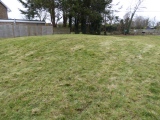
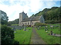
A low stone wall about 8' long by 2' high, set in bank above a hollow, under some young trees, close to the lane beside SS Peter and Paul Church. Visible from the church lane. A small metal spout in the wall discharges water into a shallow pool at the foot of the wall. The whole rather overgrown with vegetation. Locally believed to be a Holy Well.
You may be viewing yesterday's version of this page. To see the most up to date information please register for a free account.
")
Do not use the above information on other web sites or publications without permission of the contributor.
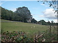
Nearby Images from Geograph Britain and Ireland:
©2019(licence)
©2019(licence)
©2019(licence)
©2019(licence)
©2019(licence)
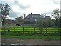
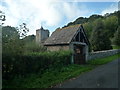
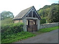
The above images may not be of the site on this page, they are loaded from Geograph.
Please Submit an Image of this site or go out and take one for us!
Click here to see more info for this site
Nearby sites
Key: Red: member's photo, Blue: 3rd party photo, Yellow: other image, Green: no photo - please go there and take one, Grey: site destroyed
Download sites to:
KML (Google Earth)
GPX (GPS waypoints)
CSV (Garmin/Navman)
CSV (Excel)
To unlock full downloads you need to sign up as a Contributory Member. Otherwise downloads are limited to 50 sites.
Turn off the page maps and other distractions
Nearby sites listing. In the following links * = Image available
5.2km WSW 249° Crossfoot Farm Standing Stone* Standing Stone (Menhir) (SO21874573)
6.1km SW 224° The Monk's Well* Holy Well or Sacred Spring (SO225432)
6.3km ESE 116° The Knapp (Bredwardine)* Ancient Village or Settlement (SO32454467)
6.5km ESE 119° Chapel field Hillfort (SO32404425)
6.6km SE 142° The Golden Well (Dorstone) Holy Well or Sacred Spring (SO30804228)
6.7km SE 130° Arthur's Stone* Chambered Tomb (SO3188843124)
6.8km SW 218° The Walk Well* Holy Well or Sacred Spring (SO225422)
7.1km SW 231° Clyro Court* Chambered Tomb (SO21234315)
7.3km ESE 113° Bredwardine Church* Carving (SO33484450)
7.7km SE 124° Pentre House Standing Stone* Standing Stone (Menhir) (SO33154307)
7.8km SE 131° Dorstone Hill* Ancient Village or Settlement (SO32604230)
8.6km SE 131° Great Llanavon Farm* Long Barrow (SO3322441689)
8.8km SSW 209° Pen-y-Wyrlod* Chambered Tomb (SO22483987)
9.3km SSW 196° Twyn-Y-Beddau* Round Barrow(s) (SO2414838610)
9.3km N 355° The Whet Stone (Hergest Ridge)* Natural Stone / Erratic / Other Natural Feature (SO26055680)
9.5km SW 232° St Maelog's Cross* Ancient Cross (SO1923941704)
9.7km N 0° Yeld Wood Stone Row / Alignment (SO26995724)
10.1km SSW 196° Maes-Coch Chambered Cairn (SO239378)
10.1km SW 233° Brynrhydd Common* Misc. Earthwork (SO18644145)
10.5km SSW 195° Pen Y Beacon* Stone Circle (SO23933735)
10.8km SSE 160° Wern Derys* Standing Stone (Menhir) (SO30363726)
11.2km N 5° Bradnor Hill 1 Stone Row / Alignment (SO27945860)
11.2km WNW 291° Six Stones* Stone Circle (SO163516)
11.3km ESE 123° Blakemere Church Stone* Marker Stone (SO362411)
11.7km N 350° Old Radnor Church* Standing Stone (Menhir) (SO24995909)
View more nearby sites and additional images


 We would like to know more about this location. Please feel free to add a brief description and any relevant information in your own language.
 Wir möchten mehr über diese Stätte erfahren. Bitte zögern Sie nicht, eine kurze Beschreibung und relevante Informationen in Deutsch hinzuzufügen.
 Nous aimerions en savoir encore un peu sur les lieux. S'il vous plaît n'hesitez pas à ajouter une courte description et tous les renseignements pertinents dans votre propre langue.
 Quisieramos informarnos un poco más de las lugares. No dude en añadir una breve descripción y otros datos relevantes en su propio idioma.