


<< Our Photo Pages >> Walton Palisaded Enclosure - Timber Circle in Wales in Powys
Submitted by AngieLake on Thursday, 28 November 2013 Page Views: 37845
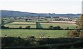
Neolithic and Bronze AgeSite Name: Walton Palisaded Enclosure Alternative Name: Walton Court ring ditch, Walton BasinCountry: Wales
NOTE: This site is 0.519 km away from the location you searched for.
County: Powys Type: Timber Circle
Nearest Village: Old Radnor
Map Ref: SO25235996
Latitude: 52.232738N Longitude: 3.09623W
Condition:
| 5 | Perfect |
| 4 | Almost Perfect |
| 3 | Reasonable but with some damage |
| 2 | Ruined but still recognisable as an ancient site |
| 1 | Pretty much destroyed, possibly visible as crop marks |
| 0 | No data. |
| -1 | Completely destroyed |
| 5 | Superb |
| 4 | Good |
| 3 | Ordinary |
| 2 | Not Good |
| 1 | Awful |
| 0 | No data. |
| 5 | Can be driven to, probably with disabled access |
| 4 | Short walk on a footpath |
| 3 | Requiring a bit more of a walk |
| 2 | A long walk |
| 1 | In the middle of nowhere, a nightmare to find |
| 0 | No data. |
| 5 | co-ordinates taken by GPS or official recorded co-ordinates |
| 4 | co-ordinates scaled from a detailed map |
| 3 | co-ordinates scaled from a bad map |
| 2 | co-ordinates of the nearest village |
| 1 | co-ordinates of the nearest town |
| 0 | no data |
Internal Links:
External Links:
I have visited· I would like to visit
AngieLake has visited here
")
The Walton Court ring ditch is by far the largest such site in mid and north-east Wales, although there are a further 18 ring ditches over 30m in diameter, of which 11 measure more than 40m, all of which are considered to be under threat from ploughing. There are distinct clusters of these large monuments in the Walton Basin and around the Severn-Vyrnwy confluence. These enigmatic sites, (reminiscent of the 110m-diameter pre-stone circle at Stonehenge) appear to fall within a recently-recognised category of so-called ‘formative henges’ dating to the Middle Neolithic period. Part of the site underlies two Roman marching camps and a excavation was designed to test their relationship to the ring ditch.
More at CPAT
Walton Court ring ditch is at SO 25235996 and appears to be a separate monument but I have combined these site pages as it is very close by. This is also the site of the Walton Palisaded Enclosure neolithic pit alignments at SO25455990. More details at CPAT here
Note: An almost free book about Walton Basin archaeology and conservation - send £2 cheque or collect from Welshpool
You may be viewing yesterday's version of this page. To see the most up to date information please register for a free account.
")
")
")
")
Do not use the above information on other web sites or publications without permission of the contributor.
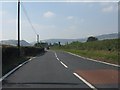
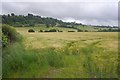
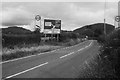
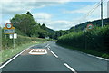
Nearby Images from Geograph Britain and Ireland:
©2011(licence)
©2019(licence)
©2019(licence)
©2018(licence)
©2020(licence)
The above images may not be of the site on this page, they are loaded from Geograph.
Please Submit an Image of this site or go out and take one for us!
Click here to see more info for this site
Nearby sites
Key: Red: member's photo, Blue: 3rd party photo, Yellow: other image, Green: no photo - please go there and take one, Grey: site destroyed
Download sites to:
KML (Google Earth)
GPX (GPS waypoints)
CSV (Garmin/Navman)
CSV (Excel)
To unlock full downloads you need to sign up as a Contributory Member. Otherwise downloads are limited to 50 sites.
Turn off the page maps and other distractions
Nearby sites listing. In the following links * = Image available
642m W 270° Knapp Mount Barrow* Barrow Cemetery (SO2458659975)
694m N 11° Hindwell Farm 1* Round Barrow(s) (SO25376064)
789m NNE 15° Hindwell Enclosure* Timber Circle (SO2544560720)
839m NNW 338° Hindwell Cursus* Cursus (SO24926074)
902m SSW 195° Old Radnor Church* Standing Stone (Menhir) (SO24995909)
926m NW 306° Hindwell Cursus* Cursus (SO24496052)
950m N 359° Hindwell Farm 2* Round Barrow(s) (SO25226091)
974m E 100° Walton Cursus Cursus (SO26195978)
1.0km W 270° Harpton Round Barrows* Round Barrow(s) (SO24225998)
1.0km NNW 341° The Hindwell Stone* Standing Stone (Menhir) (SO24916093)
1.1km NW 321° Four Stones (Powys)* Stone Circle (SO24576080)
1.1km NW 325° Four Stones Barrow Cemetary* Barrow Cemetery (SO24596091)
1.2km NNE 21° Hindwell Ash* Round Barrow(s) (SO25706111)
1.3km E 92° Walton Green Cursus (SO26525989)
1.3km N 354° Upper Ninepence barrow and Neolithic enclosure Round Barrow(s) (SO251613)
1.4km NE 46° Hindwell Causewayed Enclosure* Causewayed Enclosure (SO26246092)
1.6km E 87° Walton Cursus Cursus (SO26826001)
1.7km NE 37° Knobley Stone* Standing Stone (Menhir) (SO26296132)
2.6km NNW 340° Crossfield Lane Barrow (Kinnerton)* Round Barrow(s) (SO24356243)
2.9km NNW 346° Kinnerton* Standing Stones (SO24566274)
3.0km ESE 116° Bradnor Hill 1 Stone Row / Alignment (SO27945860)
3.2km SSE 146° Yeld Wood Stone Row / Alignment (SO26995724)
3.3km SSE 165° The Whet Stone (Hergest Ridge)* Natural Stone / Erratic / Other Natural Feature (SO26055680)
3.4km ENE 71° Burfa Camp* Hillfort (SO285610)
3.9km NNE 20° Castle Ring (Powys)* Hillfort (SO26646360)
View more nearby sites and additional images


 We would like to know more about this location. Please feel free to add a brief description and any relevant information in your own language.
 Wir möchten mehr über diese Stätte erfahren. Bitte zögern Sie nicht, eine kurze Beschreibung und relevante Informationen in Deutsch hinzuzufügen.
 Nous aimerions en savoir encore un peu sur les lieux. S'il vous plaît n'hesitez pas à ajouter une courte description et tous les renseignements pertinents dans votre propre langue.
 Quisieramos informarnos un poco más de las lugares. No dude en añadir una breve descripción y otros datos relevantes en su propio idioma.