


<< Our Photo Pages >> Chirbury - Henge in England in Shropshire
Submitted by TimPrevett on Sunday, 31 October 2004 Page Views: 6456
Neolithic and Bronze AgeSite Name: ChirburyCountry: England
NOTE: This site is 1.027 km away from the location you searched for.
County: Shropshire Type: Henge
Nearest Town: Montgomery Nearest Village: Chirbury
Map Ref: SO25189838
Latitude: 52.578066N Longitude: 3.105564W
Condition:
| 5 | Perfect |
| 4 | Almost Perfect |
| 3 | Reasonable but with some damage |
| 2 | Ruined but still recognisable as an ancient site |
| 1 | Pretty much destroyed, possibly visible as crop marks |
| 0 | No data. |
| -1 | Completely destroyed |
| 5 | Superb |
| 4 | Good |
| 3 | Ordinary |
| 2 | Not Good |
| 1 | Awful |
| 0 | No data. |
| 5 | Can be driven to, probably with disabled access |
| 4 | Short walk on a footpath |
| 3 | Requiring a bit more of a walk |
| 2 | A long walk |
| 1 | In the middle of nowhere, a nightmare to find |
| 0 | No data. |
| 5 | co-ordinates taken by GPS or official recorded co-ordinates |
| 4 | co-ordinates scaled from a detailed map |
| 3 | co-ordinates scaled from a bad map |
| 2 | co-ordinates of the nearest village |
| 1 | co-ordinates of the nearest town |
| 0 | no data |
Internal Links:
External Links:
I have visited· I would like to visit
TimPrevett has visited here
")
Site of suggested henge in far west Shropshire. Only identified from crop marks from aerial photography. Possibly some 60 feet in diameter with two entrances, around a ditch and external bank.
You may be viewing yesterday's version of this page. To see the most up to date information please register for a free account.
Do not use the above information on other web sites or publications without permission of the contributor.
coldrum has found this location on Google Street View:
Nearby Images from Geograph Britain and Ireland:
©2014(licence)
©2014(licence)
©2010(licence)
©2014(licence)
©2010(licence)
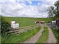
The above images may not be of the site on this page, they are loaded from Geograph.
Please Submit an Image of this site or go out and take one for us!
Click here to see more info for this site
Nearby sites
Key: Red: member's photo, Blue: 3rd party photo, Yellow: other image, Green: no photo - please go there and take one, Grey: site destroyed
Download sites to:
KML (Google Earth)
GPX (GPS waypoints)
CSV (Garmin/Navman)
CSV (Excel)
To unlock full downloads you need to sign up as a Contributory Member. Otherwise downloads are limited to 50 sites.
Turn off the page maps and other distractions
Nearby sites listing. In the following links * = Image available
3.3km SE 139° Calcot Camp* Hillfort (SO273959)
3.8km WSW 246° Ffridd Faldwyn* Hillfort (SO217969)
4.5km E 83° Middleton Hall* Standing Stone (Menhir) (SO297989)
4.9km S 183° The Rossett* Round Barrow(s) (SO24879352)
4.9km ESE 102° New House Long Barrow* Long Barrow (SO300973)
5.0km E 85° Middleton Hill Round Barrow(s) (SO302987)
5.2km ESE 107° Corndon Hill 7* Cairn (SO301968)
5.2km E 89° Mitchell's Fold* Stone Circle (SO30429837)
5.2km E 90° Mitchell's Fold outlier* Standing Stone (Menhir) (SO30429828)
5.3km E 98° The Whetstones* Stone Circle (SO30429753)
5.3km E 92° Druid's Castle* Stone Circle (SO305981)
5.4km SE 128° Roundton* Hillfort (SO29389498)
5.5km ESE 107° Corndon Hill 8* Cairn (SO304967)
5.5km ESE 107° Corndon Hill 1* Cairn (SO30449666)
5.6km ESE 104° Corndon Hill 2* Cairn (SO30609693)
5.6km WNW 302° Dyffryn Lane, Berriew* Henge (SJ2044101409)
5.7km WNW 300° Maen Beuno* Standing Stone (Menhir) (SJ2029201303)
5.7km E 84° Cow Stone (Shropshire)* Standing Stone (Menhir) (SO30919888)
5.8km ESE 112° Corndon Hill 6* Cairn (SO30539608)
5.9km ESE 105° Corndon Hill 3* Cairn (SO30909676)
6.0km ESE 104° Corndon Hill 4* Cairn (SO30949680)
6.0km E 85° Stapeley Hill Earthworks* Misc. Earthwork (SO312988)
6.0km ESE 109° Corndon Hill 5* Cairn (SO30869632)
6.1km E 83° Stapeley Hill Cairn* Cairn (SO31279904)
6.3km ESE 122° Cwm Mawr Stone Axe Factory Ancient Mine, Quarry or other Industry (SO305950)
View more nearby sites and additional images


 We would like to know more about this location. Please feel free to add a brief description and any relevant information in your own language.
 Wir möchten mehr über diese Stätte erfahren. Bitte zögern Sie nicht, eine kurze Beschreibung und relevante Informationen in Deutsch hinzuzufügen.
 Nous aimerions en savoir encore un peu sur les lieux. S'il vous plaît n'hesitez pas à ajouter une courte description et tous les renseignements pertinents dans votre propre langue.
 Quisieramos informarnos un poco más de las lugares. No dude en añadir una breve descripción y otros datos relevantes en su propio idioma.