


<< Other Photo Pages >> Santa María de Tejuela Nécropolis - Barrow Cemetery in Spain in Castilla y León
Submitted by holger_rix on Thursday, 03 December 2015 Page Views: 937
Neolithic and Bronze AgeSite Name: Santa María de Tejuela Nécropolis Alternative Name: Dolmen de BozóoCountry: Spain
NOTE: This site is 10.318 km away from the location you searched for.
Region: Castilla y León Type: Barrow Cemetery
Latitude: 42.758890N Longitude: 3.06258W
Condition:
| 5 | Perfect |
| 4 | Almost Perfect |
| 3 | Reasonable but with some damage |
| 2 | Ruined but still recognisable as an ancient site |
| 1 | Pretty much destroyed, possibly visible as crop marks |
| 0 | No data. |
| -1 | Completely destroyed |
| 5 | Superb |
| 4 | Good |
| 3 | Ordinary |
| 2 | Not Good |
| 1 | Awful |
| 0 | No data. |
| 5 | Can be driven to, probably with disabled access |
| 4 | Short walk on a footpath |
| 3 | Requiring a bit more of a walk |
| 2 | A long walk |
| 1 | In the middle of nowhere, a nightmare to find |
| 0 | No data. |
| 5 | co-ordinates taken by GPS or official recorded co-ordinates |
| 4 | co-ordinates scaled from a detailed map |
| 3 | co-ordinates scaled from a bad map |
| 2 | co-ordinates of the nearest village |
| 1 | co-ordinates of the nearest town |
| 0 | no data |
Be the first person to rate this site - see the 'Contribute!' box in the right hand menu.
Internal Links:
External Links:
")
You may be viewing yesterday's version of this page. To see the most up to date information please register for a free account.
Do not use the above information on other web sites or publications without permission of the contributor.
Nearby Images from Flickr
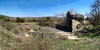
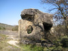
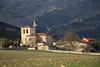
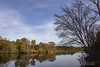
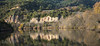
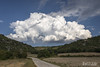
The above images may not be of the site on this page, but were taken nearby. They are loaded from Flickr so please click on them for image credits.
Click here to see more info for this site
Nearby sites
Click here to view sites on an interactive map of the areaKey: Red: member's photo, Blue: 3rd party photo, Yellow: other image, Green: no photo - please go there and take one, Grey: site destroyed
Download sites to:
KML (Google Earth)
GPX (GPS waypoints)
CSV (Garmin/Navman)
CSV (Excel)
To unlock full downloads you need to sign up as a Contributory Member. Otherwise downloads are limited to 50 sites.
Turn off the page maps and other distractions
Nearby sites listing. In the following links * = Image available
7.3km E 100° La Mina Trikuharria (Álava) Burial Chamber or Dolmen
7.6km ESE 105° La Lastra Trikuharria* Burial Chamber or Dolmen
12.2km NW 305° Villafria Zutarria Standing Stone (Menhir)
12.6km E 96° Los Andrinales Trikuharria Burial Chamber or Dolmen
14.1km NW 310° Villafria Tumulua Round Barrow(s)
15.1km NW 314° El Mojon Tumulua Round Barrow(s)
15.2km NNE 12° Alto Del Camino De Osma Zutarria Standing Stone (Menhir)
15.2km NNE 16° Las Crucijadas 1 Tumulua Round Barrow(s)
15.2km NNE 16° Las Crucijadas 2 Tumulua Round Barrow(s)
15.3km NNE 18° San Adrian Tumulua Round Barrow(s)
15.4km NW 309° Ampo Trikuharria Burial Chamber or Dolmen
15.4km NW 309° Ampo Tumulua Round Barrow(s)
15.5km NNE 17° Pozo Portillo Tumulua Round Barrow(s)
15.7km NW 315° Santa Gadea Tumulua Round Barrow(s)
15.8km NE 50° La Santa Cruz Tumulua Round Barrow(s)
17.5km NW 307° Ribera Tumulua Round Barrow(s)
17.7km NNE 20° Portillo De Luna Tumulua Round Barrow(s)
17.9km NNW 330° El Manzanal Eremu Tumularra Barrow Cemetery
18.2km NW 311° La Cruz De San Miguel Tumulua Round Barrow(s)
18.2km NNE 28° Los Cotorricos 3 Tumulua Round Barrow(s)
18.3km NNE 28° Los Cotorricos 1 Trikuharria* Burial Chamber or Dolmen
18.3km NNE 28° Los Cotorricos 2 Trikuharria Burial Chamber or Dolmen
18.6km NW 325° Ribota Zutarria* Standing Stone (Menhir)
19.2km NE 45° Cementerio De Sendadiano Tumulua Round Barrow(s)
19.3km NE 38° Sendadiano 2 Tumulua Round Barrow(s)
View more nearby sites and additional images


 We would like to know more about this location. Please feel free to add a brief description and any relevant information in your own language.
 Wir möchten mehr über diese Stätte erfahren. Bitte zögern Sie nicht, eine kurze Beschreibung und relevante Informationen in Deutsch hinzuzufügen.
 Nous aimerions en savoir encore un peu sur les lieux. S'il vous plaît n'hesitez pas à ajouter une courte description et tous les renseignements pertinents dans votre propre langue.
 Quisieramos informarnos un poco más de las lugares. No dude en añadir una breve descripción y otros datos relevantes en su propio idioma.