


<< Text Pages >> Offa's Dyke west of Ruabon - Misc. Earthwork in Wales in Wrexham
Submitted by Andy B on Saturday, 04 April 2020 Page Views: 742
Early Medieval (Dark Age)Site Name: Offa's Dyke west of RuabonCountry: Wales County: Wrexham Type: Misc. Earthwork
Nearest Town: Wrexham Nearest Village: Ruabon
Map Ref: SJ29564386
Latitude: 52.987426N Longitude: 3.050743W
Condition:
| 5 | Perfect |
| 4 | Almost Perfect |
| 3 | Reasonable but with some damage |
| 2 | Ruined but still recognisable as an ancient site |
| 1 | Pretty much destroyed, possibly visible as crop marks |
| 0 | No data. |
| -1 | Completely destroyed |
| 5 | Superb |
| 4 | Good |
| 3 | Ordinary |
| 2 | Not Good |
| 1 | Awful |
| 0 | No data. |
| 5 | Can be driven to, probably with disabled access |
| 4 | Short walk on a footpath |
| 3 | Requiring a bit more of a walk |
| 2 | A long walk |
| 1 | In the middle of nowhere, a nightmare to find |
| 0 | No data. |
| 5 | co-ordinates taken by GPS or official recorded co-ordinates |
| 4 | co-ordinates scaled from a detailed map |
| 3 | co-ordinates scaled from a bad map |
| 2 | co-ordinates of the nearest village |
| 1 | co-ordinates of the nearest town |
| 0 | no data |
Internal Links:
External Links:
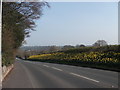
An impressive stretch of Offa's Dyke which runs behind a large secondary school in Ruabon.
You may be viewing yesterday's version of this page. To see the most up to date information please register for a free account.
Do not use the above information on other web sites or publications without permission of the contributor.
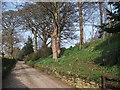
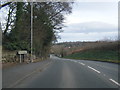
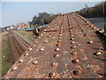
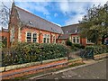
Nearby Images from Geograph Britain and Ireland:
©2012(licence)
©2014(licence)
©2012(licence)
©2024(licence)
©2012(licence)
The above images may not be of the site on this page, they are loaded from Geograph.
Please Submit an Image of this site or go out and take one for us!
Click here to see more info for this site
Nearby sites
Key: Red: member's photo, Blue: 3rd party photo, Yellow: other image, Green: no photo - please go there and take one, Grey: site destroyed
Download sites to:
KML (Google Earth)
GPX (GPS waypoints)
CSV (Garmin/Navman)
CSV (Excel)
To unlock full downloads you need to sign up as a Contributory Member. Otherwise downloads are limited to 50 sites.
Turn off the page maps and other distractions
Nearby sites listing. In the following links * = Image available
4.1km NNE 18° Hafod-y-bwch* Round Barrow(s) (SJ309477)
4.2km SW 216° Cae Carreg Lwyd Standing Stone (Menhir) (SJ270405)
4.4km NNE 14° Croes-Foel* Round Barrow(s) (SJ307481)
5.8km W 268° Brygolen Cairn 3* Cairn (SJ23794378)
5.9km W 268° Brygolen Cairn 2 Cairn (SJ23664376)
6.2km W 268° Bryngolen Cairn 1* Cairn (SJ23374372)
6.2km W 272° Eglwyseg Plantation Cairn 2 Cairn (SJ23344414)
6.5km W 271° Eglwyseg Plantation Cairn 1* Cairn (SJ23074403)
6.7km W 281° Eglwyseg Mountain* Standing Stone (Menhir) (SJ22994519)
6.7km WNW 287° Eglwyseg mountain cairns (1,2 and 3)* Cairn (SJ23154597)
6.7km NE 34° Hillbury* Round Barrow(s) (SJ33424939)
6.7km W 281° Creigiau Eglwyseg Boundary* Cairn (SJ22944522)
6.8km NNE 31° Fairy Oak* Round Barrow(s) (SJ33144962)
6.8km W 280° Eglwyseg Cairn Circle* Cairn (SJ22824513)
6.9km W 278° Eglwyseg stone (2)* Standing Stone (Menhir) (SJ22774494)
6.9km W 279° Eglwyseg Kerb Cairn A* Cairn (SJ22704509)
7.0km W 279° Eglwyseg Kerb Cairn B* Cairn (SJ227451)
7.0km W 277° Eglwyseg Stone* Natural Stone / Erratic / Other Natural Feature (SJ22574478)
7.2km W 274° Eglwyseg Plantation Barrow* Round Barrow(s) (SJ22364446)
7.3km W 263° Dinas Bran* Hillfort (SJ2224043060)
7.4km W 278° Creigiau Eglwyseg 1* Round Barrow(s) (SJ22214495)
7.5km NNE 28° Wrexham County Borough Museum* Museum (SJ3318950455)
7.6km ENE 74° Gerwyn Fechan Cursus (SJ36884584)
7.6km NW 314° Cefn-y-Gader cairn 1* Cairn (SJ241492)
8.0km WSW 253° Plas Newydd Gorsedd Stone circle* Modern Stone Circle etc (SJ2181041661)
View more nearby sites and additional images


 We would like to know more about this location. Please feel free to add a brief description and any relevant information in your own language.
 Wir möchten mehr über diese Stätte erfahren. Bitte zögern Sie nicht, eine kurze Beschreibung und relevante Informationen in Deutsch hinzuzufügen.
 Nous aimerions en savoir encore un peu sur les lieux. S'il vous plaît n'hesitez pas à ajouter une courte description et tous les renseignements pertinents dans votre propre langue.
 Quisieramos informarnos un poco más de las lugares. No dude en añadir una breve descripción y otros datos relevantes en su propio idioma.