


<< Our Photo Pages >> Offa's Dyke Centre - Museum in Wales in Powys
Submitted by TimPrevett on Monday, 01 February 2021 Page Views: 4532
MuseumsSite Name: Offa's Dyke Centre Alternative Name: Offa's Dyke Visitor CentreCountry: Wales County: Powys Type: Museum
Nearest Town: Knighton
Map Ref: SO2850172430
Latitude: 52.345263N Longitude: 3.050993W
Condition:
| 5 | Perfect |
| 4 | Almost Perfect |
| 3 | Reasonable but with some damage |
| 2 | Ruined but still recognisable as an ancient site |
| 1 | Pretty much destroyed, possibly visible as crop marks |
| 0 | No data. |
| -1 | Completely destroyed |
| 5 | Superb |
| 4 | Good |
| 3 | Ordinary |
| 2 | Not Good |
| 1 | Awful |
| 0 | No data. |
| 5 | Can be driven to, probably with disabled access |
| 4 | Short walk on a footpath |
| 3 | Requiring a bit more of a walk |
| 2 | A long walk |
| 1 | In the middle of nowhere, a nightmare to find |
| 0 | No data. |
| 5 | co-ordinates taken by GPS or official recorded co-ordinates |
| 4 | co-ordinates scaled from a detailed map |
| 3 | co-ordinates scaled from a bad map |
| 2 | co-ordinates of the nearest village |
| 1 | co-ordinates of the nearest town |
| 0 | no data |
Internal Links:
External Links:
 and Offa's Dyke (PID:101920)")
It includes an interactive exhibition allowing visitors to explore the Offa's Dyke, and an exhibition on Glyndwr’s Way including historical information about Owain Glyndwr himself.
The Centre, opened in 1999, forms the focus for activities based on the 8th Century earthwork built by Offa, the King of Mercia. The dyke itself follows the Welsh English border from the hills above Prestatyn to the Severn Estuary near Chepstow.
Free entry
Address: Offa's Dyke Centre, West Street, Knighton, Powys LD7 1EN, UK
Telephone: 01547 528 753
Visit their website or Twitter feed.
Note: How much work was involved in building the Dykes of the Mercian frontier? (More than you would think) A two-part article by archaeologist Keith Ray
You may be viewing yesterday's version of this page. To see the most up to date information please register for a free account.
")
")
")
Do not use the above information on other web sites or publications without permission of the contributor.
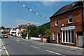
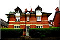
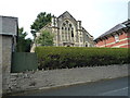
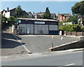
Nearby Images from Geograph Britain and Ireland:
©2014(licence)
©2017(licence)

©2017(licence)
©2018(licence)
©2014(licence)
The above images may not be of the site on this page, they are loaded from Geograph.
Please Submit an Image of this site or go out and take one for us!
Click here to see more info for this site
Nearby sites
Key: Red: member's photo, Blue: 3rd party photo, Yellow: other image, Green: no photo - please go there and take one, Grey: site destroyed
Download sites to:
KML (Google Earth)
GPX (GPS waypoints)
CSV (Garmin/Navman)
CSV (Excel)
To unlock full downloads you need to sign up as a Contributory Member. Otherwise downloads are limited to 50 sites.
Turn off the page maps and other distractions
Nearby sites listing. In the following links * = Image available
946m SW 230° Jacket's Well, The Jackets, Jackets Well* Holy Well or Sacred Spring (SO2776271836)
3.2km SE 136° Spaceguard Centre* Modern Stone Circle etc (SO3066970104)
4.2km NE 36° Caer Caradoc (Chapel Lawn)* Hillfort (SO310758)
5.1km SSW 214° St Mary (Pilleth)* Holy Well or Sacred Spring (SO25636824)
6.1km N 4° Rockhill Iron Age Enclosure* Misc. Earthwork (SO290785)
6.4km NNE 12° Clun Hill Stones* Standing Stones (SO29897873)
6.5km N 9° Clun Hill Glacial Erratic* Natural Stone / Erratic / Other Natural Feature (SO29667881)
6.9km NNE 24° Pen-Y-Wern Conglomerate* Standing Stone (Menhir) (SO31407871)
6.9km NNW 333° Offa's Dyke west of Llanfair Hill Misc. Earthwork (SO25407862)
7.0km NNE 23° Pen-Y-Wern Hill* Stone Circle (SO313788)
7.0km NNE 24° Pen-Y-Wern Outlier Standing Stone (Menhir) (SO31447880)
7.1km NNE 28° Fiddler's Elbow Standing Stone (Menhir) (SO32007865)
7.2km NE 53° Great Hagley* Standing Stone (Menhir) (SO343767)
7.3km NNW 346° Llanfair Hill East Standing Stone (Menhir) (SO26797950)
7.5km E 95° Brampton Bryan Lady Well* Holy Well or Sacred Spring (SO36007172)
7.7km ENE 62° Castle Ditches (Shropshire)* Ancient Village or Settlement (SO35357594)
8.1km E 82° Coxall Knoll* Hillfort (SO366734)
8.2km NNW 337° Llanfair Hill North Standing Stone (Menhir) (SO25428006)
8.3km SSE 152° Stapleton Henge Henge (SO32356510)
8.5km SSE 158° St Andrew's Church (Presteigne)* Ancient Cross (SO3156864528)
8.6km SSW 195° Beggar's Bush Barrow* Round Barrow(s) (SO26096417)
9.0km S 191° Castle Ring (Powys)* Hillfort (SO26646360)
9.6km N 358° Oak Farm Bowl Barrow* Round Barrow(s) (SO283820)
9.9km NNE 20° Radnor Wood Camp* Hillfort (SO320817)
9.9km N 354° Whitcott Keysett* Standing Stone (Menhir) (SO27648234)
View more nearby sites and additional images


 We would like to know more about this location. Please feel free to add a brief description and any relevant information in your own language.
 Wir möchten mehr über diese Stätte erfahren. Bitte zögern Sie nicht, eine kurze Beschreibung und relevante Informationen in Deutsch hinzuzufügen.
 Nous aimerions en savoir encore un peu sur les lieux. S'il vous plaît n'hesitez pas à ajouter une courte description et tous les renseignements pertinents dans votre propre langue.
 Quisieramos informarnos un poco más de las lugares. No dude en añadir una breve descripción y otros datos relevantes en su propio idioma.