


<< Our Photo Pages >> White Well (Breidden Hill) - Holy Well or Sacred Spring in Wales in Powys
Submitted by jamesrattue on Friday, 26 October 2007 Page Views: 4624
Springs and Holy WellsSite Name: White Well (Breidden Hill)Country: Wales County: Powys Type: Holy Well or Sacred Spring
Nearest Town: Welshpool Nearest Village: Trewern
Map Ref: SJ298144
Latitude: 52.722674N Longitude: 3.040813W
Condition:
| 5 | Perfect |
| 4 | Almost Perfect |
| 3 | Reasonable but with some damage |
| 2 | Ruined but still recognisable as an ancient site |
| 1 | Pretty much destroyed, possibly visible as crop marks |
| 0 | No data. |
| -1 | Completely destroyed |
| 5 | Superb |
| 4 | Good |
| 3 | Ordinary |
| 2 | Not Good |
| 1 | Awful |
| 0 | No data. |
| 5 | Can be driven to, probably with disabled access |
| 4 | Short walk on a footpath |
| 3 | Requiring a bit more of a walk |
| 2 | A long walk |
| 1 | In the middle of nowhere, a nightmare to find |
| 0 | No data. |
| 5 | co-ordinates taken by GPS or official recorded co-ordinates |
| 4 | co-ordinates scaled from a detailed map |
| 3 | co-ordinates scaled from a bad map |
| 2 | co-ordinates of the nearest village |
| 1 | co-ordinates of the nearest town |
| 0 | no data |
Internal Links:
External Links:
 (PID:34439)")
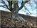
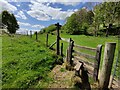
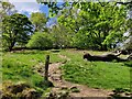
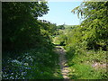
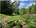
Where the path cuts straight up a gulley which should, but doesn't always, have a stream running along the bottom, watch for the point where you have to cross a field boundary over a stile. Just hidden from view by trees and bushes, and right by the path, is White Well, a small pool a few feet across scattered with various lumps of stone.
Nothing is known about this site: it appears on the Ordnance map, but that's it. I did spot a stone a few feet away which looks strangely regular, as though is was worked and part of a pillar - but it stretches credulity to imagine there was any structure at this well in such a remote location.
You may be viewing yesterday's version of this page. To see the most up to date information please register for a free account.
Do not use the above information on other web sites or publications without permission of the contributor.
Nearby Images from Geograph Britain and Ireland:
©2011(licence)
©2022(licence)
©2022(licence)
©2010(licence)
©2022(licence)
The above images may not be of the site on this page, they are loaded from Geograph.
Please Submit an Image of this site or go out and take one for us!
Click here to see more info for this site
Nearby sites
Key: Red: member's photo, Blue: 3rd party photo, Yellow: other image, Green: no photo - please go there and take one, Grey: site destroyed
Download sites to:
KML (Google Earth)
GPX (GPS waypoints)
CSV (Garmin/Navman)
CSV (Excel)
To unlock full downloads you need to sign up as a Contributory Member. Otherwise downloads are limited to 50 sites.
Turn off the page maps and other distractions
Nearby sites listing. In the following links * = Image available
403m S 186° New Pieces Enclosure* Ancient Village or Settlement (SJ2975014000)
598m W 269° Breiddin Hillfort* Hillfort (SJ292144)
1.3km SE 141° Cefn y Castell* Hillfort (SJ306134)
2.4km SSW 207° Trinity Well (Trewern) Holy Well or Sacred Spring (SJ287123)
2.4km E 87° Bausley Hill Camp* Hillfort (SJ322145)
4.1km WNW 291° Trinity Well, Arddleen Holy Well or Sacred Spring (SJ25951594)
6.0km E 89° Alberbury Cross* Ancient Cross (SJ3585514425)
7.3km SSW 205° Trinity Well, Cletterwood Holy Well or Sacred Spring (SJ26650780)
7.6km WSW 259° Gaer Fawr (Guilsfield)* Hillfort (SJ223130)
7.7km SSE 149° Caus Castle* Hillfort (SJ337078)
7.7km NNE 31° Kinnerley Cross* Ancient Cross (SJ3382520934)
8.0km W 259° Trinity Well, Guilsfield Holy Well or Sacred Spring (SJ21881297)
8.2km WNW 284° Collfryn Ring Ditch Misc. Earthwork (SJ21861650)
8.3km NNW 336° Llanymynech Hill Hillfort (SJ265220)
8.7km S 177° Walton Camp* Hillfort (SJ301057)
9.2km SSW 200° Beacon Ring* Hillfort (SJ265058)
9.6km NNE 17° Woolstone Causewayed Enclosure (SJ32752355)
9.8km ENE 59° Nesscliffe* Hillfort (SJ383193)
9.9km NE 42° The Knockin Hoarstone* Natural Stone / Erratic / Other Natural Feature (SJ36542168)
9.9km SW 223° Welshpool Eisteddfod Circle* Modern Stone Circle etc (SJ2286307263)
10.0km SW 226° Maen Llog* Standing Stone (Menhir) (SJ225076)
10.1km SW 225° Powysland Museum* Museum (SJ226073)
10.3km NNE 13° St Winifred's Well* Holy Well or Sacred Spring (SJ3222624437)
11.9km NE 41° Robin Hood's Chair* Stone Circle (SJ377233)
12.0km SW 220° Sarn-y-bryn-caled II Cursus Cursus (SJ21970523)
View more nearby sites and additional images


 We would like to know more about this location. Please feel free to add a brief description and any relevant information in your own language.
 Wir möchten mehr über diese Stätte erfahren. Bitte zögern Sie nicht, eine kurze Beschreibung und relevante Informationen in Deutsch hinzuzufügen.
 Nous aimerions en savoir encore un peu sur les lieux. S'il vous plaît n'hesitez pas à ajouter une courte description et tous les renseignements pertinents dans votre propre langue.
 Quisieramos informarnos un poco más de las lugares. No dude en añadir una breve descripción y otros datos relevantes en su propio idioma.