 with our Megalithic Portal iPhone app")

<< Text Pages >> Sheriff's Well (Greenodd) - Holy Well or Sacred Spring in England in Cumbria
Submitted by Anne T on Sunday, 17 July 2022 Page Views: 405
Springs and Holy WellsSite Name: Sheriff's Well (Greenodd) Alternative Name: Sheriffs Well (Well Wood)Country: England County: Cumbria Type: Holy Well or Sacred Spring
Nearest Town: Ulverston Nearest Village: Greenodd
Map Ref: SD3150082130
Latitude: 54.230278N Longitude: 3.052306W
Condition:
| 5 | Perfect |
| 4 | Almost Perfect |
| 3 | Reasonable but with some damage |
| 2 | Ruined but still recognisable as an ancient site |
| 1 | Pretty much destroyed, possibly visible as crop marks |
| 0 | No data. |
| -1 | Completely destroyed |
| 5 | Superb |
| 4 | Good |
| 3 | Ordinary |
| 2 | Not Good |
| 1 | Awful |
| 0 | No data. |
| 5 | Can be driven to, probably with disabled access |
| 4 | Short walk on a footpath |
| 3 | Requiring a bit more of a walk |
| 2 | A long walk |
| 1 | In the middle of nowhere, a nightmare to find |
| 0 | No data. |
| 5 | co-ordinates taken by GPS or official recorded co-ordinates |
| 4 | co-ordinates scaled from a detailed map |
| 3 | co-ordinates scaled from a bad map |
| 2 | co-ordinates of the nearest village |
| 1 | co-ordinates of the nearest town |
| 0 | no data |
Internal Links:
External Links:
Holy Well or Sacred Spring in Cumbria
Sited between the A590 to the west and the channel of the River Leven to its east, this well is classified as a holy well in the Cumbria Historic Environment Record, number 2555. Now destroyed by quarrying, they tell us "Sheriffs Well in Sheriffs Well Wood is listed as a holy well (Taylor's 'Ancient Crosses and Holy Wells of Lancs', 1906, pages 300 & 307)), but that site appears to have been destroyed by quarrying, but according to ET Thompson (CHER inspector) the well has 'long ago been piped - water flows from an old pipe into a series of three troughs, now partly overgrown". Taylor adds: "There is another well called 'Sheriff's Well' in an old bakehouse at SD 3143 8244 (some 320m to the NNW), but the owner has never heard it described as a holy well."
The name of the well is preserved in the local vicinity, with a Sheriffs Well Close, near the given grid reference for the well in the bakehouse, in Greenodd.
Sheriffs Well is shown on the 6 inch OS map of 1850, at the grid location given above - see the National Library of Scotland map Lancashire Sheet XI [link shared under the terms of the NLS Creative Commons licence CC-BY].
Does anyone have any information about this well? Able you able to confirm whether or not it has holy connections? Do you have any historical documentation or drawings you can add? If so, please could you add a comment here. Thank you.
You may be viewing yesterday's version of this page. To see the most up to date information please register for a free account.
Do not use the above information on other web sites or publications without permission of the contributor.
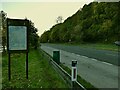
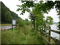
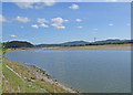
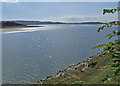
Nearby Images from Geograph Britain and Ireland:
©2020(licence)
©2012(licence)
©2009(licence)
©2009(licence)
©2009(licence)
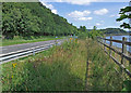
The above images may not be of the site on this page, they are loaded from Geograph.
Please Submit an Image of this site or go out and take one for us!
Click here to see more info for this site
Nearby sites
Key: Red: member's photo, Blue: 3rd party photo, Yellow: other image, Green: no photo - please go there and take one, Grey: site destroyed
Download sites to:
KML (Google Earth)
GPX (GPS waypoints)
CSV (Garmin/Navman)
CSV (Excel)
To unlock full downloads you need to sign up as a Contributory Member. Otherwise downloads are limited to 50 sites.
Turn off the page maps and other distractions
Nearby sites listing. In the following links * = Image available
642m N 354° Greenodd Holy Well (Egton with Newland) Holy Well or Sacred Spring (SD3144082770)
3.8km SSW 213° Hoad Hill* Cairn (SD294790)
4.1km WNW 300° The Beacon (Cumbria)* Stone Circle (SD28008423)
4.2km WNW 300° Lowick Ring Cairn (SD279843)
6.1km WNW 303° Great Burney* Ring Cairn (SD2640185541)
6.1km NW 304° Great Burney* Cairn (SD26458565)
6.4km W 277° Kirkby Moor Ringcairn* Round Cairn (SD25148299)
6.4km W 275° The Kirk Stone Row* Multiple Stone Rows / Avenue (SD2509182770)
6.4km W 274° The Kirk Ring Cairn* Stone Circle (SD2507082693)
6.5km SE 136° Holker Labyrinth and Standing Stones Modern Stone Circle etc (SD3590677373)
6.7km NNE 13° Rusland* Standing Stone (Menhir) (SD33098867)
6.8km NW 312° Heathwaite Settlement* Ancient Village or Settlement (SD265867)
7.9km SSW 210° Great Urswick Long Barrow* Long Barrow (SD27427540)
7.9km WNW 285° St Mary's Well (Kirkby Ireleth) Holy Well or Sacred Spring (SD2389584270)
8.0km SSW 199° Birkrigg Common Round Cairn 3 Round Cairn (SD288746)
8.0km N 359° Bethecar Moor Round Cairn* Round Cairn (SD3142090164)
8.0km W 279° Kirkby Hall Holy Well (Kirkby Ireleth) Holy Well or Sacred Spring (SD2357083550)
8.0km SSW 198° Birkrigg Common Settlement* Ancient Village or Settlement (SD28837453)
8.1km SSW 199° Birkrigg Common Enclosures and Appleby Hill and Stone Circle Ancient Village or Settlement (SD288745)
8.1km SSW 209° Great Urswick Fort* Hillfort (SD274751)
8.2km NW 314° Giants Grave (Woodland)* Cairn (SD257879)
8.2km SSW 197° Birkrigg Common Round Cairn 2 Round Cairn (SD289743)
8.3km SSW 200° Birkrigg Common Round Cairn 1 Round Cairn (SD285744)
8.3km NW 314° Giants Grave (Cumbria)* Ring Cairn (SD256880)
8.3km NW 324° White Borran Cairn, Woodland Fell* Ring Cairn (SD2668788943)
View more nearby sites and additional images


 We would like to know more about this location. Please feel free to add a brief description and any relevant information in your own language.
 Wir möchten mehr über diese Stätte erfahren. Bitte zögern Sie nicht, eine kurze Beschreibung und relevante Informationen in Deutsch hinzuzufügen.
 Nous aimerions en savoir encore un peu sur les lieux. S'il vous plaît n'hesitez pas à ajouter une courte description et tous les renseignements pertinents dans votre propre langue.
 Quisieramos informarnos un poco más de las lugares. No dude en añadir una breve descripción y otros datos relevantes en su propio idioma.