


<< Text Pages >> Cañón del Rio Lobos - Castro or Chafurdão in Spain in Castilla y León
Submitted by TheCaptain on Wednesday, 08 September 2010 Page Views: 1875
Iron Age and Later PrehistorySite Name: Cañón del Rio LobosCountry: Spain
NOTE: This site is 4.864 km away from the location you searched for.
Region: Castilla y León Type: Castro or Chafurdão
Nearest Town: Soria Nearest Village: Casarejos
Latitude: 41.800000N Longitude: 3.033W
Condition:
| 5 | Perfect |
| 4 | Almost Perfect |
| 3 | Reasonable but with some damage |
| 2 | Ruined but still recognisable as an ancient site |
| 1 | Pretty much destroyed, possibly visible as crop marks |
| 0 | No data. |
| -1 | Completely destroyed |
| 5 | Superb |
| 4 | Good |
| 3 | Ordinary |
| 2 | Not Good |
| 1 | Awful |
| 0 | No data. |
| 5 | Can be driven to, probably with disabled access |
| 4 | Short walk on a footpath |
| 3 | Requiring a bit more of a walk |
| 2 | A long walk |
| 1 | In the middle of nowhere, a nightmare to find |
| 0 | No data. |
| 5 | co-ordinates taken by GPS or official recorded co-ordinates |
| 4 | co-ordinates scaled from a detailed map |
| 3 | co-ordinates scaled from a bad map |
| 2 | co-ordinates of the nearest village |
| 1 | co-ordinates of the nearest town |
| 0 | no data |
Be the first person to rate this site - see the 'Contribute!' box in the right hand menu.
Internal Links:
External Links:
Castro in Castilla y León
Cañón del Rio Lobos is a Castro in the community of Casarejos, Province of Soria, region of Castilla y León
You may be viewing yesterday's version of this page. To see the most up to date information please register for a free account.
Do not use the above information on other web sites or publications without permission of the contributor.
Nearby Images from Flickr
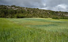
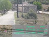
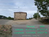
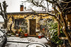
The above images may not be of the site on this page, but were taken nearby. They are loaded from Flickr so please click on them for image credits.
Click here to see more info for this site
Nearby sites
Click here to view sites on an interactive map of the areaKey: Red: member's photo, Blue: 3rd party photo, Yellow: other image, Green: no photo - please go there and take one, Grey: site destroyed
Download sites to:
KML (Google Earth)
GPX (GPS waypoints)
CSV (Garmin/Navman)
CSV (Excel)
To unlock full downloads you need to sign up as a Contributory Member. Otherwise downloads are limited to 50 sites.
Turn off the page maps and other distractions
Nearby sites listing. In the following links * = Image available
17.9km N 6° Necrópolis de Revenga* Barrow Cemetery
21.1km ESE 122° Calatañazor* Cist
25.4km SSW 192° Uxama* Ancient Village or Settlement
28.1km W 266° Colonia Clunia Sulpicia* Ancient Village or Settlement
30.3km W 262° Coruña del Conde* Not Known (by us)
30.5km ESE 113° Las Fraguas Cairn
32.6km ENE 67° La Ermita Cairn
37.2km ESE 113° Villa Romana La Dehesa Ancient Village or Settlement
39.0km NW 315° Morcales Round Barrow(s)
43.0km NW 317° Jaramillo Quemado Round Barrow(s)
44.1km W 265° Villa Romana de Santa Cruz Ancient Village or Settlement
46.1km NW 315° Hortigüela Ancient Village or Settlement
47.3km E 95° Proximadas de Soria Castro or Chafurdão
47.4km E 95° Almaluez Castro or Chafurdão
49.4km ENE 71° San Gregorio dolmen* Burial Chamber or Dolmen
53.1km S 190° Montejo de la Sierra Castro or Chafurdão
53.6km NW 315° Cubillejo Dolmen Burial Chamber or Dolmen
53.7km NW 312° Mazariegos Dolmen* Burial Chamber or Dolmen
59.0km SE 128° Cerro Gordo Not Known (by us)
63.2km E 80° Carrascosa de la Sierra dolmen* Burial Chamber or Dolmen
66.2km NE 38° Portillo de los Ladrones Chambered Cairn
67.8km NE 39° Collado Palomero Burial Chamber or Dolmen
69.2km NE 40° Montalbo: Fuente Morena Burial Chamber or Dolmen
71.2km NE 40° Barranco de la Cadena dolmen* Burial Chamber or Dolmen
72.8km NNW 327° Sima de los Huesos* Cave or Rock Shelter
View more nearby sites and additional images


 We would like to know more about this location. Please feel free to add a brief description and any relevant information in your own language.
 Wir möchten mehr über diese Stätte erfahren. Bitte zögern Sie nicht, eine kurze Beschreibung und relevante Informationen in Deutsch hinzuzufügen.
 Nous aimerions en savoir encore un peu sur les lieux. S'il vous plaît n'hesitez pas à ajouter une courte description et tous les renseignements pertinents dans votre propre langue.
 Quisieramos informarnos un poco más de las lugares. No dude en añadir una breve descripción y otros datos relevantes en su propio idioma.