 with our Megalithic Portal iPhone app")

<< Our Photo Pages >> St Andrew's Church (Presteigne) - Ancient Cross in Wales in Powys
Submitted by Anne T on Sunday, 08 August 2021 Page Views: 441
Medieval (High and Late)Site Name: St Andrew's Church (Presteigne) Alternative Name: Presteigne Church; Llanandras ChurchCountry: Wales
NOTE: This site is 2.099 km away from the location you searched for.
County: Powys Type: Ancient Cross
Nearest Town: Presteigne
Map Ref: SO3156864528
Latitude: 52.274625N Longitude: 3.00437W
Condition:
| 5 | Perfect |
| 4 | Almost Perfect |
| 3 | Reasonable but with some damage |
| 2 | Ruined but still recognisable as an ancient site |
| 1 | Pretty much destroyed, possibly visible as crop marks |
| 0 | No data. |
| -1 | Completely destroyed |
| 5 | Superb |
| 4 | Good |
| 3 | Ordinary |
| 2 | Not Good |
| 1 | Awful |
| 0 | No data. |
| 5 | Can be driven to, probably with disabled access |
| 4 | Short walk on a footpath |
| 3 | Requiring a bit more of a walk |
| 2 | A long walk |
| 1 | In the middle of nowhere, a nightmare to find |
| 0 | No data. |
| 5 | co-ordinates taken by GPS or official recorded co-ordinates |
| 4 | co-ordinates scaled from a detailed map |
| 3 | co-ordinates scaled from a bad map |
| 2 | co-ordinates of the nearest village |
| 1 | co-ordinates of the nearest town |
| 0 | no data |
Internal Links:
External Links:
I have visited· I would like to visit
Anne T visited on 14th Jul 2021 - their rating: Cond: 3 Amb: 4 Access: 4 St Andrew's Churchyard Cross, Presteigne: From the Kinnerton Standing Stone, we drove into New Radnor to try and get some lunch, only to find all the shops, pubs and cafe all shut down, which meant driving onto Presteigne. Andrew was keen to see the c1510 AD Flemish tapestry in the church, but as we walked into the churchyard, found this cross, too.
 (PID:230022)")
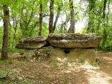
This churchyard cross, at the south eastern entrance to the churchyard, is recorded as Archwilio PRN 323, which describes this as: "a square-sectioned shaft but with stopped chamfers. One face is inset. It is about 0.9m high and fixed in an octagonal base".
There is also an entry in Coflein NPRN 306466, which simply tells us this is: "An octagonal cross-shaft is fixed into an octagonal cross-base of dubious antiquity".
Inside the church, displayed on the north wall, is a Flemish tapestry which dates from around 1510 AD, showing the Entry of Christ into Jerusalem. The information sign tells us that "it is very similar to one of a set of the Life of Christ originally made for Canterbury Cathedral and now in Aix-en-Provence. It was clearly made from the same cartoon".
The name Llanandras (Presteigne's Welsh name), means "the holy place of St Andrew". The website for the church tells us there has been a church on this site since before the Norman Conquest, although the current church is largely 14th century.
You may be viewing yesterday's version of this page. To see the most up to date information please register for a free account.
 (PID:230021)")
 (PID:230019)")
 (PID:230018)")
 (PID:230017)")
 (PID:230020)")
Do not use the above information on other web sites or publications without permission of the contributor.
Click here to see more info for this site
Nearby sites
Key: Red: member's photo, Blue: 3rd party photo, Yellow: other image, Green: no photo - please go there and take one, Grey: site destroyed
Download sites to:
KML (Google Earth)
GPX (GPS waypoints)
CSV (Garmin/Navman)
CSV (Excel)
To unlock full downloads you need to sign up as a Contributory Member. Otherwise downloads are limited to 50 sites.
Turn off the page maps and other distractions
Nearby sites listing. In the following links * = Image available
967m NE 53° Stapleton Henge Henge (SO32356510)
1.8km ESE 119° Cat and Fiddle Enclosure Cropmark Ancient Village or Settlement (SO33146362)
3.6km SE 124° Wapley Camp* Hillfort (SO3457162465)
4.7km SW 220° Burfa Camp* Hillfort (SO285610)
5.0km WSW 259° Castle Ring (Powys)* Hillfort (SO26646360)
5.5km W 265° Beggar's Bush Barrow* Round Barrow(s) (SO26096417)
5.6km N 350° Spaceguard Centre* Modern Stone Circle etc (SO3066970104)
6.2km WSW 238° Knobley Stone* Standing Stone (Menhir) (SO26296132)
6.4km SW 235° Hindwell Causewayed Enclosure* Causewayed Enclosure (SO26246092)
6.5km SW 226° Walton Cursus Cursus (SO26826001)
6.8km WSW 239° Hindwell Ash* Round Barrow(s) (SO25706111)
6.8km SW 227° Walton Green Cursus (SO26525989)
6.9km SSW 211° Bradnor Hill 1 Stone Row / Alignment (SO27945860)
7.0km WNW 301° St Mary (Pilleth)* Holy Well or Sacred Spring (SO25636824)
7.2km SW 228° Walton Cursus Cursus (SO26195978)
7.2km WSW 237° Hindwell Enclosure* Timber Circle (SO2544560720)
7.2km WSW 243° Upper Ninepence barrow and Neolithic enclosure Round Barrow(s) (SO251613)
7.2km WSW 255° Kinnerton* Standing Stones (SO24566274)
7.3km WSW 239° Hindwell Farm 2* Round Barrow(s) (SO25226091)
7.3km WSW 237° Hindwell Farm 1* Round Barrow(s) (SO25376064)
7.5km WSW 253° Crossfield Lane Barrow (Kinnerton)* Round Barrow(s) (SO24356243)
7.6km WSW 241° The Hindwell Stone* Standing Stone (Menhir) (SO24916093)
7.6km WSW 239° Hindwell Cursus* Cursus (SO24926074)
7.8km SW 233° Walton Palisaded Enclosure* Timber Circle (SO25235996)
7.8km WSW 242° Four Stones Barrow Cemetary* Barrow Cemetery (SO24596091)
View more nearby sites and additional images


 We would like to know more about this location. Please feel free to add a brief description and any relevant information in your own language.
 Wir möchten mehr über diese Stätte erfahren. Bitte zögern Sie nicht, eine kurze Beschreibung und relevante Informationen in Deutsch hinzuzufügen.
 Nous aimerions en savoir encore un peu sur les lieux. S'il vous plaît n'hesitez pas à ajouter une courte description et tous les renseignements pertinents dans votre propre langue.
 Quisieramos informarnos un poco más de las lugares. No dude en añadir una breve descripción y otros datos relevantes en su propio idioma.