


<< Our Photo Pages >> Blaenawey Well (Bettws) - Holy Well or Sacred Spring in Wales in Monmouthshire
Submitted by Sunny100 on Wednesday, 21 September 2011 Page Views: 4553
Springs and Holy WellsSite Name: Blaenawey Well (Bettws) Alternative Name: Ffynnon Blaena, Ffynnon BlaenaweyCountry: Wales
NOTE: This site is 2.141 km away from the location you searched for.
County: Monmouthshire Type: Holy Well or Sacred Spring
Nearest Town: Abergavenny Nearest Village: Bettws
Map Ref: SO290194
Latitude: 51.868638N Longitude: 3.032596W
Condition:
| 5 | Perfect |
| 4 | Almost Perfect |
| 3 | Reasonable but with some damage |
| 2 | Ruined but still recognisable as an ancient site |
| 1 | Pretty much destroyed, possibly visible as crop marks |
| 0 | No data. |
| -1 | Completely destroyed |
| 5 | Superb |
| 4 | Good |
| 3 | Ordinary |
| 2 | Not Good |
| 1 | Awful |
| 0 | No data. |
| 5 | Can be driven to, probably with disabled access |
| 4 | Short walk on a footpath |
| 3 | Requiring a bit more of a walk |
| 2 | A long walk |
| 1 | In the middle of nowhere, a nightmare to find |
| 0 | No data. |
| 5 | co-ordinates taken by GPS or official recorded co-ordinates |
| 4 | co-ordinates scaled from a detailed map |
| 3 | co-ordinates scaled from a bad map |
| 2 | co-ordinates of the nearest village |
| 1 | co-ordinates of the nearest town |
| 0 | no data |
Internal Links:
External Links:
 (PID:81719)")
The well is located by a footpath at the side of a hill just west of Blaenawey farm, along a farm track close to the hamlet of Bettws. It is built of stone slabs and has an inner square-shaped stone basin. The water is cold and fairly clear most of the time - the water itself coming from deep in the hillside, but it may be connected to the Blaena stream, which flows close by.
This is obviously an ancient well/spring that has supplied the Blaenewey farm, some of the old buildings of which are several hundred years old. The water is said to be drinkable. [Please be aware the well is on private land though access will probably be given if you ask at the farm].
You may be viewing yesterday's version of this page. To see the most up to date information please register for a free account.
Do not use the above information on other web sites or publications without permission of the contributor.
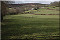
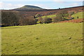
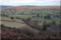
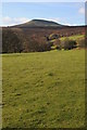
Nearby Images from Geograph Britain and Ireland:
©2007(licence)
©2013(licence)
©2007(licence)
©2013(licence)
©2005(licence)
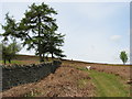
The above images may not be of the site on this page, they are loaded from Geograph.
Please Submit an Image of this site or go out and take one for us!
Click here to see more info for this site
Nearby sites
Key: Red: member's photo, Blue: 3rd party photo, Yellow: other image, Green: no photo - please go there and take one, Grey: site destroyed
Download sites to:
KML (Google Earth)
GPX (GPS waypoints)
CSV (Garmin/Navman)
CSV (Excel)
To unlock full downloads you need to sign up as a Contributory Member. Otherwise downloads are limited to 50 sites.
Turn off the page maps and other distractions
Nearby sites listing. In the following links * = Image available
2.6km N 8° Twyn-y-Gaer (Monmouthshire) Hillfort (SO2938721948)
3.1km SE 128° Trillech Stone Row / Alignment (SO314175)
3.2km SSE 168° Twyn yr Allt* Ancient Village or Settlement (SO296163)
3.2km NNW 339° Partrishow Churchyard Cross* Ancient Cross (SO2788822434)
3.2km NNW 338° Ffynnon Ishow* Holy Well or Sacred Spring (SO2784322428)
3.7km SE 144° St Teilo's Church (Llantilio Pertholey)* Ancient Cross (SO31141633)
4.1km NNE 12° St Martin's Church (Cwmyoy)* Ancient Cross (SO29902340)
4.2km ESE 104° Ysgyryd Fawr* Hillfort (SO331183)
4.7km NE 40° Pen-Twyn Hillfort (SO321230)
5.0km NW 322° Disgwylfa, Cairn I* Cairn (SO2597023440)
5.3km WSW 252° Golden Grove* Standing Stone (Menhir) (SO2396217829)
5.3km W 263° Coed Ynys Faen* Standing Stones (SO237188)
5.5km S 169° Abergavenny Museum* Museum (SO2995913943)
5.6km S 181° Llanfoist Standing Stone* Standing Stone (Menhir) (SO28781379)
5.7km SSE 167° Priory Well (Abergavenny)* Holy Well or Sacred Spring (SO30231387)
5.7km N 349° Llanthony Barrow Cemetery (SO2825)
6.1km N 350° Garn Wen (Monmouthshire)* Stone Circle (SO28072545)
6.2km W 262° Llangenny Camp* Hillfort (SO228186)
6.3km WSW 245° Cwrt-y-Gollen* Standing Stone (Menhir) (SO2324116860)
6.5km W 281° Crug Hywel* Hillfort (SO226207)
6.9km W 261° Great Oak Stone* Standing Stone (Menhir) (SO22181846)
7.4km NW 324° Nant Yr Ychen Round Cairn* Cairn (SO2476025470)
7.4km SW 215° Bedd y Gwr Hir* Standing Stone (Menhir) (SO246134)
7.7km WSW 237° Gaer Settlement Ancient Village or Settlement (SO225153)
7.7km ESE 106° St Gwytherine's Grave Stone* Early Christian Sculptured Stone (SO364172)
View more nearby sites and additional images


 We would like to know more about this location. Please feel free to add a brief description and any relevant information in your own language.
 Wir möchten mehr über diese Stätte erfahren. Bitte zögern Sie nicht, eine kurze Beschreibung und relevante Informationen in Deutsch hinzuzufügen.
 Nous aimerions en savoir encore un peu sur les lieux. S'il vous plaît n'hesitez pas à ajouter une courte description et tous les renseignements pertinents dans votre propre langue.
 Quisieramos informarnos un poco más de las lugares. No dude en añadir una breve descripción y otros datos relevantes en su propio idioma.